We put together a forecast for Milwaukee shortly after the 4th of July, and it was not an altogether summerly forecast. Last Thursday was plenty warm, but a weak wave rippling through the region Friday made for a decidedly different day than one would expect from July. The clouds and light rain kept temperatures from rising above 72. Not exactly anyone’s idea of a hot Friday night. Forecast outlets generally didn’t want to bear the bad news that the first Friday of July wouldn’t be so wonderful, so it was the emotionless computers at Forecast.io that claimed victory. Actuals: Thursday – High 80, Low 64 Friday – .05 inches of rain, High 72, Low 66
We have reached the hottest stretch of the year, even if sometimes August feels like it is much warmer. Well spend extra time down south to really feel the burn.
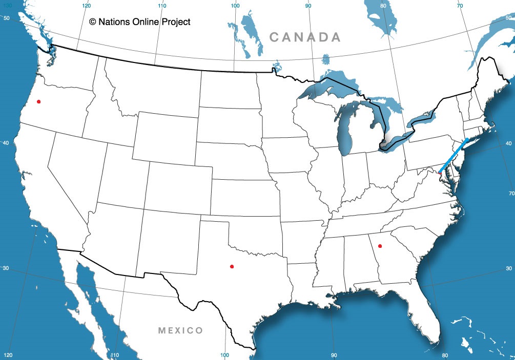
Baltimore, Maryland Road Trip from New Haven, Connecticut to Baltimore
When I think of California, I think of Mt. Shasta or Eureka — Not particularly warm places. Redding is the furthest north major population center in California, and residents there would like to let you know that it can be pretty hot there.
At 853AM, PT, Redding was seeing clear skies, and the temperature of already 85 degrees. Some light flow onshore is bringing fog to the coast. The light, oceanic flow through the Bay Area and the fog on the coast is cooling things of a bit in northern California, though Redding is a clear hot spot, stifled and away from the maritime flow. There is a trough moving through the Pacific Northwest through the middle of the week. Monsoonal flow and cool sea surface temperatures will ensure that there won’t be much moisture associated with the feature, so all eyes will be on the jet trough, with hopes it will break the heat. It doesn’t seem as though that will be terribly successful. If there are any impacts near Redding, it will come in the way of clearer mornings, with fog less likely on Thursday morning. Tomorrow- Hot and partly cloudy, High 101, Low 69 Thursday – Hot and sunny High 103, Low 66
TWC: Tomorrow – Mainly sunny. High 100, Low 69 Thursday – Sunny, High 103, Low 68
AW: Tomorrow – Mostly sunny, High 100, Low 71 Thursday – Mostly sunny and very warm High 102, Low 68
NWS: Tomorrow – Sunny and hot, High 99, Low 71 Thursday – Sunny and hot, High 102, low 70
WB: Tomorrow – Sunny, High 100, Low 73 Thursday – Sunny, High 102, Low 68
WN: Tomorrow – Sunny, High 99, Low 71 Thursday – Sunny, High 101, Low 70
FIO: Tomorrow – Clear throughout the day. High 101, Low 73 Thursday – Clear throughout the day. High 104, Low 69
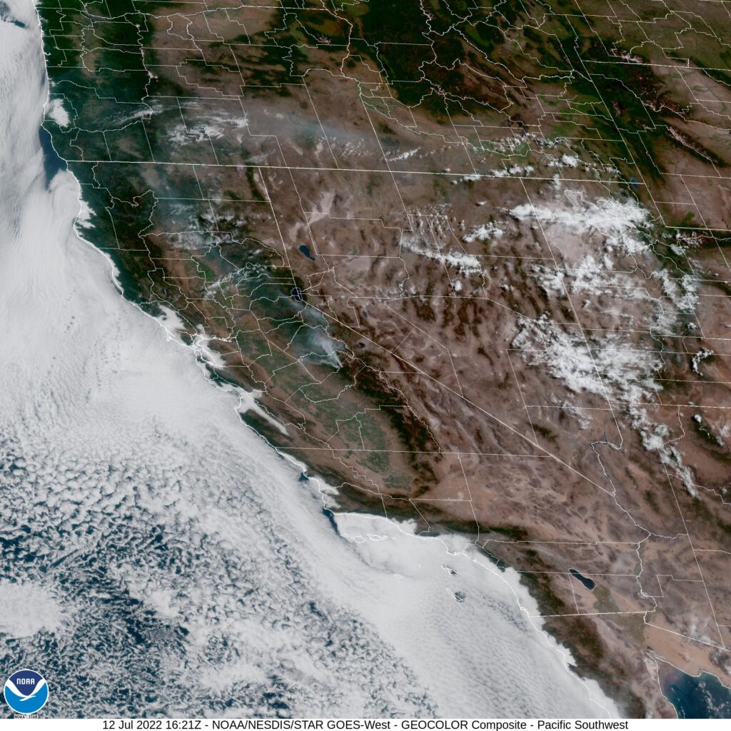
That’s pretty hot, as promised. And also as promised, it will be cooler tomorrow and Thursday than today, where forecast highs are about 105. Enjoy that relief! Here is the satellite, with low clouds along the coast.
Manchester in the US is in New Hampshire. In England, Hampshire is nowhere near Manchester (which is its own county, between Lancashire and Cheshire). There is a Portsmouth in both New and original Hampshire, but we’re here to talk about Manchester.
At 253PM, ET, Manchester was reporting a temperature of 82 degrees with mostly cloudy skies. Low pressure over the Atlantic, south of Greenland was parenting an inverted trough over northern Quebec that ran to central Ontario. Between the two disturbances was a rife spot for some midlevel instability, and some spotty clouds. Disturbed weather to the south is more impressive on satellite, but is not going to pose a wet threat for Manchester. The remnant wave in pursuit of the Greenland low will pivot into New England through the day on Friday. The parent remnant trough will actually start to redevelop, and with it, so too will the local jet. By this point, moisture associated with the feature will be spent in the White Mountains, and instead, a crisp change to the air mass will take hold overnight Friday into Saturday, making for a pleasant summer weekend. Tomorrow – Partly to mostly cloudy, High 87, Low 64 Saturday – Clearing and pleasant, High 82, Low 62
TWC: Tomorrow – Partly cloudy skies. High 86, Low 63 Saturday – Sunshine and clouds mixed High 81, Low 64
AW: Tomorrow – Clouds and sun High 87, Low 65 Saturday – Mostly sunny; a beautiful start to the weekend High 80, Low 63
NWS: Tomorrow – Patchy fog before 8am. Otherwise, mostly sunny, High 86, Low 62 Saturday – Sunny, High 79, Low 61
WB: Tomorrow – Partly sunny, High 86, Low 65 Saturday – Mostly sunny, High 79, Low 65
WN: Tomorrow – Mostly sunny, High 86, Low 61 Saturday – Mostly sunny, High 79, Low 61
FIO: Tomorrow – Mostly cloudy throughout the day. High 86, Low 64 Saturday – Partly cloudy throughout the day. High 81, Low 62
That looks like some nice weather on it’s way! I’m surprised the forecast wasn’t a bit warmer tomorrow for a lot of outlets, but I wasn’t going to go any higher, so maybe I shouldn’t be that surprised!
I enjoy a good trip to the Cheese State every now and then. It’s right next door to Victoria-Weather in Minnesota, but it seems so completely alien…
At 103PM, CT, Milwaukee was reporting mostly cloudy skies with a temperature of 70 degrees. Cloudy skies were widespread across the Great Lakes, as an area of low pressure was slogging through the Canadian Maritimes. While a weak jet ridge was emerging over western Ontario, which was helping build high pressure in the northern Great Lakes, a connector front between the low in New Brunswick and a lee trough kept a chance for precipitation south of Milwaukee. High pressure is going to remain in place, but fairly weak through the end of the work week. Generally westerly flow will mean generally stable conditions, though with some passing clouds. Guidance is in agreement about a wave moving into the region overnight Thursday into Friday, bringing some showers to end the workweek. The rain won’t last all day, and there will be some clearing by nightfall. Tomorrow – Partly cloudy, increasing clouds late with a chance of a storm, High 78, Low 64 Friday – Rain, especially early, with clouds and cooler conditions, High 76, Low 65
TWC: Tomorrow – Partly cloudy skies during the morning hours will become overcast in the afternoon. A stray shower or thunderstorm is possible. High 78, Low 64 Friday – Rain showers early with mostly cloudy conditions later in the day. High 71, Low 66
AW: Tomorrow – Humid and warmer with times of clouds and sun; a thunderstorm in spots in the afternoon High 79, Low 60 Friday – Times of clouds and sun High 76, Low 64
NWS: Tomorrow – A slight chance of showers between 10am and 1pm, then a slight chance of showers and thunderstorms after 1pm. Mostly cloudy High 76, Low 63 Friday – A 30 percent chance of showers before 1pm. Mostly cloudy, then gradually becoming sunny, High 75, Low 66
WB: Tomorrow – Mostly cloudy. Chance of light showers and slight chance of a thunderstorms in the late morning and afternoon. High 78, Low 62 Friday – Partly cloudy with a 30 percent chance of light showers. High 71, Low 66
WN: Tomorrow – Mostly cloudy, High 74, Low 63 Friday – Partly cloudy with scattered showers, High 73, Low 66
FIO: Tomorrow – Mostly cloudy throughout the day. High 78, Low 64 Friday – Possible light rain in the morning. High 72, Low 66
On the whole, I am confused by the group of forecasts! I am far more aggressive with the rain forecasts on Friday than anyone, but everyone is all over the map. The same neighborhood, I guess, but timing is very different all over. Maybe all these clouds have something to do with the confusion.