When you are working with clear skies in the Plains, you might expect to have a pretty easy forecast. Even with low pressure moving towards Topeka late in the forecast period last week, it was the first day of our forecast period that proved toughest. Those clear skies brought temperatures all the way down to 29 degrees by Wednesday morning, which was a solid 5 degrees colder than anyone prognosticated. The Weather Channel was the best aside from that blip that was on everyone’s ledger, as they accurately had the warmest high temperature forecast. Actuals: Wednesday – High 72, Low 29 Thursday – High 72, Low 30gradec
They are only two states away, but at opposite ends of those big Prairie states. What I am trying to say, is that the distance between Rapid City and Topeka is a little bit longer than I expected. Most of it is on an interstate, so the 686 miles will pass at a pace of 67.3mph. I will spare you the math, that’s a 10 hour drive.
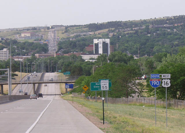
Rapid City, South Dakota
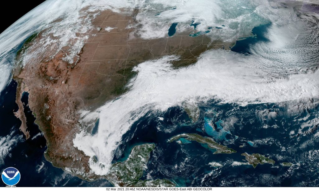
I don’t want to sound too overdramatic, but this drive will be a race against time. An area of low pressure moving out of the southern Rockies is headed right toward Topeka. Our route will go north of the northern most fringe of the rain and then east of the easternmost fringe of rain on Thursday. The rain will finally reach Topeka after midnight on Thursday, which means our drive will be dry, but our day in Topeka will not be.
I really enjoy forecasting in Kansas. It’s right there, smack dab in the middle of the country, and it gets a little bit of influence from the Rockies, a little from the Gulf. It’s a lot of fun, I think.
At 253, PM, CT, Topeka was reporting a temperature of 62 degrees with clear skies and a brisk southwest wind. High pressure was dominating the picture in the middle of the country, leaving the entirety of Kansas in a pleasant warm air regime. Some brisk southerly winds were being drawn towards low pressure in the Canadian Prairies, but a feature along the Gulf Coast was intercepting moisture across the country, leading to the warm, dry situation in the Plains. The clear skies and increasing warm weather will continue unabated through the middle of the week, however a fast moving wave presently over the Pacific, off the California coast will move swiftly on a line for Kansas. Rain should wait until after midnight, coming on Friday morning, but some warm south winds will take hold on Thursday afternoon. Tomorrow – Sunny, High 69, Low 37 Thursday – Increasing clouds late, High 70, Low 34
TWC: Tomorrow – Sunny, High 71, Low 34 Thursday – Generally sunny despite a few afternoon clouds. High 70, Low 34
AW: Tomorrow – Mild with plenty of sun High 67, Low 35 Thursday – Mild with plenty of sun High 69, Low 34
NWS: Tomorrow – Sunny, High 66, Low 34 Thursday – Sunny, High 67, Low 34
WB: Tomorrow -Sunny, High 70, Low 35 Thursday – Sunny, High 69, Low 35
WN: Tomorrow – Sunny, High 66, Low 34 Thursday – Mostly sunny, High 67, Low 34
FIO: Tomorrow – Clear throughout the day. High 69 Low 35 Thursday – Clear throughout the day. High 69, Low 36