St. Louis was under a dominating ridge of high pressure during our forecast period. Return flow on the west side of the ridge drove temperatures up on Thursday, and nearly everyone handled things exquisitely. Victoria-Weather had a perfect forecast for Wednesday, but things ended up cooler in the morning on Thursday, which opened up the forecast for The Weather Channel to narrowly win. Actuals: Wednesday – High 81, Low 58 Thursday – High 87, Low 55
Welcome to September. Lets get ourselves off to a good start with a forecast from the middle of the country.
At 751PM, CT, St. Louis was reporting a temperature of 74 degrees with mostly cloudy skies. High pressure was blanketing the northeastern part of the US, with the western flank laying over the Mississippi Valley. There was, as a result, a bit of moisture flowing at the mid levels bringing the scattered clouds to St. Louis. The ridge isn’t going to be easy to move. A short wave is going to ripple at the southern flank of the subtropical jet in Canada. The cold front associated with it will struggle to produce any rain fall in the middle of the country, and will be rubbed out before it reaches the Mississippi Valley. Ahead of the boundary, however, some warmth will filter in and give another taste of summer. Tomorrow – Mostly sunny, High 81, Low 58 Wednesday – Sunny and warmer, High 88, Low 60
TWC: Tomorrow – Cloudy skies. High 79, Low 57 Wednesday – Partly cloudy skies. High 86, Low 56
AW: Tomorrow – Partly sunny and pleasant; a gorgeous day to be outside High 78, Low 57 Wednesday – Mostly sunny and nice High 85, Low 55
NWS: Tomorrow – Mostly cloudy High 81, Low 57 Wednesday – Mostly sunny High 86, Low 59
WB: Tomorrow – Mostly cloudy, High 79, Low 61 Wednesday – Mostly sunny, High 85, Low 60
WN: Tomorrow – Mostly cloudy, High 81, Low 56 Wednesday – Partly cloudy, High 84, Low 58
CLI: Tomorrow – Mostly cloudy, High 80, Low 60 Wednesday – Sunny, High 88, Low 60
I could have gone even warmer on Wednesday, but alas, what is a couple of degrees? Wispy clouds for St. Louis tonight.
We’ve been following along with a front that moved steadily across the country, snapping the summer like start to September for a lot of the eastern two thirds of the country. We started looking at it when it was about to pass through St. Louis about a week ago. Temperatures ended up dropping by about 10 degrees from Tuesday to Wednesday. The low temperatures on Wednesday were actually the biggest discrepancy across the board, as they went all the way down to 60. The lowest low forecast for last Wednesday was from The Weather Channel, and as a result, they were the champion in St. Louis. Actuals: 9/14 – .22 inches of rain in thunderstorms, High 90, Low 69 9/15 – .02 inches of rain, High 82, Low 60
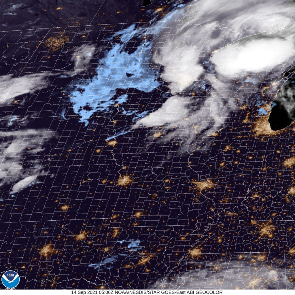
At 1151PM, CT, St. Louis was reporting a temperature of 80 degrees with clear skies. St. Louis was between two major systems tonight, with Hurricane Nicholas sliding along the Texas Coast to the south, and a fall like area of low pressure moving through the western Great Lakes overnight tonight. High pressure will keep St. Louis dry at least through the morning. Nicholas will spiral eastward after landfalling, while the cold front from the northern feature will sink south. The boundary will pass through St. Louis late in the evening on Tuesday, with isolated thunderstorms continuing until after midnight. The full impact of this front will be blunted by Nicholas intercepting a lot of the moisture attempting to filter northward. Wednesday looks pretty OK after the morning showers clear out. Tomorrow – Isolated thunderstorms in the evening, High 90, Low 72 Wednesday – Morning rain, then clearing, High 81, Low 65
TWC: Tomorrow – Sunny in the morning then increasing clouds with some scattered thunderstorms later in the day. Storms may contain strong gusty winds. High 90, Low 70 Wednesday – Cloudy skies early will become partly cloudy later in the day. A stray shower or thunderstorm is possible. High 81, Low 64
AW: Tomorrow – Very warm and humid with times of clouds and sunshine; caution advised if doing strenuous activities outside (late storms) High 89, Low 71 Wednesday – Humid; cloudy in the morning, then intervals of clouds and sunshine in the afternoon (early storms) High 81, Low 66
NWS: Tomorrow – Sunny, (late storms) High 90, Low 71 Wednesday – A 40 percent chance of showers and thunderstorms. Partly sunny High 82, Low 66
WB: Tomorrow – Mostly sunny (Late storms), High 89, Low 71 Wednesday – Mostly sunny, High 80, Low 66
WN: Tomorrow – Partly cloudy with isolated storms, High 90, Low 71 Wednesday – Partly cloudy with chance of storms, High 83, Low 66
FIO: Tomorrow – Rain in the evening. High 91, Low 70 Wednesday – Rain overnight and in the morning. High 81, Low 65
It will be interesting to see how ardently this front moves through. There is definitely a change to the airmass late in the week for St. Louis, but there might not be as much of a show to get there as one might typically expect. You can see the peripheries of both features on satellite.