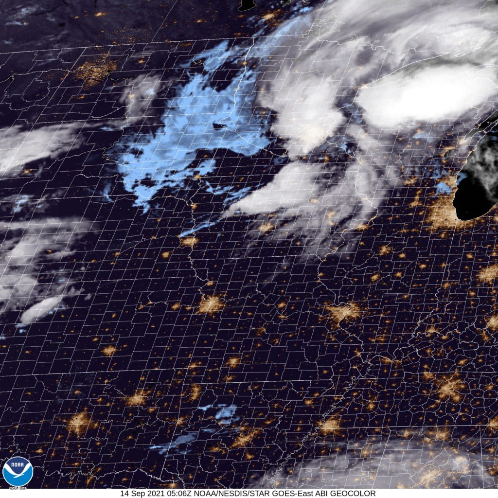
Night time forecasts are where the fun is!
At 1151PM, CT, St. Louis was reporting a temperature of 80 degrees with clear skies. St. Louis was between two major systems tonight, with Hurricane Nicholas sliding along the Texas Coast to the south, and a fall like area of low pressure moving through the western Great Lakes overnight tonight. High pressure will keep St. Louis dry at least through the morning.
Nicholas will spiral eastward after landfalling, while the cold front from the northern feature will sink south. The boundary will pass through St. Louis late in the evening on Tuesday, with isolated thunderstorms continuing until after midnight. The full impact of this front will be blunted by Nicholas intercepting a lot of the moisture attempting to filter northward. Wednesday looks pretty OK after the morning showers clear out.
Tomorrow – Isolated thunderstorms in the evening, High 90, Low 72
Wednesday – Morning rain, then clearing, High 81, Low 65
TWC: Tomorrow – Sunny in the morning then increasing clouds with some scattered thunderstorms later in the day. Storms may contain strong gusty winds. High 90, Low 70
Wednesday – Cloudy skies early will become partly cloudy later in the day. A stray shower or thunderstorm is possible. High 81, Low 64
AW: Tomorrow – Very warm and humid with times of clouds and sunshine; caution advised if doing strenuous activities outside (late storms) High 89, Low 71
Wednesday – Humid; cloudy in the morning, then intervals of clouds and sunshine in the afternoon (early storms) High 81, Low 66
NWS: Tomorrow – Sunny, (late storms) High 90, Low 71
Wednesday – A 40 percent chance of showers and thunderstorms. Partly sunny High 82, Low 66
WB: Tomorrow – Mostly sunny (Late storms), High 89, Low 71
Wednesday – Mostly sunny, High 80, Low 66
WN: Tomorrow – Partly cloudy with isolated storms, High 90, Low 71
Wednesday – Partly cloudy with chance of storms, High 83, Low 66
FIO: Tomorrow – Rain in the evening. High 91, Low 70
Wednesday – Rain overnight and in the morning. High 81, Low 65
It will be interesting to see how ardently this front moves through. There is definitely a change to the airmass late in the week for St. Louis, but there might not be as much of a show to get there as one might typically expect. You can see the peripheries of both features on satellite.


Comment (1)