It was a chilly weekend last weekend, particularly Sunday, in north Texas. We had a forecast for Sherman, and we knew that it was going to cool down, but clearly, we weren’t fully appreciative of how cold it was going to get. Accuweather had the top forecast for the weekend, and even they were 10 degrees too warm on the Sunday high of 37. Fortunately for them, that was the one really big issue they had, successfully navigating the rest of the forecast. Actuals: Saturday – High 66, Low 35 Sunday – High 37, Low 26
It’s a short trip today, but really, a four hour trip between a couple of towns that avoids much population anywhere along the way is pretty exciting. This means that we haven’t really been able to talk about a trip through places like Paris, Texas, or Broken Bow, Oklahoma or De Queen, Arkansas. not that the post will include them after this, but still! It’s a 239 mile journey that will last just shy of 4 1/2 hours, covering only 54.5. At that pace, maybe we will lament driving through Paris, Broken Bow and De Queen.
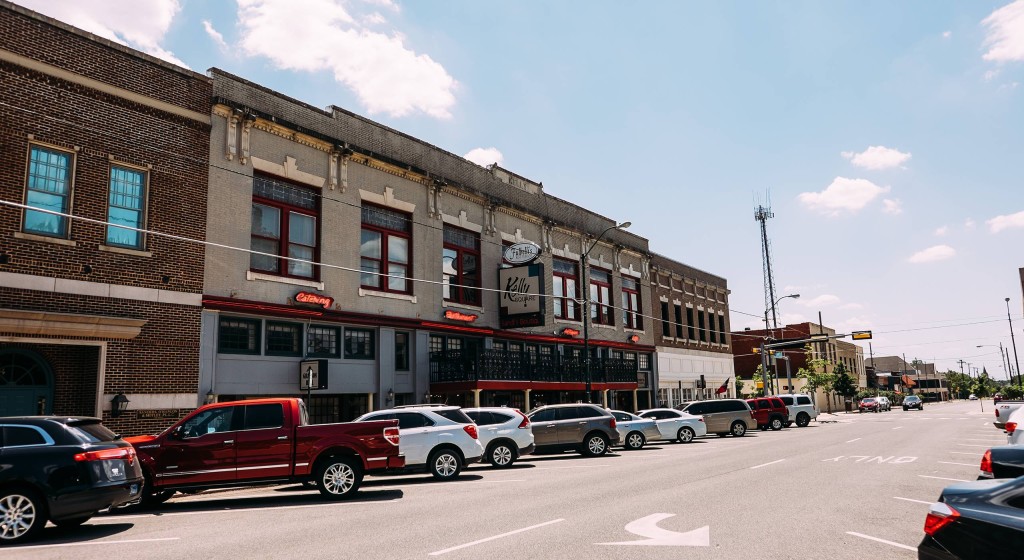
Sherman, Texas
If you have been following along here at Victoria-Weather, or if you have been outside east of the Rockies lately, you know that it is pretty chilly. A warm up is coming, however, as high pressure that has been keeping it so cold is shuffling eastward. This won’t disrupt the day at all, as it often can when one air mass leaves town. The tail of the surface high is sinking into hte northern Gulf, which will prevent moisture from infiltrating our route. It should be a fine day for driving, in about perfect conditions for keeping the windows rolled up, but without needing the heat or AC.
The forecast for the day will come from north Texas. Given the pattern right now, this might be one of the colder forecasts you see from Texas.
At 115PM, CT, Sherman was reporting a temperature of 68 degrees. Skies were clear behind a trough sweeping a band of clouds through the Piney Woods. Dew points in north Texas have already dropped off, but the lag in temperature gradient goes back to Kansas, where temperatures have dropped into the 30s. A succession of clippers have moved through the Upper Midwest, riding a strong jet streak through the Plains. The jet streak is expected to start oscillating through the weekend, with high pressure then building in the south central US. High pressure building in the Plains will do so on the back of cold weather from Canada. With a deep trough at the upper levels, there is enough cyclonic flow to continue reinforcing cold air in North Texas. The thermal ridge will wait until the middle of next week to start taking temperatures back up. Before then, don’t be surprised to see some sub-freezing air arrive in Sherman Tomorrow – Partly cloudy, High 58, Low 39 Sunday – Sunny and a bit warmer, High 42, Low 26
TWC: Tomorrow – Partly cloudy. High 61, low 38 Sunday – Sunny. High 42, Low 27
AW: Tomorrow – Times of clouds and sun; best day of the weekend High 65, low 37 Sunday – Mostly sunny; breezy in the morning, then turning much colder high 47, Low 26
NWS: Tomorrow – Mostly sunny, high 63, Low 38 Sunday – Sunny, high 46, Low 28
WB: Tomorrow – Mostly sunny. High 60, Low 38 Sunday – Sunny. Much cooler High 44, low 33
WN: Tomorrow – Mostly sunny, High 63, Low 38 Sunday – Sunny, High 46, Low 28
CLI: Tomorrow – Sunny, High 60, Low 38 Sunday – Sunny, High 42, low 27
It’s going to be interesting to see how quickly temperatures fall off on Saturday night. There is a good chance that is a midnight high. It’s clear right now, but don’t let that fool you!
When we forecast for Sherman last week, expectations were low. It was going to be sunny with some late season warmth, and not a lot of intrigue. The biggest question was how warm would it get on Election Day, and how Accuweather has time to add notes to all their local forecasts. I still have no answer for the second question, but I can tell you it hit 86 last Tuesday, which was warmer than all forecasts. This handed the victory to the warmest forecaster, who happened to be Victoria-Weather. Actuals: Monday – High 82, Low 63 Tuesday – High 86, Low 63
Our forecast takes us to the Red River Valley, northeast of the MetroPlex. The Thanksgiving Holiday is soon approaching, so I have to believe more of us are looking at the weather in even more places.
At 250pm, CT, Sherman was reporting a temperature of 81 degrees with clear skies. While there was a weak jet streak bringing high clouds to central Texas, the strongest flow aloft was well to the north. There was a strong wave of low pressure preparing to develop in the northern High Plains, which will act t draw flow from the south. The strong jet to the north will usher the surface feature along while forming into a long waved, low amplitude ridge. This will provide stability to the region, and lead to some warmer air and sunny skies. Tomorrow – Breezy partly cloudy, High 82, Low 61 Tuesday – Sunny, High 85, Low 62
TWC: Tomorrow – A mainly sunny sky, High 82, Low 61 Tuesday – A mainly sunny sky. High 82, Low 62
AW: Tomorrow – Mostly sunny, breezy and very warm; great day to be outside High 82, Low 61 Tuesday – Breezy and very warm with plenty of sunshine; dry weather for getting out to vote High 83, Low 62
NWS: Tomorrow – Sunny, High 79, Low 61 Tuesday – Sunny, High 82, Low 62
WB: Tomorrow – Mostly sunny, High 78, Low 62 Tuesday – Sunny, High 79, Low 63
WN: Tomorrow – Mostly sunny, High 79, Low 61 Tuesday – Mostly sunny, High 82, Low 62
CLI: Tomorrow – Sunny, High 82, Low 60 Tuesday – Sunny High 84, Low 62
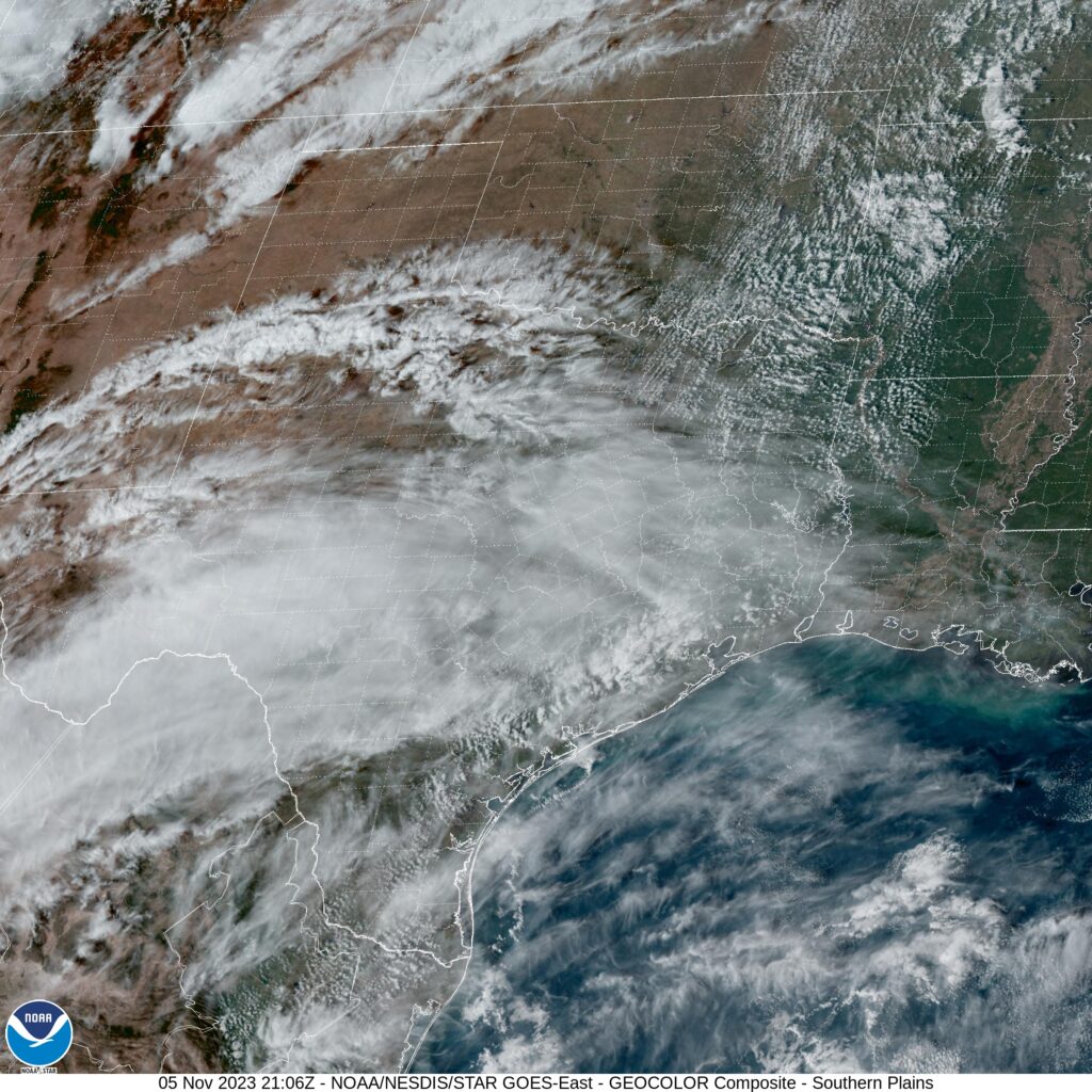
A look at the satellite shows that jet streak I mentioned earlier. A look at Accuweather’s forecast shows a bit of editorial commentary suggesting that they had too much free time for this forecast.
Forecasts across the board forecast for light rain on the morning on Wednesday the third in Sherman, Texas. The remnants of a system were on their way out of town, and a it appeared as though the worst of the night had long since passed by Tuesday evening’s forecast. Overnight, some of the trailing precipitation caught a little bit of extra energy, and before mid morning, Sherman saw another inch of rain. That’s definitely not just light showers. The temperature forecasts were decent, and we all did forecast for rain, so the forecast scores are pretty decent, but that doesn’t reflect just how sloppy things ended up after our forecast. Victoria-Weather took the top prize in Texas. Actuals: Wednesday – 1.07, High 47, Low 44 Thursday – High 54, Low 37
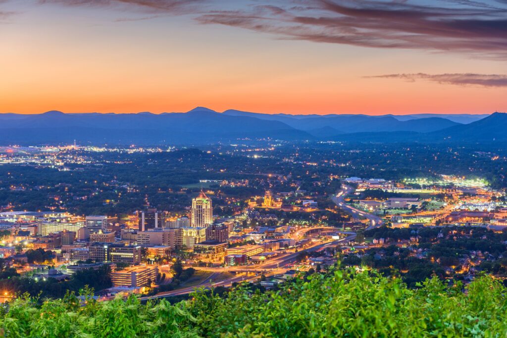
Tonight, we take a trip through what should be some nice weather. It’s a two day trek from Sherman to Roanoke, and will cover 1080 miles. That means a pace of 67.8 mph, and that will ultimately mean about 543 miles on the first day, which is a nice even split of the trip into two days.
DAY ONE (Sunday)
Sherman, Texas
High pressure is in charge east of the Mississippi, and an emerging low in the Plains is helping direct some southerly flow to the region. Our drive will be in the sun, in warmer air than the region has seen for a couple of days. We’re going to make it through Arkansas and into Tennessee. Parkers Crossing, Tennessee will be the destination. The town is just northeast of Jackson.
DAY TWO (Monday) That high pressure is just going to hang on in the eastern US. Even the drive through the Smokey Mountains and astride of the Appalachians will be devoid of the fog and haze that can be persistent in that area. Roanoke will be nice for the autumn.
Happy Election Day, and Happy November everyone. We’re going to mosey just south of the Red River and check out Sherman.
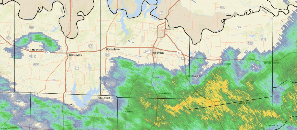
At 815PM, CT, Sherman was reporting a temperature of 49 degrees with overcast conditions. A swath of rain was falling just to the south, between Sherman-Denison and I-30, and generally drifting eastward. Scattered showers extended as far to the west as Wichita Falls, so even though the heaviest rain is probably over for the night, more rain is likely on the way tonight. An upper level trough is represented by a notch within a surface ridge, with the ridging expected to overtake the disturbance through the day tomorrow. The rain tonight will continue through late morning, perhaps, but a clear, cool afternoon is anticipated. With high pressure reestablished under an early winter trough, Sherman should see some tastes of normal to slightly below normal temperatures for the season. Tomorrow – Light showers early, then clearing and cool, High 50, Low 45 Thursday – Partly cloudy and chilly in the morning, high 56, Low 40
TWC: Tomorrow – Showers in the morning, then cloudy in the afternoon High 48, Low 45 Thursday – Mostly cloudy skies early will become partly cloudy later in the day. High 57, Low 42
AW: Tomorrow – Cool with occasional rain and drizzle High 51, Low 47 Thursday – Clouds giving way to some sun and cool High 57, Low 42
NWS: Tomorrow – Showers and possibly a thunderstorm before 1pm, then a slight chance of showers between 1pm and 3pm. High 49, Low 47 Thursday – Partly sunny, High 55, Low 43
WB: Tomorrow – Showers and perhaps a thunderstorm in the morning, then a slight chance of showers in the afternoon, High 49, Low 47 Thursday – Mostly cloudy in the morning, then becoming partly sunny, High 56, Low 42
WN: Tomorrow – Cloudy with light showers and isolated thunderstorms, High 49, Low 47 Thursday – Partly cloudy, High 55, Low 43
FIO: Tomorrow – Rain until afternoon. High 52, Low 47 Thursday – Partly cloudy throughout the day. High 57, Low 41
I’m drier and clearer than the rest, and it shows in my temperature forecasts. It looks a little damp tonight.