Our first forecast in the month of March went pretty well, frankly. There was a late developing, potentially virulent storm headed towards the Great Lakes that lead to an array of precipitation forecasts in Michigan City. In the end, on March 9th, Michigan City saw precipitation in the evening, which changed to all snow quite quickly. This happened sooner than anticipated, but it wasn’t doom and gloom for most of the forecasts, at least those that called for precipitation. The temperatures were baked in before the precipitation was expected, so for those that called for rain, the forecast worked well. Victoria-Weather started the month with a W. Actuals: March 8th, High 46, Low 30 March 9th, Trace of precipitation, HIgh 43, Low 32
We’re going to start the week with what should be a pretty quick jaunt. It won’t be, because we will be navigating the Chicagoland region, but it definitely SHOULD be. The drive will be nearly 3 1/2 hours, at a glacial pace of 63mph.
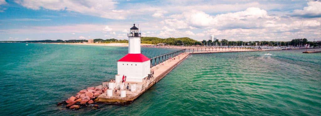
Michigan City, Indiana
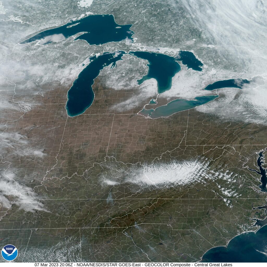
A weak little wave is moving through the Great Lakes this evening, and it will generally be in the central and eastern Great Lakes before the drive begins on Monday. I don’t think there will be much in the way of flurry activity south of Lake Michigan, though it can’t be ruled out, especially in Michigan City and Laporte. I would expect some dryer skies through Chicago proper, but as we approach Waukegon and north through Milwaukee, I would expect flurries to pick up again. This weak little feature is wrapping in a considerable amount of light snow that just doesn’t want to cut out, so I have to believe it will still be snowing in Fond du Lac when we arrive. Nothing accumulating, but it will be happening.
I think we can all agree that Michigan City, Indiana is a strange name for a town that is part of the greater Chicagoland region, yes?
At 255PM, ET, Michigan City was reporting a temperature of 39 degrees with clear skies. A brisk flow is coming off of Lake Michigan, a true lake breeze flowing from the colder dense air to relatively warm air of northern Indiana, absent of prevailing synoptic flow. Temperatures were about 5 or 6 degrees warmer away from the Lake. A broad ridge aloft is helping the southern Great Lakes to dry out, and it should be a fairly pleasant middle of the week in Michigan City. A broad area of low pressure in the Rockies and High Plains bears watching, however. It will be slow in transpiring, but low pressure will develop at the surface through the day on Saturday. Precipitation will arrive in Michigan City late on Thursday. It is likely to be a chilly rain, but given the uncertainty wrought by the lateness in development of this feature, snow cannot be left out of the forecast. Tomorrow – Mostly sunny, High 44, Low 30 Thursday – Increasing clouds with a late rain-snow mix, High 41, Low 32
TWC: Tomorrow – Mostly cloudy skies High 43, Low 30 Thursday – Overcast. High 42, Low 30
AW: Tomorrow – Sun and clouds, High 41, Low 29 Thursday – Cloudy, late rain and snow, High 42, Low 33
NWS: Tomorrow – Partly sunny High 42, Low 30 Thursday – Mostly cloudy, Late rain/snow, High 44, Low 30
WB: Tomorrow – Cloudy, high 42, Low 32 Thursday – Cloudy, high 42, Low 32
WN: Tomorrow – Partly cloudy, High 42, Low 30 Thursday – Partly cloudy, High 44, Low 30
CLI: Tomorrow – Overcast, High 42, Low 29 Thursday – Overcast, High 41, Low 29
I think you can see some of the uncertainty with the model guidance showing up in the forecast. The models aren’t spread over a wide range, but without any thing fully developed yet, there is a lack of precipitation commitment. Look how clear it is right now! And you’re telling me it might snow?
It’s autumn, and it ure feels that way east of the Rockies, even if that’s not the case along the west coast. We’ll take a 4 day run to Puget Sound, which will cover 2182 miles. There is a lot of interstate contained on this route, even if we are covering some high terrain, so the pace will be about 68.2 mph, good for 545 miles a day.
DAY ONE (Thursday)
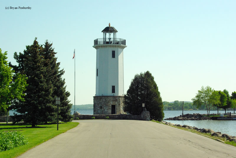
Michigan City, Indiana
One of the factors in the Upper Midwest being cooler than normal is the presence of deep low pressure over Labrador, which is swinging more cold air and troughing into the area. It will clear up today in Michigan City, but more drizzle and clouds will emerge by tomorrow morning, and will be the situation through most of our Thursday drive. Some drips and drops will spatter our windshield through Chicago, Milwaukee and Madison, and probably won’t truly clear up until after we pass through LaCrosse. We’ll make it to Lakefield, Minnesota before we pull off for the night.
DAY TWO (Friday) High pressure is entrenched west of that deep area of low pressure. There might be a few high streaking clouds over the western Dakotas, but I would hard pressed to believe they will touch the ground. We’ll traverse South Dakota and clip northeastern Wyoming before we stop in Boyes, Montana, a ghost town in the southeastern corner of the state. It’s going to start warming up by the end of the day.
DAY THREE (Saturday) The entirety of our day will be spent in the windswept prairies of eastern Montana, and the peaks of western Montana that will be significantly less windswept, and definitely not as cool as you might hope. We’ll make it to Wye, on the northwest side of Missoula, and call it a night.
DAY FOUR (Sunday) The best news for our Sunday drive is that the threat for wildfires in the Pacific Northwest has significantly lessened. It will be dry and unseasonably warm in the interior west, before it gets a bit more comfortably as we head north from Seattle into Bellingham.
By Nick Kelly / Faithlife Corporation – Faithlife Corporation, CC BY-SA 4.0, https://commons.wikimedia.org/w/index.php?curid=37611512