Chalk one up for the Front Range. Fort Collins’ forecast didn’t quite go as anticipated. Most notably, after a cold front moved through Friday into Saturday, temperatures… climbed into the low 80s. Then, the day when westerly flow arrived with the next feature (Sunday) the expected warm downslope flow was actually cool. Temperatures dropped nearly 10 degrees. Weatherbug was 10 degrees off on their high temperature on Saturday. They missed out on first place by 1 degree. Does that paint the picture for you? The Weather Channel and Accuweather converged at the top. Actuals: Saturday: .01″ of rain, High 82, Low 64 Sunday: .07″ of rain, High 74, Low 58
Having some minor (I hope) server issues today at Victoria-Weather HQ. That shouldn’t change the weather in Fort Collins, though, right? What can we expect in Northern Colorado this weekend?
At 956AM, MT, Fort Collins was reporting a temperature of 77 degrees with clear skies and a brisk north wind. There is a bit of shower activity across northern Colorado is associated with a cold front appended to an area of low pressure in western Ontario. A leading trough has switched winds to northerly across Fort Collins, but the boundary remained just to the north in southern Wyoming. Shower activity is largely found in the mountains west of Fort Collins and Cheyenne, though there will be some light activity as the day wears on, lasting into the morning tomorrow. As the area of low pressure moves on to the east, high pressure will build in the Plains. In the southwest, warm air will begin to build again, and a laminar flow over the Rockies will lead to a down-slope and lee troughing in the Colorado flatlands. The contrast in air mass will lead to some ridge-riding thunderstorms in eastern Colorado by Sunday, but guidance and intuition suggest that the bulk of the activity will be south of the Palmer Divide, leaving Fort Collins mostly unbothered, but late in the period some activity could press into the area. Tomorrow – Isolated showers, especially early, High 74, Low 60 Sunday – Partly to mostly cloudy, isolated thunder late High 80, Low 57
TWC: Tomorrow – Scattered thunderstorms in the morning. Partly cloudy skies late High 78, Low 61 Sunday – Partial cloudiness early, with scattered showers and thunderstorms in the afternoon High 75, low 51
AW: Tomorrow – Low clouds breaking for some sun with a thunderstorm in one or two spots High 76, Low 60 Sunday – Intervals of clouds and sunshine with a thunderstorm or two in the afternoon High 76, Low 55
NWS: Tomorrow – A chance of showers, with thunderstorms also possible after noon. Mostly cloudy, High 75, low 59 Sunday – Showers likely and possibly a thunderstorm between noon and 3pm, then showers and thunderstorms likely after 3pm. Partly sunny, High 79, low 58
WB: Tomorrow – Mostly cloudy. Chance of showers in the morning then a chance of thunderstorms in the afternoon High 72, Low 60 Sunday – Thunderstorms likely. High 74, low 56
WN: Tomorrow – Mostly cloudy with scattered showers and a chance of storms, High 75, low 59 Sunday – Mostly cloudy with light showers and scattered storms, High 79, Low 58
CLI: Tomorrow – Thunderstorm, High 76, Low 60 Sunday – Thunderstorm, high 78, low 56
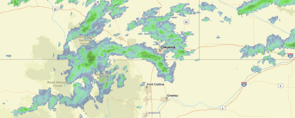
Count me in the “not likely” camp on Sunday thunderstorms. Everything right now just looks like it will show up too far to the south. Not today though, here is radar imagery, with showers heading in from Wyoming.
We’ve made it through the Holiday weekend, and are ready for wherever the road may take us. In this case, it is taking us to Arkansas. The drive will last 12 hours, the longest we are allowed to travel in one day during these trips, and we will cover 863 miles. On average, that is a pace of almost 72mph. Hard to stick your nose up at that.
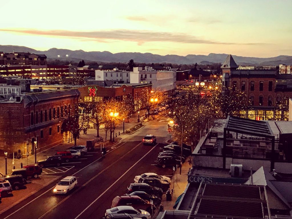
Fort Collins, Colorado
This afternoon, a weak trough sweeping through the Front Range will touch off an area of thunderstorms in the Canadian Prairies, moving towards western Kansas. This will ensure that the atmosphere settles out a bit as we start out on Tuesday. We’re going to see sunny skies in Colorado and western Kansas, but will eventually reach the back end of the instability around Wichita. The bulk of any moisture or storm activity will be seen in Missouri, and we are going to be swinging south through Oklahoma. There will be some lare storms in northern Oklahoma, but by the time it really fires up, I suspect we will already be waiting in Fort Smith when it gets more showery in Oklahoma and across the border in Arkansas.
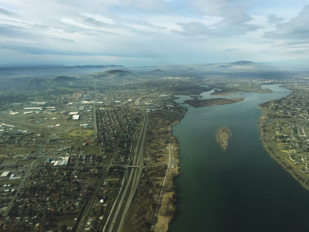
What a lovely, winding mountain drive we get to take this week, running from Fort Collins to Kennewick. It will take two mountain filled days to get from Colorado to Washington, covering a road distance of 1035 miles. This will mean a pace of 67.7mph, thanks to a route that eschews large population centers. The first day will be longer, and will cover 541 miles of the interior west, leaving a shorter day to enjoy the scenery in the Pacific Northwest.
DAY ONE (Friday)
Fort Collins, Colorado
The two most magical words to any road tripper concerned about the weather are going to apply to our Friday drive. “High Pressure” It will be pleasant and seasonably warm as we hit 4 states on Friday. Most of the time will be spent in Wyoming, a considerable amount in Utah, with our endpoints starting in Colorado and Idaho. You will be able to see for miles in Juniper, Idaho, in the southern part of the state, and the destination for our first day of travel.
DAY TWO (Saturday) Low pressure arriving from the Gulf of Mexico will not be as cooperative as the high pressure from Friday. Not much precipitation often finds its way inland, so we won’t see heavy precipitation, but we will certainly see some rain between Caldwell, Idaho, a western suburb of Boise, and La Grande in northeast Oregon. Subsident air on the lee side of the Cascades will clear things up for us once again as we arrive in Kennewick. It will probably be clearer and a little more crisp, but what else do you want in the high terrain?