We assembled a forecast for Dover ahead of the Nor’Easter that shook up the East Coast earlier this month. Yeah, it rained, sure temperatures came down, but I really wanted to see what the wind registered at. It gusted to nearly 40MPH on Sunday the 12th! After the hatches were properly battened, we could appreciate a good clustering of forecasts. Ultimately, the National Weather Service narrowly overcame the other outlets. Actuals: October 11th, .11 inches of rain, High 69, Low 52 October 12th, .43 inches of rain, High 66, Low 57
Confirmed: It is a long way from Portland to Dover. 2892 miles, in fact, and that distance will take us 5 days to cover, and that last day will be an 11 hour grind. The pace will be 67.2 mph, which translates to 538 miles a day. This is a long one, folks.
DAY ONE (Saturday)
Portland, Oregon
Low pressure will have moved inland from the Pacific Northwest as we depart tomorrow morning. Moisture will be able to clear the Cascades, but will begin to squeeze out moisture again as this instability reaches the Rockies. Rain will be tapering, but still possible in Portland to the Dalles, and we will be dry in the Columbia River Gorge. We will pop out again and head southeast towards Boise, where we will encounter a few more showers between Pendleton and Baker City. The higher terrain of Idaho is both well to the north of our route and well to the east. We will reach Wendell, between Mountain Home and Twin Falls, without fear of rain.
DAY TWO (Sunday) Precipitation in the mountains always looks messy, but there is expected to be organization in the lee of the Rockies, which will clear the skies along our route. No worries crossing the Wasatch, except for running out of gas. Not many places to stop, and we will end the night in Table Rock, Wyoming, which might not be a real place.
DAY THREE (Monday) This is going to be a weird point to refer to, but back in the Gulf of California, an old tropical feature will be making landfall, kicking some moisture from the south up into the Rockies. Some of this moisture is expected to bleed into the Plains, where it will intercept the tail of a cold front extending from Hudson Bay, and it may bring a light shower to south central Nebraska. That is a worst case scenario, though, and I don’t believe it likely. I think instead we will get some windswept prairie and a chilly time parking in Gibbon, for our stop on Monday night.
DAY FOUR (Tuesday) This wasn’t on my bingo board, but yes, on this trip we will be dealing with some tropical moisture in Nebraska on Tuesday. Rain should be starting overnight in Gibbon, which is near Kearney, if you were wondering, and may be steady at times, all the way to Omaha, which will be the largest city we will have seen in days. The rain will lighten, and we will dry out around Bondurant, shortly after passing Des Moines. Cedar Rapids and the Quad Cities will be dry, and we will make it about a third of the way through Illinois, stopping in Spring Valley for the night.
DAY FIVE (Wednesday) Because of the way this works we will touch parts of 7 states in 11 long hours. Fortunately, we should have unobstructed views of all those welcome signs, because high pressure will be building in the Great Lakes, pushing towards the mid-Atlantic. Temperatures will be comfortable for the season, and we will be exhausted upon arriving in Dover.
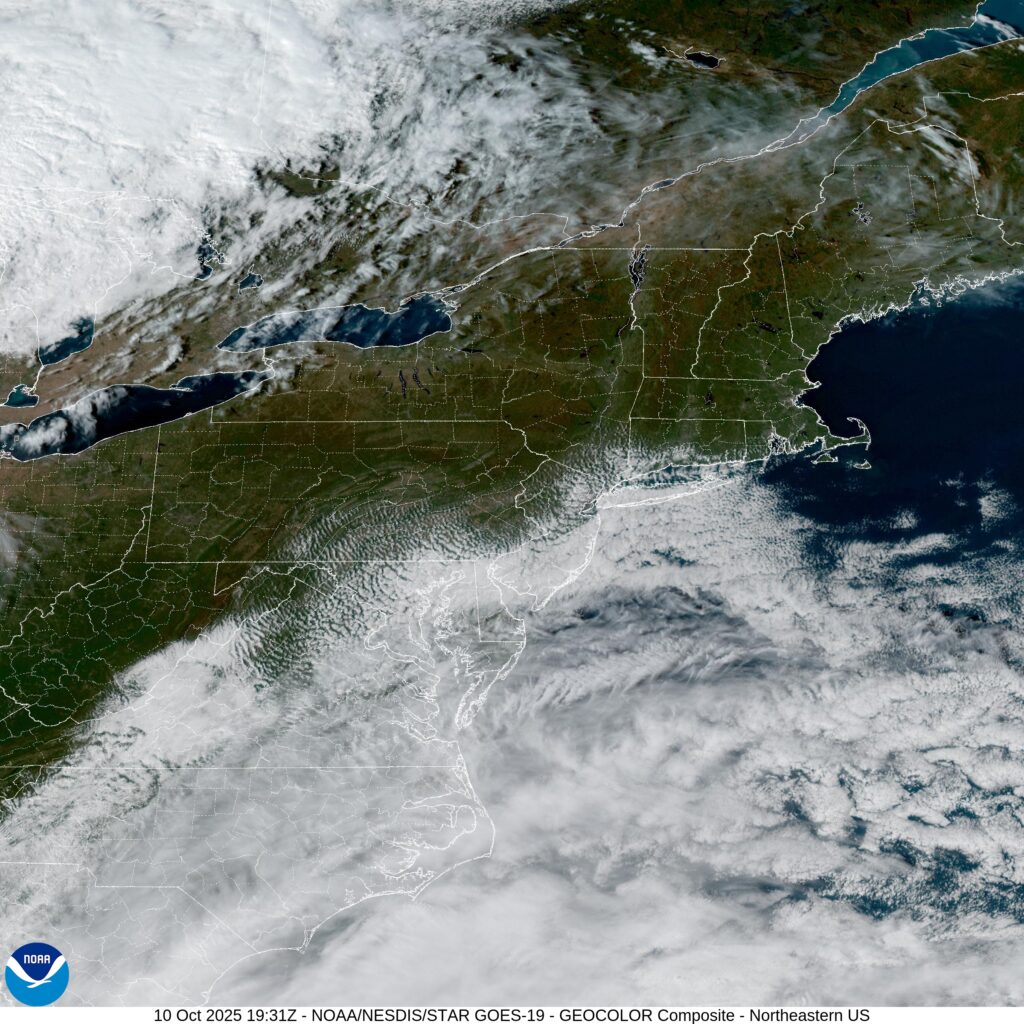
There isn’t a lot too Delaware, but given the location along the coast, it can sure serve up some interesting times.
At 315PM, ET, Dover was reporting a temperature of 60 degrees with overcast skies. High pressure remains in control this afternoon in the Delmarva, however a deep cutting trough swinging out of the Great lakes towards an already unsettled region in the Bight of Georgia is going to bring about some significant changes for the weekend. The developing low, which may ultimately get a name from the NHC, but even if it doesn’t, it should be a very early season Nor’Easter for the coast. The initial spots of rain will arrive in Dover tomorrow morning, with the threat steadily increasing through the day. The strongest band of heavy rain projects to arrive on Sunday morning. This will likely be accompanied by some blustery winds and make for a wholly uncomfortable morning. The heavy rain will begin to taper in the early afternoon, but more light rain will continue through the remainder of the day. Tomorrow – Scattered showers, High 72, Low 58 Sunday – Rain with wind, tapering a bit in the evening, High 67, Low 60
TWC: Tomorrow – Overcast. Slight chance of a rain shower. High 71, Low 55 Sunday – Rain and wind. High 66, Low 64
AW: Tomorrow – Breezy with occasional rain and drizzle high 70, Low 57 Sunday – Rain and wind from tropical rainstorm; flooding in poor drainage areas; stronger wind and worse flooding at the beaches High 65, Low 60
NWS: Tomorrow – A chance of rain, mainly after 9am. Mostly cloudy, High 70, Low 55 Sunday – Rain, High 66, Low 60
WB: Tomorrow – Mostly cloudy with a 50 percent chance of rain. High 69, Low 56 Sunday – Rain windy .High 67, Low 61
WN: Tomorrow – Mostly cloudy with showers, High 70, Low 54 Sunday – Mostly cloudy with showers, High 67, low 61
CLI: Tomorrow – Rain showers High 69, low 58 Sunday – Light rain showers High 67, Low 60
Yuck. That’s going to be particularly nasty on Sunday. Don’t be surprised if there is a rumble or two with the heavy rain on Sunday. Looks good right now in the interior east!