I know the forecast is long expired now, but the road trip forecast I published last night looks good. The light bands of showers through the Mountaineer State are continuing at this hour, but there is no thunder activity, and it isn’t very heavy. Post frontal, but still northerly flow from a strong area of low pressure.
Almost there
Sorry to the deep south though, I guess the cool down is still way out.
Get used to this.
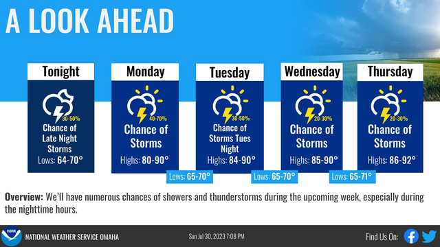
The thing about summer is that patterns get slow and sluggish, less dynamic. A cold front has sagged into the middle of the Ohio Valley and is connected with a stationary front through Montana. Not strong, not moving much, but present, which will mean isolated storms within a couple hundred miles o the boundary. Not strong, but not moving, either. Enjoy this active forecast, Omaha (courtesy the NWS)
Expect August to be dominated by two different stories. The continuing heat, which has lead to extreme warmth in the north Atlantic, and the approach of peak hurricane season. All other things being equal, you might expect that the increased sea surface temperature would lead to an increased risk for hurricane development. There is a long way to go and it certainly remains to be seen, but at this point, it’s still pretty quiet out there.
Of course, while it feels like a slow season, the next named storm will already be the 5th of the year.
Surprise! It’s a severe thunderstorm watch
Severe weather has been pretty sparse in Minnesota lately, but we have a severe thunderstorm watch just issued, and it is on the very northern end of the thunderstorm risk today. There is a little bit of activity in eastern Minnesota so far, but it seems like a strange sight! We’ll see how it goes.
There is a bit of cooler air filtering into the northern US, slowly but surely. Bands of training thunderstorms are expected in the Upper Midwest today. The threat for storms is in the hail and wind variety, particularly when they get going later today. The jet is lingering near the Canadian border, so don’t expect this action to move further south. Sure, it’s hot down there, but at least it isn’t stormy, right?
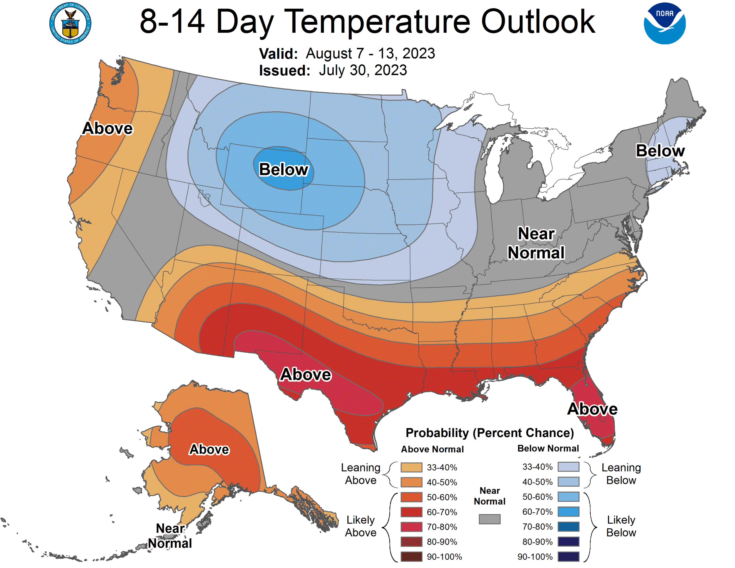
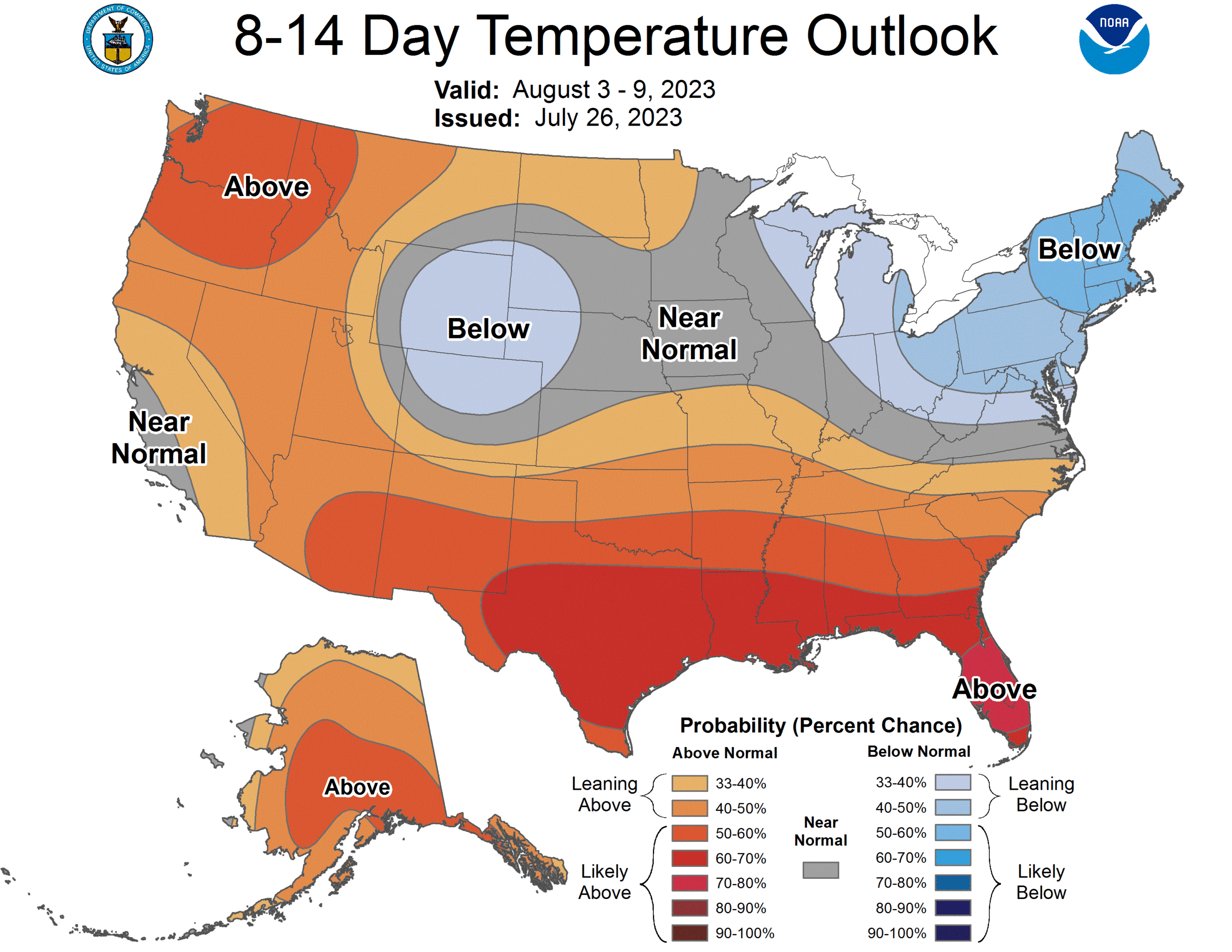
Good news with the heat
The heat is on across the country, as you have no doubt felt and heard about on the news. The really hot weather is expected to ease everywhere, but a true return to normal is coming for New England and California by the beginning of August. As luck with have it, that is the most populous part of the country
Strong storms coming for Michigan tomorrow
There is some heavy weather in the northern Plains this evening, including tornado warnings in South Dakota and Nebraska. Fortunately, this activity is in pretty remote terrain, which makes tomorrows threat more dangerous, even if the storms were at the same level as today’s, because Michigan, especially lower Michigan, is well populated.
Tornadoes and strong winds will be the primary concern, though hail is a threat as well.
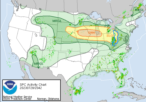
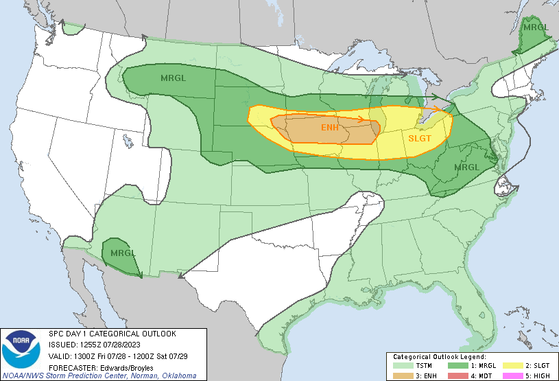
Storms in New York State this afternoon
The risk was marginal initially, but now we are up to a slight with severe hail storms and a severe thunderstorm watch in New York. As these storms pulse down, winds could take down some branches in the forested parts of the eMpire State.
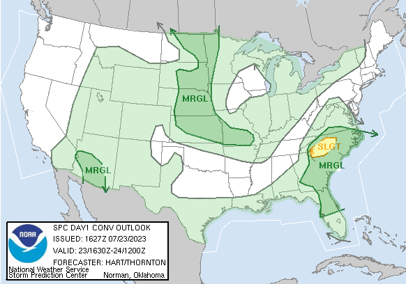
It’s hot and humid, which means thunderstorms
There isn’t a lot of organization to the weather activity with the current pattern, but it’s so warm, and so humid that they are likely to just pop up here and there. Unless you are travelling from Pittsburgh to Jackson and west to Oklahoma City, then you should be ok.