
Friday morning lows
from Victoria-Weather

We made it through the most stressful month of hurricane season, and are moving into at a breakneck pace towards winter. I think autumn and the beginning part to winter are the hardest seasons to forecast for. Those first snow storms are impossible to get right. Wish us all luck
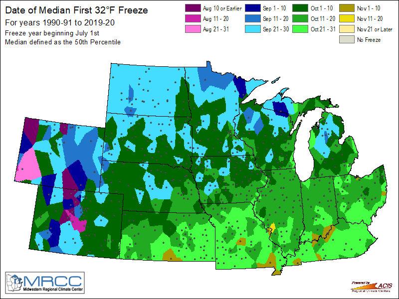
It’s one last blast of summer for the Central Plains, with record heat cancelling the Twin Cities Marathon yesterday, hours before it was scheduled to start. This incredible warmth is only hear for a little bit longer though. By the end of the week, places like Great Falls and Bismarck are going to be playing footsie with the freezing line in the mornings.
If I have to look at this, then so do you.
Ophelia was a soaker on the East Coast earlier this week, but right now there are two disturbances in the Atlantic basin, and neither are expected to significantly impact American interests. Tropical Storm Phillippe is going to diminish as he winds into the northern Antilles, and the next area that the NHC is monitoring is expected to spiral into the open ocean, bothering nobody.
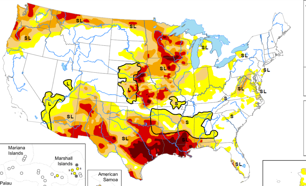
The drought map as summer 2023 winds down is much less aggressive than it has been typically. All the snow, and Tropical Storm Hilary have really taken care of things out west. A soaking rain in the upper Midwest will see some of those areas see their drought levels reduced at the next update. The glaring areas are in two places that typically see a lot of moisture, the Northwest and the western Gulf Coast, so before too long, one would imaging they will see some moisture as well.
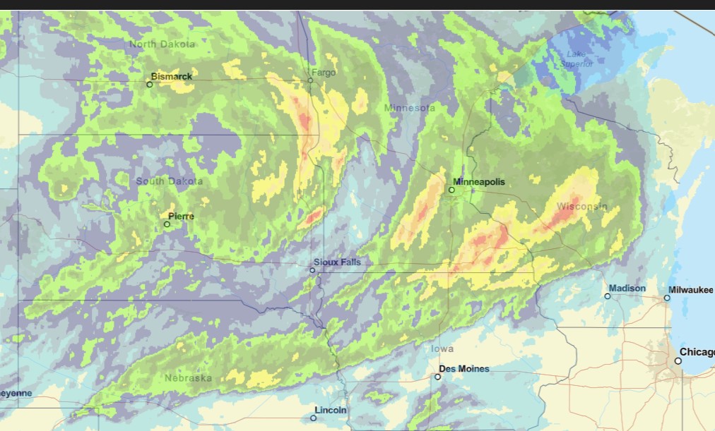
That’s a lot of territory that got a steady rain today. That’s great, but of course it came on the weekend, and at the end of the season. Beggers can’t be choosers.
There will be more to come tomorrow and lastnig to the early part of next week.
Do you remember all the stories we have heard recently about the western US? I think the most recent weather story was about all the snow and rain the region received first with a vigorous winter and then with the remnants of Tropical Storm Hilary. Now? How about some pleasant, below normal temperatures to wrap up the summer. Weird, huh?
Man, it just seems like the Twin Cities can’t get a drop of rain these past couple of years
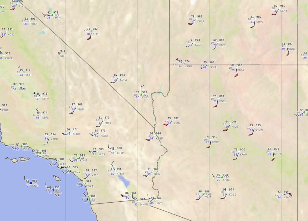
Tired of looking at the Tropics? Me too! Check out these storms in western New Mexico.
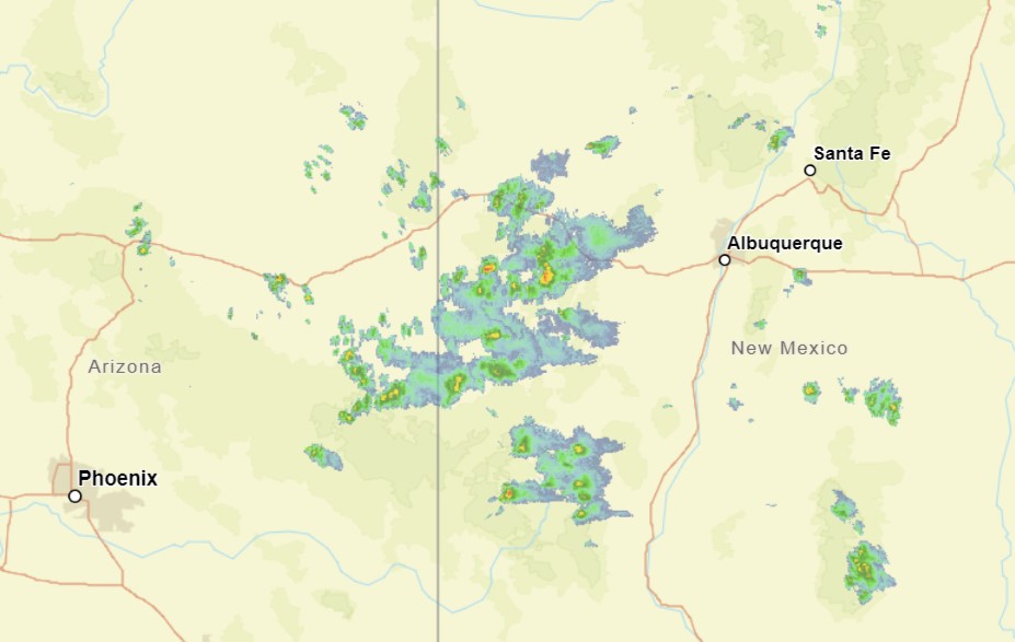
This is some monsoonal moisture, but this time of year, things are moving a little bit more from west to east. This moisture is going to get collected into a developing area of low pressure that will bring a little bit of severe weather to Oklahoma and Texas early this week.