
We’ve had a pattern lately with the subtropical and polar jet were seen in the Continental US, but now, there is only one strong jet rising and falling through the country. Instead of winter weather, though, it is bringing a strong ridge in from the west coast, which is going to lead to a pretty warm middle of December.
A sluggish start to the weekend

A look at the Aviation Weather page shows a lot of red and purple dots, which means IFR and Low IFR conditions. These conditions are tied to low visibility or low clouds, that make landing difficult without instruments (that is what the I stands for). A look at the satellite imagery would show that this has less to do with clouds, and more to do with widespread fog, giving us a gray and dismal start for the weekend to a lot of people.
Hanging on
It’s that time of year for the Great Lakes. The Lakes haven’t yet iced over, but it’s still fairly chilly. There is a weak wave moving through the region, which means that it will be streaming cold air over the warm water, and it’s just going to keep snowing. It’s not really the western New York, multiple feet of snow kind of Lake Effect, just a persistent flurry that won’t go away. No thank you!
Turkey Day snow in the mountains
Snow totals in the mountains were less than one might expect for typical weather advisories. Sure, in the tallest peaks it piled up, but even at some of the resorts, there were only 3-5″ of snow, less on the heavily travelled corridors. Hopefully that means everyone did their holiday traveling safely.
Happy Thanksgiving!
Per the National Weather Service:
A significant winter storm will continue today across the Northern/Central Rockies and portions of the Central Plains. Gusty winds, heavy snow and ice are all possible especially across central Wyoming. Minor to moderate travel impacts are expected across Utah, Central/Southern Wyoming, Colorado and the Nebraska Panhandle.
NWS – State College
So I hope that you aren’t spending this holiday traversing the most desolate stretches of American highways, and instead are spending it with loved ones. Happy Thanksgiving!
A sigh of relief
There was an enhanced risk for severe weather in the Lower Mississippi Valley Monday, which often means a long night of terrible reports. The severe storms were over by nightfall, and there just weren’t as many reports as the high end events can often bring.
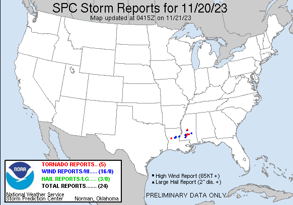
Furthermore, this storm system has brought a soaking rain to a part of the country that desperately needs it. Louisiana and Mississippi are dry, and will welcome the rain, especially if it comes without severe weather.
Snow season is here
I know a big chunk of the Northern Plains saw snow late in October, but it has been nice enough to begin November that I am guessing there is a cross section that doesn’t really remember the wintry weather. As we get deeper into November, every successive storm feature is more and more likely to bring winter weather advisories, or even more severe. For example, take a look at the current advisories from the NWS:
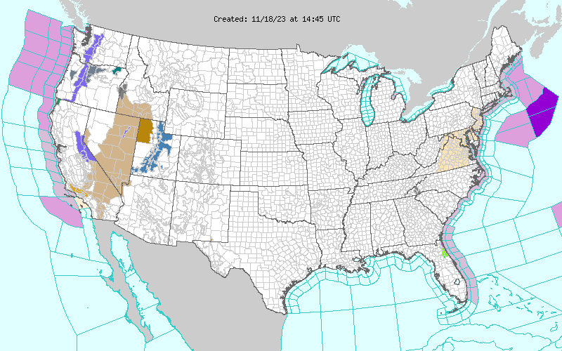
There are advisories for the Cascades, Sierras and Wasatch Mountains. It’s still early enough in the season that the first few waves necessitate a warning, but late enough that the snow is definitely here.
We wrote a couple of follow ups recently, from the approximate end of the Atlantic Hurricane Season and the October Forecaster of the Month. It is easy to wonder how different things would have looked if it had been a busy landfalling October, to see where our attention was and how the outlets did, comparatively. As it was, we were all pretty similar in effectiveness.
The Northern Lights were out in Canada
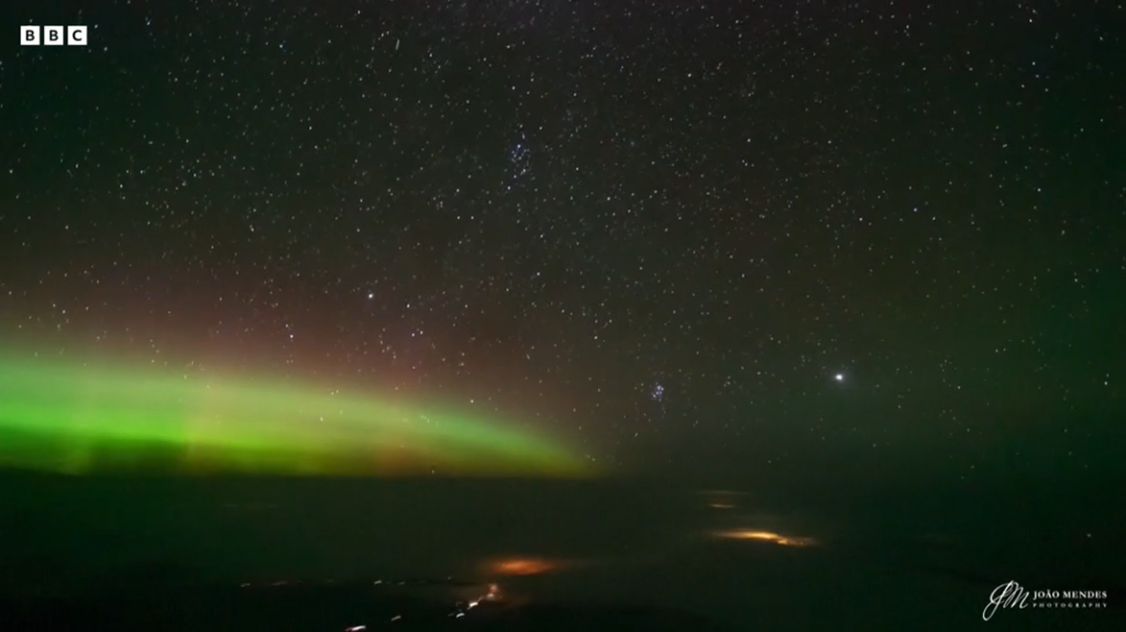
The full video from the BBC is here.
No volcano concerns for aviation
Remember 2010, when Eyjafjallajökull erupted in Iceland, and kicked up so much ash that it crippled North Atlantic aviation for weeks at a time? Well, there is another large eruption in Iceland anticipated near the Grindavik region, but for now, there are no concerns that there will be similar disruptions.