11:09PM – It’s late, but as you may know, we have seen some severe weather tonight, and earlier this week. I haven’t missed my chance, because there will be more!
from Victoria-Weather

11:09PM – It’s late, but as you may know, we have seen some severe weather tonight, and earlier this week. I haven’t missed my chance, because there will be more!
3:41PM I’m sorry, but what in the Wide World of February are we doing here? A marginal risk for severe storms on Mardi Gras in Omaha?
(Note to ed: Don’t look at Thursday’s forecast if this bothers you!)
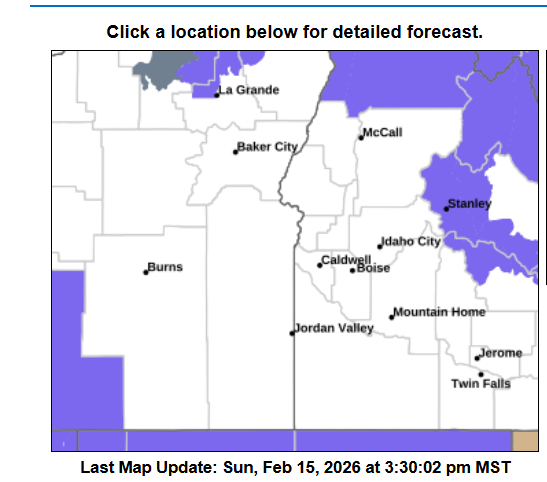
4:37PM: Things are active across the country, including severe weather in the Southeast and the potential for winter weather in the Northwest. I have to say, the current advisory map for Boise is fairly ominous. You’re surrounded!
10:53PM: Happy Valentines Day! Especially if you are in the middle of the country, and are a fan of warm weather. Record highs were reported in Minneapolis today, as a part of that surge of warm air. Heart shaped sunglasses for all.
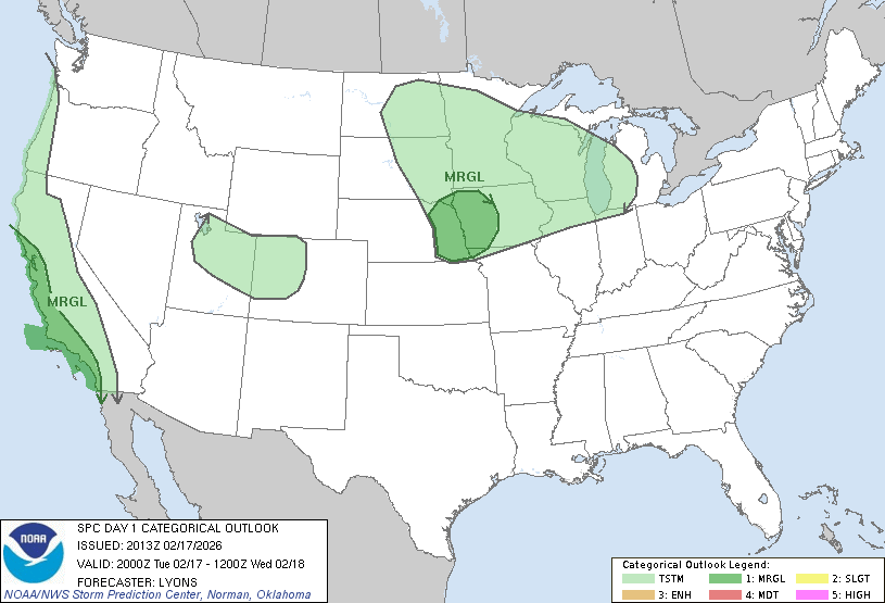
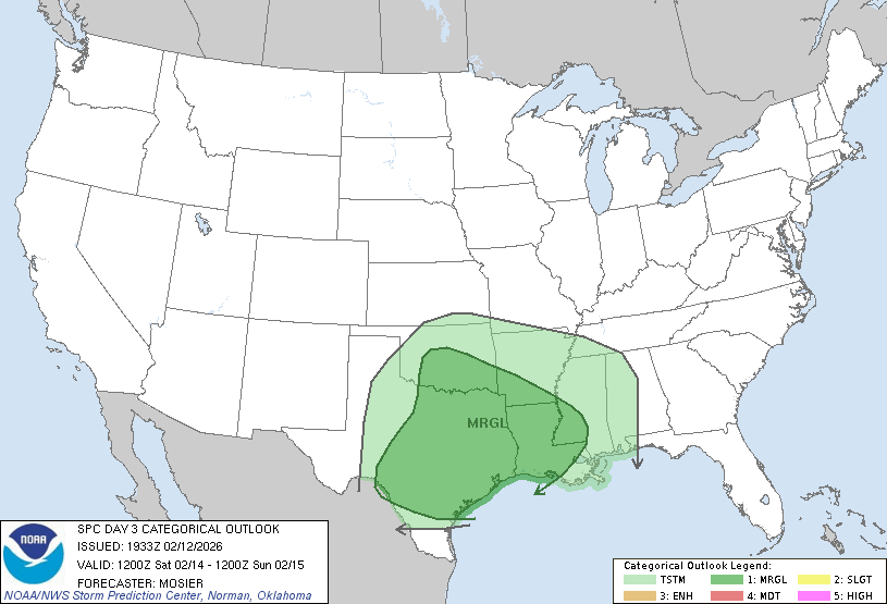
10:28PM: We talked about the change the pattern is going to be experiencing in the very short term. One of the functions of this change is that we will see an active pattern, with low pressure drawing moisture out of the Gulf. Well, here it comes. This is the thunderstorm outlook for Saturday.
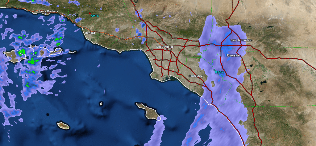
8:04: Absolute pandemonium is about to ensue. The LA area is getting dampened, and it is only going to get wetter.
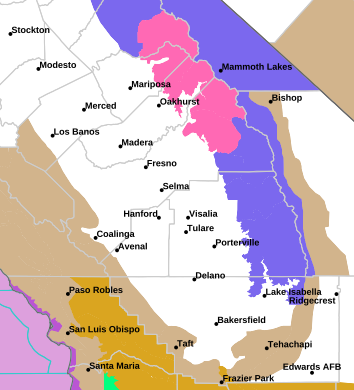
11:46PM: Here we go gang! Look at all these snow and winter advisories in the Sierras!
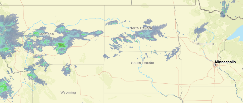
11:33PM: I hope everyone enjoyed the big game! If you are taking a quick gander at the radar before bed, the only thing that stands out to me is that a boundary in the northern Plains is spitting out a bit more snow than I think we expected. Otherwise, a pretty quiet night elsewhere. Except Seattle, I assume.
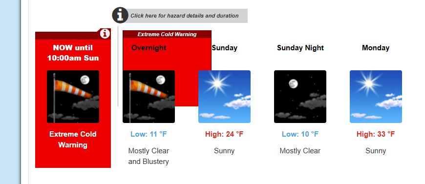
11:41PM: Stay warm on the east coast tonight, folks! It is going to be very chilly, with extreme cold warnings as far south as Baltimore.
10:52AM: I can confirm from our forecast for Janesville last night that a weak little band of snow did come through, but there were no accumulations noted. There were light snow showers in the observations for about 3 hours, and now it is 36. It is cloudy, so don’t get ready to go tanning or anything quite yet.
12:57PM: The weather is quiet for a lot of the US right now, but there is one pocket of the nation that is looking ahead to a bit of snow. It is a very narrow pocket, and it isn’t much snow, though. This one is for the handful of people that might actually visit this site!
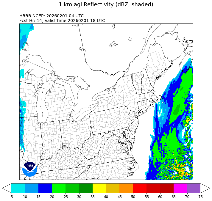
12:04AM: Wind? Yes? Snow in the mid-Atlantic and New England? No.