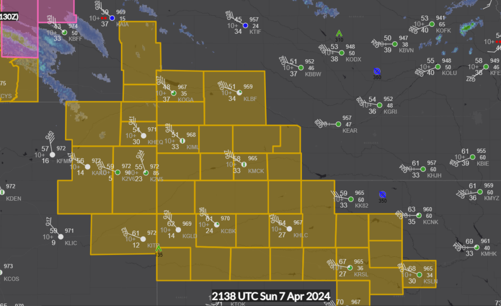
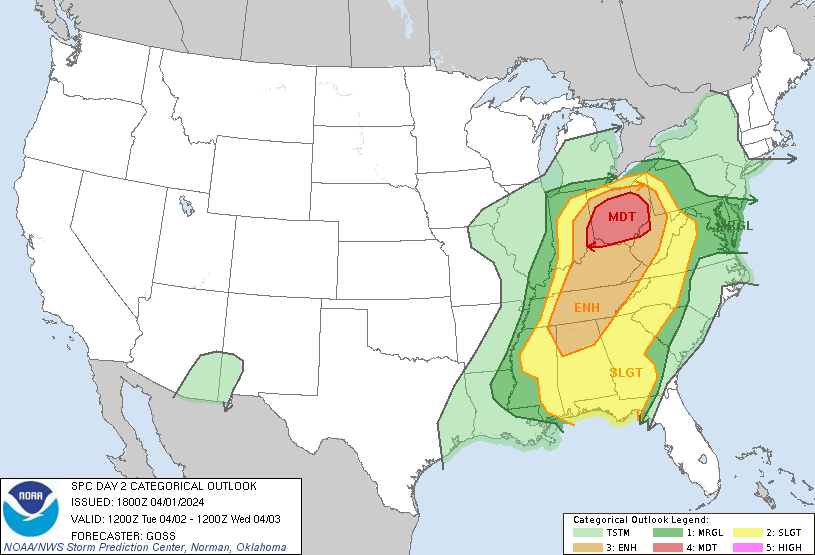
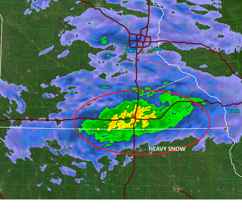
At this point, most of the precipitation in southern Minnesota is falling as rain, and even then, there is a dry slot right over the Twin Cities metro area that isn’t being picked up well by models. Right now, the NAM model has among the better solutions, but the best bet is looking at the short range models. One thing all of them are consistent on is a reformed area of low pressure and another blast of nasty, and this time windy, conditions overnight.

Heavy snow band setting up in southern MN

A band of very heavy snow is presently just north of the Iowa border in Minnesota. At Austin, they are reporting some thunder along with the snow, indicating the rapid rate that the precipitation is falling, and the energy in the system. The change to rain keeps moving up in the forecast though, and will be chasing this heavy band, and we still await confirmation on how much snow we will see

I’ve earned this

How many times have I mentioned that warm weather keeps continuing in the middle of the country, and we are looking more and more like we are getting out of winter without much, if any more snow? Naturally, that has invited this 72 hour accumulation forecast, which will only fill in in the Upper Midwest as the forecast period moves toward the weekend.

A fairly inauspicious feature moving through the Great Lakes yesterday has tapped into some cold air as it arrives in the mid Atlantic. There is mixed precipitation east of the Great Lakes, and some snow falling in the terrain of the Poconos.

Wind, hail blowing through Wisconsin

A tightly wound area of low pressure, remnant from the terrible flooding in the Southwest, is plowing through the Great Lakes. It’s February 8th, and the feature is intense enough that it is producing storm reports, including 50mph wind and 1 inch hail.

I should note that these are simply the most recent observations, with the wind coming from the system in the area, but there was even a tornado observed south of Madison this afternoon. It was the first February tornado in Wisconsin in recorded history.

The work week is right around the corner, and it looks terribly active, especially out west, where flooding and mountain snow are going to be the story for millions of people in California and Nevada. Fortunately, this won’t translate to severe weather later in the week. I’ll look forward to having a few posts on all this weather, including forecasts, starting as soon as tomorrow.