
A fairly inauspicious feature moving through the Great Lakes yesterday has tapped into some cold air as it arrives in the mid Atlantic. There is mixed precipitation east of the Great Lakes, and some snow falling in the terrain of the Poconos.
Wind, hail blowing through Wisconsin
A tightly wound area of low pressure, remnant from the terrible flooding in the Southwest, is plowing through the Great Lakes. It’s February 8th, and the feature is intense enough that it is producing storm reports, including 50mph wind and 1 inch hail.
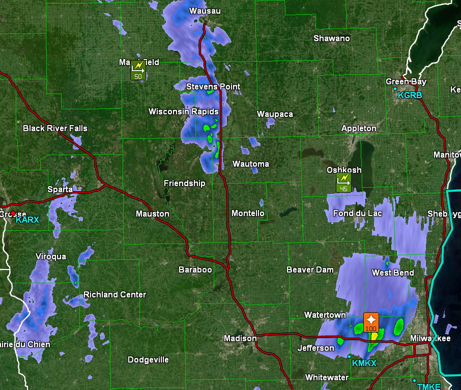
I should note that these are simply the most recent observations, with the wind coming from the system in the area, but there was even a tornado observed south of Madison this afternoon. It was the first February tornado in Wisconsin in recorded history.
The work week is right around the corner, and it looks terribly active, especially out west, where flooding and mountain snow are going to be the story for millions of people in California and Nevada. Fortunately, this won’t translate to severe weather later in the week. I’ll look forward to having a few posts on all this weather, including forecasts, starting as soon as tomorrow.
We were doing so well
Oh, man, when we looked last week in Dallas, things were looking to get a little bit better. Now when I check in after the weekend expires, they are mired in some low ceilings and visibilities in the wake of a weak system that brought chilly rain to the region to start the week. At least they didn’t get the ice they got in Oklahoma City and Kansas City!
Did you know the slogan for high surf put forth by the NWS?
“When in doubt, don’t go out”. Now you know.
Chilly spell coming for the Rockies
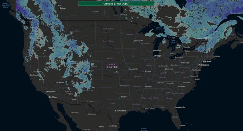
Not much snow yet
I noted the storm getting ready to move into New England over the next 48 hours, but what I didn’t note was that interior New England is one of the few places across the country that already has snow on the ground. If you want snow, you had better also have a mountain or an upwind Great Lake.
Another note to the storm headed to New England… The element that is supposed to be introducing the cold air isn’t even cold enough for snow in Michigan. Rain is expected overnight through much of lower Michigan
Only one jet, patterns more apparent
We’ve had a pattern lately with the subtropical and polar jet were seen in the Continental US, but now, there is only one strong jet rising and falling through the country. Instead of winter weather, though, it is bringing a strong ridge in from the west coast, which is going to lead to a pretty warm middle of December.
A sluggish start to the weekend

A look at the Aviation Weather page shows a lot of red and purple dots, which means IFR and Low IFR conditions. These conditions are tied to low visibility or low clouds, that make landing difficult without instruments (that is what the I stands for). A look at the satellite imagery would show that this has less to do with clouds, and more to do with widespread fog, giving us a gray and dismal start for the weekend to a lot of people.
Hanging on
It’s that time of year for the Great Lakes. The Lakes haven’t yet iced over, but it’s still fairly chilly. There is a weak wave moving through the region, which means that it will be streaming cold air over the warm water, and it’s just going to keep snowing. It’s not really the western New York, multiple feet of snow kind of Lake Effect, just a persistent flurry that won’t go away. No thank you!