Tonight we embark on a 1,500 mile trip, from the Pacific Coast to the Big D. What weather will this weekend road trip encounter?? Let’s find out!
DAY ONE
As an upper-level trough shifts through the Pacific NW, an area of low pressure at the surface is developing over western WY and trailing a cold front of sorts back through the Great Basin. Luckily for us, all this activity is going to stay to the north of our Day One travels as we head east out of Oxnard through the northern LA Basin and then eastward on I-10 past Palm Springs and through the desert, eventually ending the day in Phoenix.
DAY TWO
It’s going to be a full day heading east on I-10, and better have those sunglasses because it’s looking like a pretty good day for traveling! There’s a slight chance of a few evening isolated thunderstorms, but those are just expected around the Big Bend area of the TX/Mexico border and should be off to the south of where we end our day in Van Horn, TX.
DAY THREE
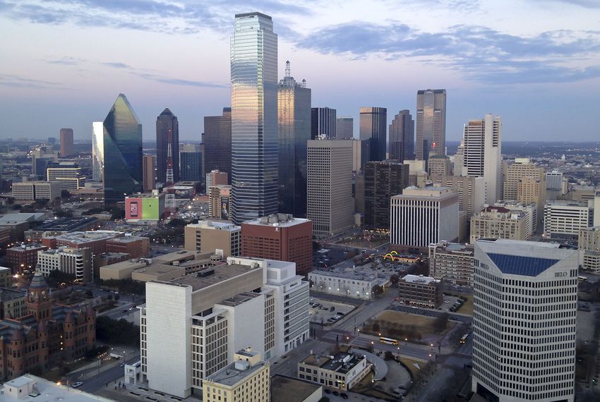
I-20 is gonna be our home for the final leg of this stretch. It should be a pretty quiet day as we pass be Odessa, Midland, and Abilene. As we approach our final destination, there could be some widely scattered showers and thunderstorms as the tail end of a cold front shifts through the Red River Valley. Most activity should be off to the north over OK though, so odds are it’ll be a dry evening as we pull into Dallas!
Just to provide some context for just how big these United States are, we will be staying entirely west of the Mississippi and remain in states that border either the Gulf of Mexico or the nation of Mexico, and we will still be traveling 1,842 miles and taking 3 long days to get where we are going. We’ll even take interstates, so we’ll cover 68mph, and 546 miles per those first two days, and we’ll STILL have a lengthy 11 hour day to finish with.
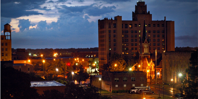
Monroe, Louisiana
DAY ONE (Wednesday) There is a stout ridge of high pressure in the southeastern United States, and most of the precipitation for the next couple of days will be ridge riding on the north side of this dome, meaning very hot, dry and mostly sunny weather in the southeast, including in Louisiana and east Texas. The western edge of this dome will be in west Texas, but we will stop in Childress, before we run into the associated showers and thunderstorms. Hopefully, the AC works in the hotel.
DAY TWO (Thursday) As is the nature of shower activity on the backside of high pressure, it won’t be moving anywhere, but it’s coverage will probably expand through the day on Thursday. Expect some showers and storms through Amarillo, and as we cross into New Mexico, rain will lighten, but persist. In fact we may see rain persist right up to Tijeras, butting up against the foothills of the mountains surrounding Albuquerque. We’ll be in the clear, however, by the time we reach New Mexico’s biggest town, and will drive in sun to Manuelito, just before the Arizona line.
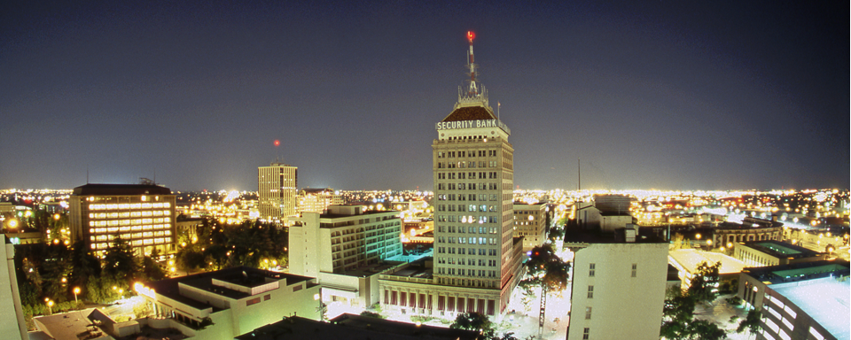
DAY THREE (Friday) High elevation rain showers may encroach the hills east of Manuelito, but that will be the only threat for this long finishing day of our trek. Strong low pressure is going to develop in the Rockies, kicking up a Santa Ana wind that may necessitate a firm grasp of the steering wheel. particularly as the day reaches it’s final stages, and we turn north into the San Joaquin Valley. Fresno will be mild and could be fairly breezy.
We are going to head right into the heat here in the dog days of summer. There will be a point where we have to pass through some storms to get from moderately more tranquil weather in New England to the steamy south, but where will it happen along our 2013 mile journey? And when, over the 4 day trek? As you might be able to establish, we will cover a bit more than 500 miles a day (519, actually) while traveling at a pace just shy of 65mph, which is somewhat slow, thanks to the tangled web of the east coast, and not a fear of impending thunderstorms.
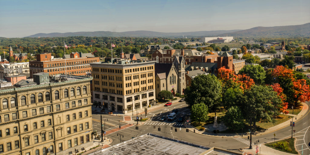
Providence, Rhode Island
DAY ONE (Tuesday) Naturally, the feature first expected to impact our journey will be a weak shortwave trough moving out of the Great Lakes. Why is this great? Because I’m being sarcastic, and this will be difficult to forecast around. There is consensus that we will be dry through the New York City area, but then it becomes a little dodgier. I think the model that brings a lot of rain to Pennsylvania is doing so because of poor resolution. I think it’s going to generally be mostly cloudy with some isolated spots of rain, but maybe not enough to even turn the wipers on. These dots will be possible for the rest of the journey, though becoming less likely as we pass into Virginia. The day will end in New Market, Virginia, in the northern part of the state.
DAY TWO (Wednesday) Another wave moving into the Great Lakes is going to carry with it a bit more weight. Inflow towards the low might lead to some fog and haze in the Appalachians and Smokey Mountains, but the potential for heavy thunderstorms will arise in Tennessee. Not widespread, destructive thunderstorms, mind you, but isolated, pop up showers and storms of questionable coverage. The strongest storms will stay west of the Appalachians, and coverage will begin to wane as a strong batch of storms erupts over northern Missouri late in the afternoon. We’ll make it to Reece City, Alabama, northeast of Gadsden.
DAY THREE (Thursday) I’m not in the market for going out on an island to predict tropical storms, but I will say, there looks like a week area of low pressure developing over the western Gulf through the middle of the week. Alabama will stay dry on Thursday morning, but some scattered showers will pop up fairly early in Mississippi, and we should be soaked through southern Louisiana. Thunderstorms are likely, but I would be surprised if any of this activity is severe. We’ll stop just west of Lafayette, in Scott, Louisiana.
DAY FOUR (Friday) That at times steady rain, with a few embedded thunderstorms, will continue through western Louisiana, and may even remain a concern as deep into Texas as Houston, but after we reach the western suburbs, I think we are in the clear. Just in time for more oppressive heat! At least there will be a few clouds every here and there, but not enough to make things feel significantly diffeent in San Antonio than they did in Providence.
Today we embark on a 2-day, 677-mile trek through the Appalachians to the Deep South. We could probably get this one in one very long day, but we’re gonna take our time and enjoy some scenery!
DAY ONE
High pressure is found over the OH and TN Valleys, keeping much of the region dry into the Central and Southern Appalachians. A sunny day is expected as we head south out of Morgantown through WV and through western Virginia. Continued pleasant but hot conditions are anticipated for the rest of the day as we end this leg in Knoxville.
DAY TWO
As high pressure continues to control the region, more sunny skies and dry conditions are expected for the rest of the trip. Temperatures are expected to hit the triple digits as we head past Chattanooga into Alabama and eventually into Birmingham, but at least the trip will be dry!
Today we embark on a 3-day, 1,687-mile cross-country trip. However, we’re not going coast to coast, we’re going from the Gulf to the Great Plains! Let’s see what the next few days has in store for us as we make our way from Tallahassee to Grand Forks.
DAY ONE
Quiet conditions are expected for our departure from Tallahassee in the morning. As we pass by Montgomery midday, a few isolated showers and thunderstorms look to develop in the region, but most of that should be off to the east of the route. Dry weather should persist for the rest of the day as we pull into Nashville for the night
DAY TWO
Quiet conditions are anticipated for the start of the second day, though as we head northwestward on I-24 into KY, there could be a couple isolated showers during the late morning hours. We’ll pass by Paducah and head north towards Champaign, with partly to mostly cloudy skies along the route. Dry weather persists throughout the day as we pass Champaign and continue north towards Rockford, our stop for the night. There could be some isolated shower activity as we pull in, but thunderstorms might be seen off to the northwest.
DAY THREE
Low pressure shifting through WI and IL to start the day could make for a cloudy and showery morning as we head north towards Madison. Thunderstorm activity, if it’s already started, should be off to the east so that’s some good fortune for us as we start this long day. Dry conditions are expected through the midday and afternoon hours along I-94 through WI towards the Twin Cities, though don’t be surprised if a late-afternoon shower pops up as we make our way into MN. As we continue along I-94 past St. Cloud towards Fargo, dry conditions are expected once again and remain so for the rest of the trip into Grand Forks!
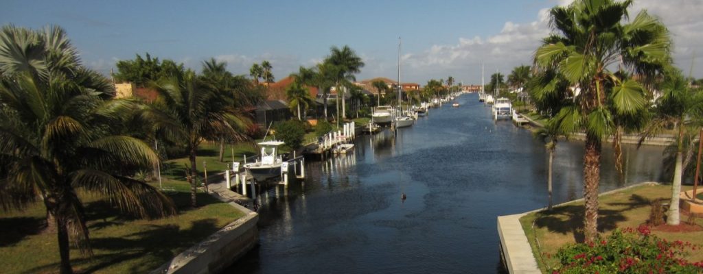
I know how great vacation can be, but driving to Florida along the East Coast seems like such a challenge. But then, getting to La Guardia from Bridgeport doesn’t seem like a lot of fun either, so a 2 and a half day trip it is! We’ll meander over the course of 2 1/2 days at a pace of 62.6mph, which as you should know by now, isn’t very fast. We will cover barely over 500 miles a day on days one and two, with the rest of our 1284 mile journey reserved for Saturday.
Punta Gorda, Florida
DAY ONE (Thursday) This is the rare August in which the southeast is somewhat synoptically active. There are a lot of showers and storms in the northeastern Gulf as high pressure sinks into the Carolinas. The daily convection in the southeast will likely not make it further north than Gainesville, which means that if we start early enough, we should stay dry all day. Well, save for the sweat we break out into every time we stop for gas. It’s still going to be hot and humid, until we reach Gable, South Carolina, southeast of Sumter. This blog is very into Sumter right now.
DAY TWO (Friday) High pressure won’t last long in the face of August heat and humidity in the southeast. Alas, a blob of moisture will waft north into Georgia and the Carolinas. We should be sneaking into Virginia by the time it really gets active, but with the moisture wrapping into the eastern exposures of the Shenandoahs and Blue Ridge, don’t be surprised to see some late afternoon haze and clouds, even as far north as Havre du Grace, Maryland, at the northern end of Chesapeake Bay, and our terminus for the day.
DAY THREE (Saturday) Further north, high pressure often has a greater toehold, and that will be the case on Saturday. A wedge of dry air associated with low pressure in Canada will make itself at home in between the moisture blob to the south and that same area of low pressure. It’s going to be a bit of an intense day of driving, as we pass through the southern and eastern parts of the Philadelphia metro, and then right through the heart of New York, but it should be worth it, as Bridgeport is in for a fantastic start to the weekend.
This drive will straddle the Appalachians, and despite the nexus generally in the Eastern US, we will duck a lot of the traffic trouble. We’re going to take 2 days with a total distance of 1,066 miles. We’ll average 66mph, and will travel 528 miles, a little less than half, on our first day of travel.
Pittsfield, Massachusetts
DAY ONE (Friday) It’s been a bit active in the eastern United States, but we are looking at a break in the action, at least in the Northeast and Mid-Atlantic tomorrow. A perturbation rolling through the Great Lakes tomorrow will bring some rain to interior New England initially, and reaching the coast by late afternoon. By that time, though, we’ll be well into the Potomac Valley, on our way to Mint Spring, Virginia, which is near Staunton.
DAY TWO (Saturday) The sunshine will continue while we are to the east of the Appalachians, but as we crest them, we will also begin to intersect the moisture flow from the Gulf. Our drive through Tennessee will be dotted with rain and thunderstorms triggered by flow sneaking up the hillsides, and we will have to navigate this threat for the remainder of our drive. There will be more widespread gaps in precipitation the nearer we are to to Hunstville, thanks to the slightly flatter terrain, but the storms will be based nearer to the surface, which suggests a bit more intensity when we are in them. And gosh dang, will it be hot.
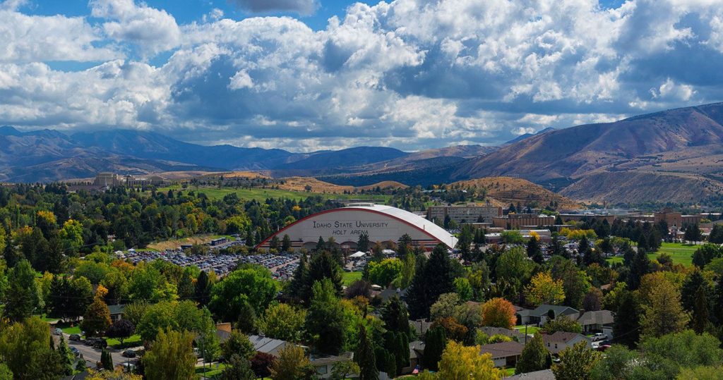
It is a hot and active time in the northern US right now. Where there are no storms, there is blistering heat, but where there are storms, the heat abates. What will we contend with? The heat? The storms? Certainly the humidity? The only way to know is to look into the future, as we forecast for this 4 1/2 day trip, which will cover 2,463 miles. We will collect 532 miles a day. at a modest 66.5mph
DAY ONE (Tuesday)
Pocatello, Idaho
DAY ONE (Thursday) While things have been a bit tumultuous this week, the biggest, baddest area of low pressure in the Plains is lifting towards Hudson Bay, as though it were a regular winter feature. This will provide a modicum of relieve for waterlogged farmers in the northern Plains, and a great deal of relief for anyone navigating the wilds of Idaho and Wyoming, as we will. There won’t be much to get in our way as we trek eastward, stopping in Egbert, Wyoming by night’s end.
DAY TWO (Friday) Flow over the mountains will continue to be westerly, and as it ever does, it will fill in the gap behind the previous system with another lee trough. It will be tapped of moisture, though, and will function only to accelerate the warm air from the Gulf to the Plains. Hot and stick in Nebraska, and western Iowa, where we will alight upon Wiota, west of Des Moines, for the night.
DAY THREE (Saturday) That advancing area of low pressure will start causing problems on our Saturday drive. The GFS, generally agreed to be more reliable in the longer term is indicating widespread precipitation from Iowa to Illinois and Indiana, though I suspect that is a resolution issue. Instead, it’s going to be hot and humid all day, with only a stray thunderstorm here or there. Granted, those storms will likely dump a lot of rain where ever they do show up, which will severely cramp our style. The drive will end in Howe, Indiana, off of the Indiana Toll Road. when we get there depends on how bound up a stray thunderstorm makes Chicago.
DAY FOUR (Sunday) That area of low pressure from earlier in the trip, the one that we noted would be headed towards Hudson Bay? Well, he’s still going to be there, just hanging out. This will lead to much of the eastern third of the country being active, though not in a terribly organized way. Scattered thunderstorms cropping up in the heat of the day, without any semblance of a plan. This will require us to be vigilant with the wipers from Howe to Syracuse, though there is a chance those showers start tapering off as we role into Syracuse for the night.
DAY FIVE (Monday) The mishmash of showery humid air will organize a bit to start next week. In New England and New York, this can be a bit more dangerous because of all the tree coverage. A bit of wind can block roadways for hours with the debris. don’t be surprised to see extra traffic through Albany and on to Massachusetts and southern New Hampshire.
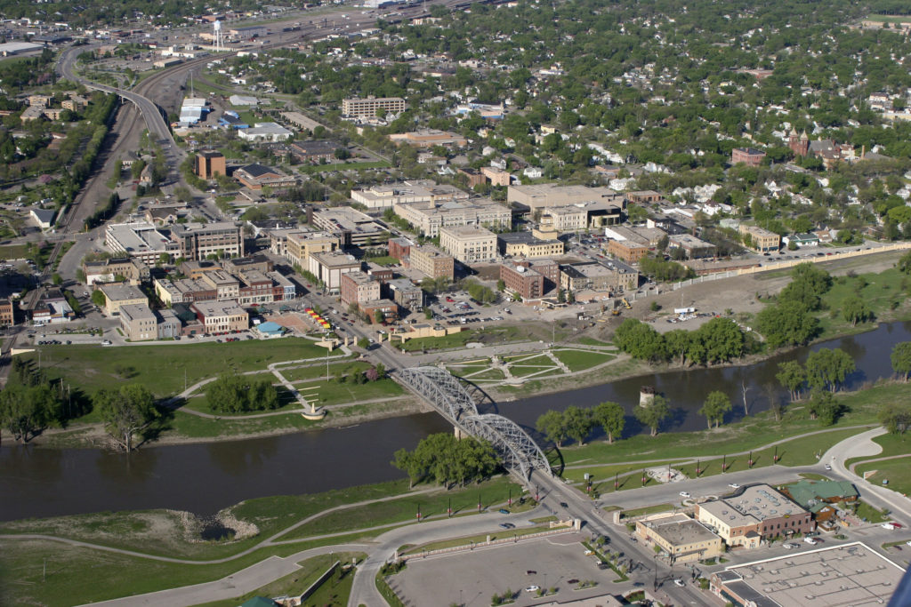
One day. One long day, and four states, those are the stats on this Midwestern trek. It will take a little over 9 hours, albeit those will be traffic slogged in Chicago, to cover 608 mles. How bad will traffic be? Google suggests an alternate route through Indianapolis that is less than an hour longer, but covers 72 more miles. The pace of our route is 66.4mph, which doesn’t seem daunting, but it does seem optimistic.
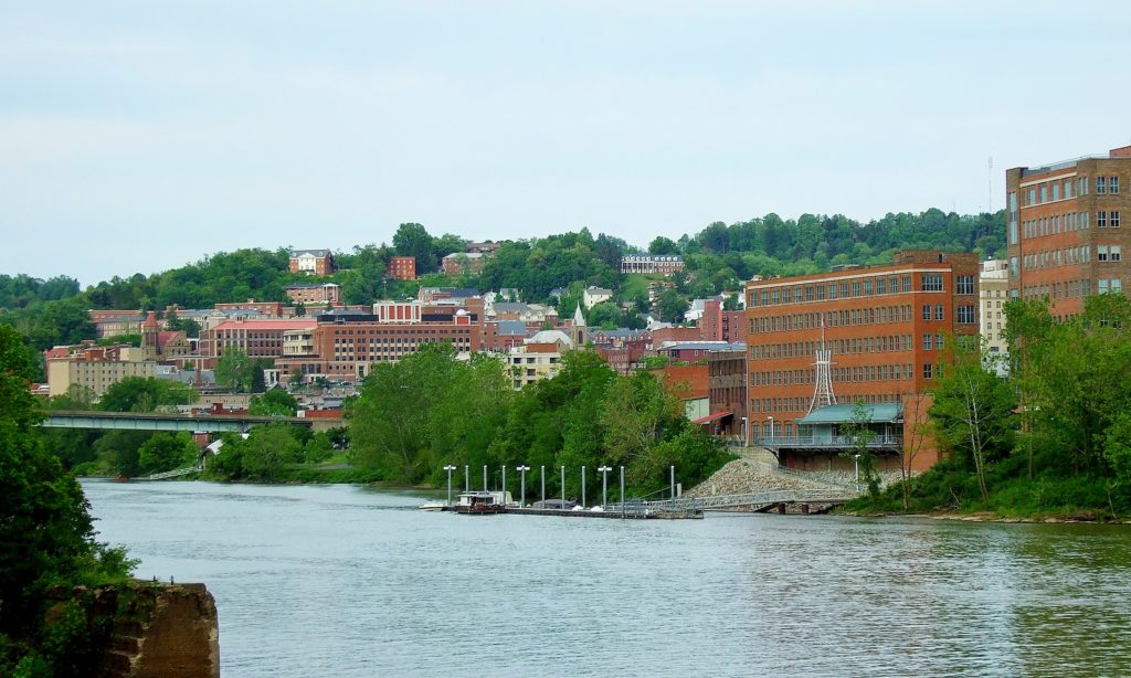
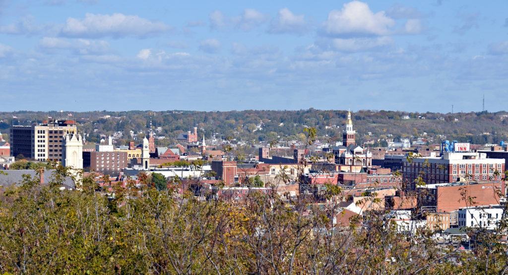
Canton, Ohio, via VisitCanton.com
Low pressure in the Great Lakes is bringing some northerly flow to the Northern Plains and cycling in batches of rain and isolated thunderstorms to most of our route. The low is shifting north and a little east, however, and by tomorrow, the Ohio and Indiana portions of our journey will be in the clear. A second volley of wet weather will cycle into the region late in the day tomorrow, and while most of the activity will be heavy clouds in northern Illinois, we should expect some rain in spits and starts between Chicago and the Quad Cities, with thinner clouds bout those same spots of rain between Davenport and Dubuque. Not much, but it will be there, probably when you are bringing luggage to your hotel.
By Dirk – originally posted to Flickr as Dubuque Iowa, CC BY 2.0, https://commons.wikimedia.org/w/index.php?curid=7121481
Got a long trip from northern CA to the Deep South, covering 2,536 miles, which should take 5 days to cover.
DAY ONE
A broad ridge of high pressure is found over the Great Basin/Four Corners region, which is keeping most of the thunderstorm activity over the Sierras as well as the Rockies in the Four Corners region. Much of the day should be dry and fairly quiet as we travel southward from Redding along I-5 to Sacramento, then along Hwy 99 through much of the Central Valley past Fresno and Bakersfield. Late in the afternoon and evening we’ll cut across the Antelope Valley on 58 before ending our long day in Barstow.
DAY TWO
Going to be spending all day on I-40 as we head east out of Barstow and eventually make our way into northwestern AZ by midday. Some spotty thunderstorms are expected to get going over the mountains as we make our way towards Flagstaff, so by the evening hours some of this activity looks to roll off of them, which could give us a bit of a wet welcome heading past Winslow and Holbrook before ending our night in Gallup, NM.
DAY THREE
Slightly shorter day today, but still a hike across New Mexico as we continue our tour of I-40. However, storms are expected to flare up over the mountains in the central part of the state, so if we don’t get past them in time, we’ll be needing to turn on our wipers as we pass Albuquerque and eventually Santa Rosa. If we can get out ahead of the storms, it should be smooth sailing into Amarillo, TX, where we’ll end the night. Don’t be surprised if some late evening storms roll into town however, might keep us up a bit.
DAY FOUR
Our tour of I-40 comes to an end as we head southeast on 280 out of Amarillo towards Wichita Falls. Unfortunately a boundary settling across the Central Plains eastward is interacting with moisture coming up from the Gulf, and widespread showers and thunderstorms are expected to develop during the midday hours and persist well into the evening. Some thunderstorm activity could get potent as we pass by the Dallas-Fort Worth area, hopefully we’re able to dodge it as we continue onwards and end the long day in Shreveport, LA.
DAY FIVE
Looks like it will be another day of dodging showers and storms as low pressure shifts into the Mid-MS River Valley, increasing the chances of storms from AR/LA eastward into AL/GA as the day progresses. I don’t expect a washout, but you will have to keep an eye on the sky as we push through MS on I-20 past Jackson and eventually into Alabama before finally ending our trip in Montgomery.