I was in Costa Rica just two months ago. The capital and largest city there is also called San Jose, though I suspect the forecasts to begin this week will be a hair different.
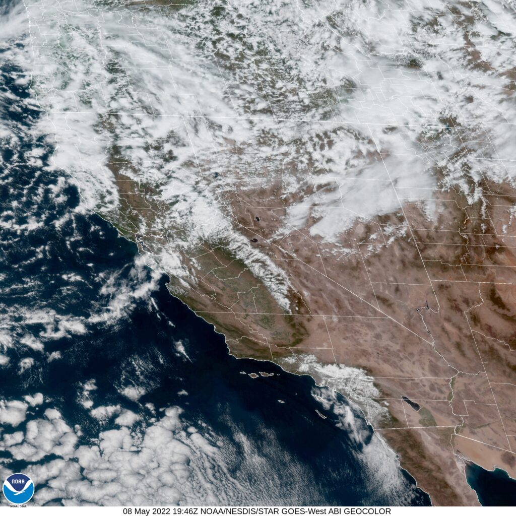
AT 753PM, PT, San Jose was reporting partly cloudy skies with a temperature of 54 degrees. Low pressure in the Pacific Northwest is extending a cold front being reflected at the surface approaching Victorville, while a band of clouds is streamed across the San Jose area. Brisk northwesterly winds give evidence that the boundary is through the region already. Heavy snow is expected in the higher terrain in Northern California as the upper level trough remains entrenched and moisture abundant.
As ridging strengthens in the middle of the country, the upper level trough will contort and dig deeper across the Bay area. Precipitation will become less likely, as a deeply distended trough in the northwest has less access to moisture, but unseasonably cold temperatures will be on the order for Silicon Valley, accompanied by blustery winds.
Tomorrow – Mostly cloudy, High 60, Low 45
Tuesday – Mostly cloudy, High 60, Low 45
TWC: Tomorrow – Mostly cloudy skies early will become partly cloudy later in the day. High 63, Low 46
Tuesday – Sunshine along with some cloudy intervals. High 63, Low 45
AW: Tomorrow – Cool with times of clouds and sun High 62, Low 47
Tuesday – Partly sunny and cool with a shower in places High 63, Low 45
NWS: Tomorrow – A 20 percent chance of showers after 11am. Mostly sunny, High 62, Low 42
Tuesday – A 20 percent chance of showers. High 63, Low 41
WB: Tomorrow – Partly cloudy. A slight chance of showers in the afternoon. High 61, Low 46
Tuesday – Partly cloudy. A slight chance of showers, High, 62, Low 46
WN: Tomorrow – Partly cloudy with light rain showers, High 63, Low 43
Tuesday – Partly cloudy with isolated showers, High 63, Low 41
FIO: Tomorrow – Partly cloudy throughout the day. High 61, Low 47
Tuesday – Clear throughout the day. High 64, Low 45
A wide array for you to choose form. Who will be right in the end? Satellite shows chaos to the north, and one defined boundary in California.