Springfield, Massachusetts

I am sure this is something you all know out in New England, but I learned recently that Springfield is actually serviced by Hartford’s Bradley International Airport. They are so close!

At 1055AM, ET, Springfield was reporting clear skies with a temperature of 31. There is a steady north wind thanks to a vast gyre off the coast of New England, and some scattered clouds north of Massachusetts, but despite these factors working against the town, a pleasant February day is anticipated.
Surface high pressure will continue to remain in place for the next few days, but a jet ridge will start nosing into the area by the end of the week, with a warm front nosing in on Thursday, really bringing about a warming trend.
Tomorrow – Mostly sunny, High 43, Low 26
Thursday – Partly cloudy, a bit warmer, High 47, low 28

TWC: Tomorrow – Generally sunny despite a few afternoon clouds. High 44, Low 25
Thursday – Plentiful sunshine. High 47, Low 26

AW: Tomorrow – Plenty of sun High 46, Low 24
Thursday – Sunny and mild High 48, Low 25

NWS: Tomorrow Sunny, High 43, Low 24
Thursday – Sunny, High 46, Low 25

WB: Tomorrow – Sunny, High 40, Low 28
Thursday – Sunny, High 45, Low 28

WN: Tomorrow – Mostly sunny, High 43, Low 24
Thursday – Mostly sunny, High 46, low 25

CLI: Tomorrow – Partly cloudy, High 46, Low 25
Thursday – Sunny, High 50, Low 25

Wow, Clime is going for the gusto, boldly putting Springfield at 50. We’ll see how that goes.

San Luis Obispo, California

This has been a busy January. Not only have we had a lot of forecasts, but they have all been during or very close to significant weather. The real test will be if we can keep it up with a forecast in California.

AT 256PM, PT, San Luis Obispo was reporting a temperature of 58 degrees with overcast skies. A weak wave was moving through the Pacific Northwest, and sweeping a mid level cold front as far south as Point Conception. There were scattered showers through out the region, though right now, the heaviest precipitation is diminishing between San Luis Obispo and Bakersfield, with another batch closer to Los Angeles.
The rain is expected to linger in the area, though mostly inland from San Luis Obispo and south towards the LA Basin. The onshore flow behind the boundary will mean that San Luis Obispo will see some overcast through the day Thursday even if they don’t get much more rain. An advancing ridge should bring clearer skies to end the work week.
Tomorrow – Mostly cloudy, with a few breaks late. Early sprinkles, High 64, Low 50
Friday – Sunny with a bit of morning haze, High 72, Low 45

TWC: Tomorrow – Intervals of clouds and sunshine. High 67, Low 53
Friday – Intervals of clouds and sunshine. High 72, Low 47

AW: Tomorrow – Low clouds giving way to sunshine High 70, Low 55
Friday – Partly sunny and pleasant High 74, Low 48

NWS: Tomorrow – Patchy drizzle before 10am. Mostly cloudy, then gradually becoming sunny, High 65, Low 51
Friday – Mostly sunny High 69, Low 49

WB: Tomorrow – Mostly cloudy in the morning, then sunny. Patchy drizzle in the morning, High 67, Low 53
Friday – Partly cloudy, High 71, Low 47

WN: Tomorrow – Partly cloudy with patchy drizzle, High 66, Low 51
Friday – Partly cloudy, High 69, Low 49

CLI: Tomorrow – Sunny, High 69, Low 50
Friday – Mostly cloudy, High 73, Low 48

It IS raining in southern California, but things are improving quickly. Now, here is the ultra rare SOCAL RADAR!

Charlotte, North Carolina

It’s a Carolina kind of day here at Victoria-Weather, after the earlier verification in South Carolina. What will we look forward to in the coming days in North Carolina?

At 952PM, ET, Charlotte was reporting a temperature of 42 degrees with overcast skies. Coastal North Carolina finds itself between a strong offshore low, and a wave sweeping in from the Great Lakes. The wave is ushering in cold air, while the strong low is inducing more rain and convective activity. The Great Lakes feature is dragging a cold front across the Appalachians right now, with rain and some sleet reported in the far western reaches at Andrews of the state. Not much, if any of this moisture will descend the mountains into Charlotte, but that doesn’t mean a dry 24 hours for the Queen City.
Light precipitation is going to linger in the area through most of the morning as the offshore low intensifies and adopts the clipper moving in from the northwest. While most of the moisture will be spent in the mountains, the cold air will not be. This will be a prime opportunity for cold air damming, but temperatures will still be chillier for the beginning of the weekend. Cold high pressure will trap the chilly temperatures
Tomorrow – A bit of drizzle, then clearing with temperatures dropping, High 48, Low 28
Saturday – Clear but quite cold, High 33, Low 18

TWC: Tomorrow – Partly cloudy skies with gusty winds developing during the afternoon. (early rain) High 48, Low 30
Saturday – Sunny. High 34, Low 20

AW: Tomorrow – Mostly cloudy; breezy in the afternoon (Early rain) High 49, Low 29
Saturday – Plenty of sunshine, but colder High 34, Low 22

NWS: Tomorrow – Mostly sunny, Early rain, High 47, Low 26
Saturday – Sunny High 33, Low 18

WB: Tomorrow – Partly sunny early, then clearing, (early rain) High 47, Low 28
Saturday – Sunny, High 33, Low 23

WN: Tomorrow – Partly cloudy (early rain), High 47, Low 25
Saturday – Sunny, High 33, Low 18

CLI: Tomorrow – Sunny (early rain) High 50, Low 27
Saturday – Sunny, High 36, Low 19

A pretty chilly day for Charlotte, shortly after a pretty chilly forecast for Dallas. I should note, that everyone had rain through about 5AM, but that doesn’t translate to their daily forecast. Here comes the rain on radar.

Dallas, Texas

The weather of Texas isn’t supposed to be like it’s been. Alas, it is January, and we have a robust, strong jet stream leading to an equally strong, robust surface pattern. Let’s continue to discuss.

At 253PM, CT, Dallas was reporting a temperature of 41 degrees with fair skies and a brisk south wind. High pressure has set up in the southeastern US, which is bringing about the southerly flow, however with the strong jet structure, another trough emerging is leading to a transient pattern, and todays blustery conditions.
The next upper level trough will have little reflection in terms of a well structured cyclone or precipitation, but the cold air mass will be defined and strong as it presses southward. It will remain dry and snow free in the MetroPlex, however even colder air will head south for the region on Thursday night.
Tomorrow – Mostly sunny, breezy, High 53, Low 32
Friday – Chilly in the morning, partly cloudy, High 37, Low 27

TWC: Tomorrow – Partly cloudy skies. High 57, Low 33
Friday – Sunny, High 36, Low 25

AW: Tomorrow – Warmer with plenty of sunshine High 55, Low 30
Friday – Breezy in the morning; otherwise, very cold with plenty of sunshine; after a brief break, very cold air returns High 36, Low 23

NWS: Tomorrow – Sunny, High 56, Low 32
Friday – Sunny, High 36, Low 24

WB: Tomorrow – Sunny, High 51, Low 31
Friday – Sunny, Much cooler, High 36, Low 28

WN: Tomorrow – Mostly sunny, High 56, Low 32
Friday – Sunny, High 36, Low 24

CLI: Tomorrow – Sunny, High 55, Low 33
Friday – Sunny, High 39, Low 23

Brr! That’s a cold Friday for most people, and especially in Texas. At least there isn’t the added challenge of driving in the snow or ice this time around. Clear skies overhead for the Lone Star State at this time.

Lansing, Michigan

We’re off to Michigan’s capital to put together a forecast in the wake of yet another round of significant wintry weather. Are we in for a pause?

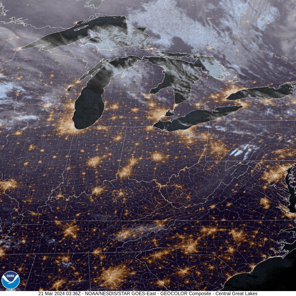
At 453PM, ET, Lansing was reporting a temperature of 5 degrees and a brisk northwest wind. The slow start to winter has led to a Lake Michigan much more capable of producing lake effect snow, and it is compounding the accumulations in the wake of yesterday’s event. All told, Lansing has received only a couple of inches, but over a foot has fallen along the lakeshore. A strong area of low pressure was retrograding to the west over Hudson Bay, sending brisk northwest winds to ensure that visibilities, even in the light snow, would be challenged.
Low pressure in Canada will continue to spin thanks to the support of a strong jet trough. At the surface over the center of the country, high pressure will build in. This will dry out most of the country, the part that relies on the Gulf of Mexico for it’s moisture, however the combination of features will only bring about gustier west winds in Michigan. Expect persistent west winds and some intermittent snow showers throughout the forecast period.
Tomorrow – Overcast with light snow, High 8, Low 0
Tuesday – Continued wind and clouds with light snow, High 9, Low 3

TWC: Tomorrow – Cloudy High 11, Low -4
Tuesday – Cloudy skies. Continued very cold. High 7, Low 4

AW: Tomorrow – Variable clouds with flurries, frigid; breezy in the morning; bitter cold; be sure to wear layers High 10, Low -1
Tuesday – Low clouds and bitterly cold; bitter cold; be sure to wear layers High 8, Low 6

NWS: Tomorrow – A 20 percent chance of snow showers after 1pm. Mostly cloudy and cold, High 10, Low -1
Tuesday – A 20 percent chance of snow showers after 1pm. Mostly cloudy and cold,  High 9, Low 5

WB: Tomorrow – Partly sunny. Areas of blowing snow, High 9, Low 0
Tuesday – Partly sunny, High 9, Low 6

WN: Tomorrow – Mostly cloudy with slight chance of light snow showers, High 10, Low -1
Tuesday – Mostly cloudy with slight chance of light snow showers, High 9, Low 5

CLI: Tomorrow – Overcast, High 13, Low -3
Tuesday – Light snow showers, High 12, Low 3

Here is a look at the radar, which is going to look pretty familiar for lower Michigan radar watchers for the next couple of days.

Florence, South Carolina

We’re going to sneak down to the Carolinas on the heels of a very active weather day for the southeastern US.

At 906PM, ET, Florence was reporting a temperature of 54 degrees with scattered clouds. A line of thunderstorms swept through earlier, with 63kt gusts reported at Florence. Winds have died down, but with a few post frontal sprinkles over South Carolina, Florence stands to get a little bit more rain before all is said and done. The jet structure is still very active, which will only encourage the area of low pressure to drift to the northeast, bringing the threat for rain to an end overnight tonight.
The next round of low pressure is going to get organized in the south central US by Friday evening, which will also indicate the point at which warmer air will start returning to Florence. Dry conditions are expected in Florence from sunrise tomorrow through the day on Thursday.
Tomorrow – Some clouds early, then sunny, High 53, Low 38
Thursday – Mostly sunny, High 58, Low 34

TWC: Tomorrow – Sunny, along with a few afternoon clouds. High 53, Low 38
Thursday – Partly cloudy. High 59, Low 35

AW: Tomorrow – Partly sunny, windy and cooler High 53, Low 39
Thursday – Milder with plenty of sun High 61, Low 35

NWS: Tomorrow – Sunny, High 52, Low 40
Thursday – Mostly sunny, High 58, Low 34

WB: Tomorrow – Sunny, High 51, Low 41
Thursday – Mostly sunny, High 59, Low 35

WN: Tomorrow – Mostly sunny, High 52, Low 48
Thursday – Partly cloudy, High 57, Low 34

CLI: Tomorrow – Mostly cloudy, High 54, Low 39
Thursday – Mostly cloudy, High 61, Low 36

There was quite a bit of severe weather in the southern and southeastern US over the last 48 hours. The strongest and most intense storms were overnight in the Florida Panhandle, but now we are near a break.

Logan, Utah

We’re going to head to northern Utah, away from the real weather of the week, because that simply how we operate here at Victoria-Weather. Constantly missing the point.

At 851 PM, MT, Logan was reporting light snow and a temperature of 22 degrees. As the well advertised storm system begins to emerge in the southern High Plains, some of the same energy is bringing snow to the Wasatch Range. The sharp, strong trough that is the culprit behind the weather this week will transition out of the inter-mountain west by midday tomorrow, leaving the potential for some more flurries to continue into tomorrow morning in Logan.
The rest of the day and early Monday look as though they will continue to be tranquil thorough the early part of the day on Tuesday as well. The next upper level wave in the jet structure is rippling through the Gulf of Alaska, preparing to bring more wet weather to the Pacific Northwest. The storm system will press moisture beyond the Cascades and as far as northern Utah by Tuesday evening. It’s going to remain chilly in Logan, so precipitation is going to fall as snow, and will predominantly fall in higher terrain.
Tomorrow – A lingering flurry early, then increasingly sunny, High 25, Low 13
Tuesday – Sunny early, clouds and snow return late, High 27, Low 16

TWC: Tomorrow – Intervals of clouds and sunshine. High 25, Low 10
Tuesday – Cloudy with snow showers becoming a steady accumulating snow later on. High 30, Low 14

AW: Tomorrow – Mostly cloudy High 22, Low 9
Tuesday – Cloudy with a little snow High 30, Low 12

NWS: Tomorrow – Mostly sunny, High 24, Low 9
Tuesday – Snow, mainly after 11am. High 29, Low 11

WB: Tomorrow – Partly cloudy in the morning, then becoming sunny (Early snow) High 17, Low 13
Tuesday – Breezy. Snow likely in the morning then snow in the afternoon. High 23, Low 13

WN: Tomorrow – Partly cloudy, High 24, Low 13
Tuesday – Mostly cloudy with light snow, High 30, Low 11

CLI: Tomorrow – Mostly cloudy, High 24, Low 12
Tuesday – Blowing snow, High 32, Low 15

I’ll tell you what, these mountain forecasts sure get a lot of different forecasts. It doesn’t help that Utah doesn’t ever have an over head satellite image. You can see most of the snow is over the mountains.

New York, New York

Heading for the Big Apple for our first forecast of 2024. Absolutely no pressure, right?

At 151PM, ET, Central Park was reporting cloudy skies with a brisk northwest wind and a temperature of 44 degrees. Temperatures across the region were in the mid-40s with the northwest wind, as the area found itself between a large north Atlantic storm and a weaker system in New England. A line of showers extending from Concord, New Hampshire to White Plains was going to pass through the City in the next couple of hours, but given the presence of the offshore feature, not much rain is anticipated.
High pressure will follow the messy system into town, giving the New York area a day to prepare for the first strong winter storm seen in a couple of years. Strong low pressure is going to start organizing in west Texas overnight tonight, and begin sweeping through the Gulf Coast by morning. Saturday morning, the feature will be a formidable system centered over Mobile Bay, getting ready to press north. Meanwhile, a Clipper in the Upper Midwest will be moving eastward, supplying cold air for the pending storm. Precipitation will move in around nightfall. While snow will be persistent in New Jersey, Downstate New York and Connecticut, it will struggle to accumulate initially on Long Island, Staten Island and Manhattan. There could be an inch or two in some parts of the Bronx before Sunday rolls around. Warm air will intrude on Sunday and wash away any snow that does accumulate, but in the evening, things will get more interesting, and accumulating snow is possible even in Manhattan.
Tomorrow – Mostly sunny, High 37, Low 26
Saturday – Clouds increase, with rain and some flakes mixed in late, High 38, Low 30

TWC: Tomorrow – A mainly sunny sky. High 40, Low 28
Saturday – Cloudy skies with periods of rain later in the day. High 39, Low 31

AW: Tomorrow – Sunny to partly cloudy High 39, Low 27
Saturday – Rather cloudy; snow and deteriorating travel conditions at night High 40, Low 30

NWS: Tomorrow – Sunny, High 38, Low 28
Saturday – A chance of snow after 2pm, mixing with rain after 5pm. Cloudy, High 40, Low 32

WB: Tomorrow – Sunny, High 35, Low 26
Saturday – Cloudy. Rain and snow likely in the afternoon. Little or no snow accumulation, High 36, Low 29

WN: Tomorrow – Sunny, High 37, Low 29
Saturday – Partly cloudy with a wintry mix likely, High 41, Low 32

CLI: tomorrow – Sunny, High 39, Low 27
Saturday – Rain Showers, High 37, Low 30

Well, that was a lot. I think the real chance for accumulation will be just outside of the city, and after our forecast period expires, but I can’t well leave it out, right? Here is the rain headed for NYC right now.

New

Kansas City, Missouri

Kansas City’s larger portion is on the Missouri side of the river, but many of the large suburbs exist on the Kansas side. None of this really helps with our forecast, or dictates a different climate between the towns.

At 253PM, CT, Kansas city was reporting mostly cloudy skies with a temperature of 49 degrees. West-northwest winds were blustery and bringing temperatures down a bit, but without the clouds that are being seen further to the north, it’s still a quite bearable end to the year.
The clouds and whatnot seen in the Great Lakes is a western lobe of a broader trough on the east coast. The cooler air mass is going to continue sinking further south, even without a particular threat for precipitation. This will drive an inactive cold front through Kansas City overnight, leading to a cooler day tomorrow before a stout, clear area of high pressure moves into the middle of the country.
Tomorrow – Mostly cloudy, High 36, Low 25
New Years Day – Sunny, High 37, Low 20

TWC: Tomorrow – Mostly cloudy skies early will become partly cloudy later in the day. High 39, Low 28
New Years Day – Some clouds in the morning will give way to mainly sunny skies for the afternoon. High 40, Low 27

AW: Tomorrow – Colder with times of clouds and sun High 37, Low 29
New Years Day – Mostly sunny High 41, Low 25

NWS: Tomorrow – Partly sunny,  High 36, Low 28
New Years Day – Sunny, High 37, Low 25

WB: Tomorrow – Partly Sunny, High 35, Low 29
New Years Day – Sunny, High 36, Low 26

WN: Tomorrow – Partly cloudy, High 37, Low 28
New Years Day – Mostly Sunny, High 37, Low 25

CLI: Tomorrow – Overcast, High 37, Low 27
New Years Day – Sunny, High 50, Low 25

Those lows in the V-W forecast are a bit lower because we used the information out of the Kansas City airport, which is well outside the city center. Check out the forecast for KCTV-5. There is a distinct focus on the Chiefs football game this weekend.

Macon, Georgia

Macon is right in the heart of Georgia, and the home of Mercer University. I hope either of these facts might help you with Jeopardy! some day.

At 353PM, ET, Macon was reporting a temperature of 65 degrees with fair skies. Winds were from the northwest, and there was a brisk flow aloft thanks to occluded low pressure over the center of the country. The primary round of wet weather has already proceeded offshore, however the cold air still remains nearer the Mississippi Valley. This postfrontal trough will not reconstitute as a cold front, however, and shouldn’t bring any rain to central Georgia.
The jet structure is robust, as it should be this time of year, and is guiding the low pressure center that brought the rain to town northeastward, and will not allow time for the secondary boundary to organize any precipitable activity. Even so, expect temperatures to continue to drop over the next couple of days, with a chilly Friday on the horizon.
Tomorrow – Mostly sunny, High 58, Low 41
Friday – Cloudy and cooler, High 49, Low 36

TWC: Tomorrow – Some clouds in the morning will give way to mainly sunny skies for the afternoon. High 61, Low 44
Friday – Intervals of clouds and sunshine High 52, Low 33

AW: Tomorrow – Mostly sunny High 61, Low 45
Friday – Cooler with intervals of clouds and sunshine High 52, Low 35

NWS: Tomorrow – Mostly sunny high 60, Low 44
Friday – Mostly sunny, High 51, Low 32

WB: Tomorrow – Sunny, High 57, Low 43
Friday – Mostly sunny, High 50, Low 38

WN: Tomorrow – Mostly sunny, High 59, Low 44
Friday – Partly cloudy, High 51, Low 33

CLI: Tomorrow – Sunny, High 61, Low 39
Friday – Mostly cloudy, High 53, Low 34

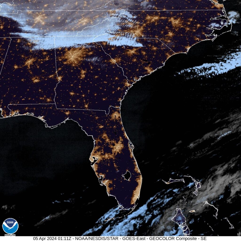
A look at the satellite imagery shows some clearer skies rolling into Georgia, behind a very sharp air mass demarcation through Alabama.