Palm Coast is a fairly new addition to the census, having first been developed only starting in 1969, and incorporating 30 years later. Palm Coast is only 25, and in the last 25 years has grown by over 200%. It also has had a history of local wildfires. Will that be a factor with this forecast?
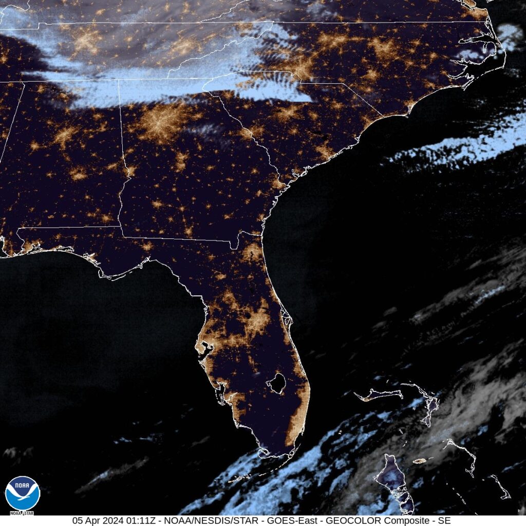
At 1035 PM, ET, Palm Coast was reporting a temperature of 58 degrees and clear skies. In fact, Florida found itself entirely under clear skies, which was surely helping with the temperatures dipping into the 50s in April. Low pressure was bringing a late season snow storm to interior New England, and its attendant cold front had already swept through the Sunshine State and was splitting the Bahamas this evening.
The clear air will continue into the morning, before a ridge builds into the region. Expect a little bit of cloud cover to return in the afternoons of both Friday and Saturday, thanks to some light sea breezes. Flow aloft will be negligible over Florida, so surface features will have a greater role in the daily weather, but the region hasn’t hit the rainy season yet, and rain is not expected even if cumulus fields form. A weak upper level ridge in the southeast will provide another element of stability for the area.
Tomorrow – Partly cloudy, High 75, Low 49
Saturday – Partly cloudy, High 69, Low 50
TWC: Tomorrow – A mainly sunny sky. High 75, Low 50
Saturday – Sunshine. High 69, Low 51
AW: Tomorrow – Nice with plenty of sun High 75, Low 51
Saturday – Partly sunny High 68, Low 52
NWS: Tomorrow -Sunny High 74, Low 50
Saturday – Sunny High 70, Low 50
WB: Tomorrow – Sunny, High 75, Low 46
Saturday – Sunny, High 68, Low 46
WN: Tomorrow – Sunny, High 72, Low 51
Saturday – Sunny, High 67, Low 51
CLI: Tomorrow – Sunny, High 73. Low 50
Saturday – Partly cloudy High 67, Low 50
A brisk north wind as the ridge settles in is going to be the driving factor in those temperatures coming down. Starting cool because of the crystal clear skies, however.


Comment (1)