
The CPC has issued their outlook, as of yesterday, for the 6-10 day, 8-14 day and 3-4 week outlooks. This is the 6-10 day outlook, but I assure you, the other two vary only slightly.
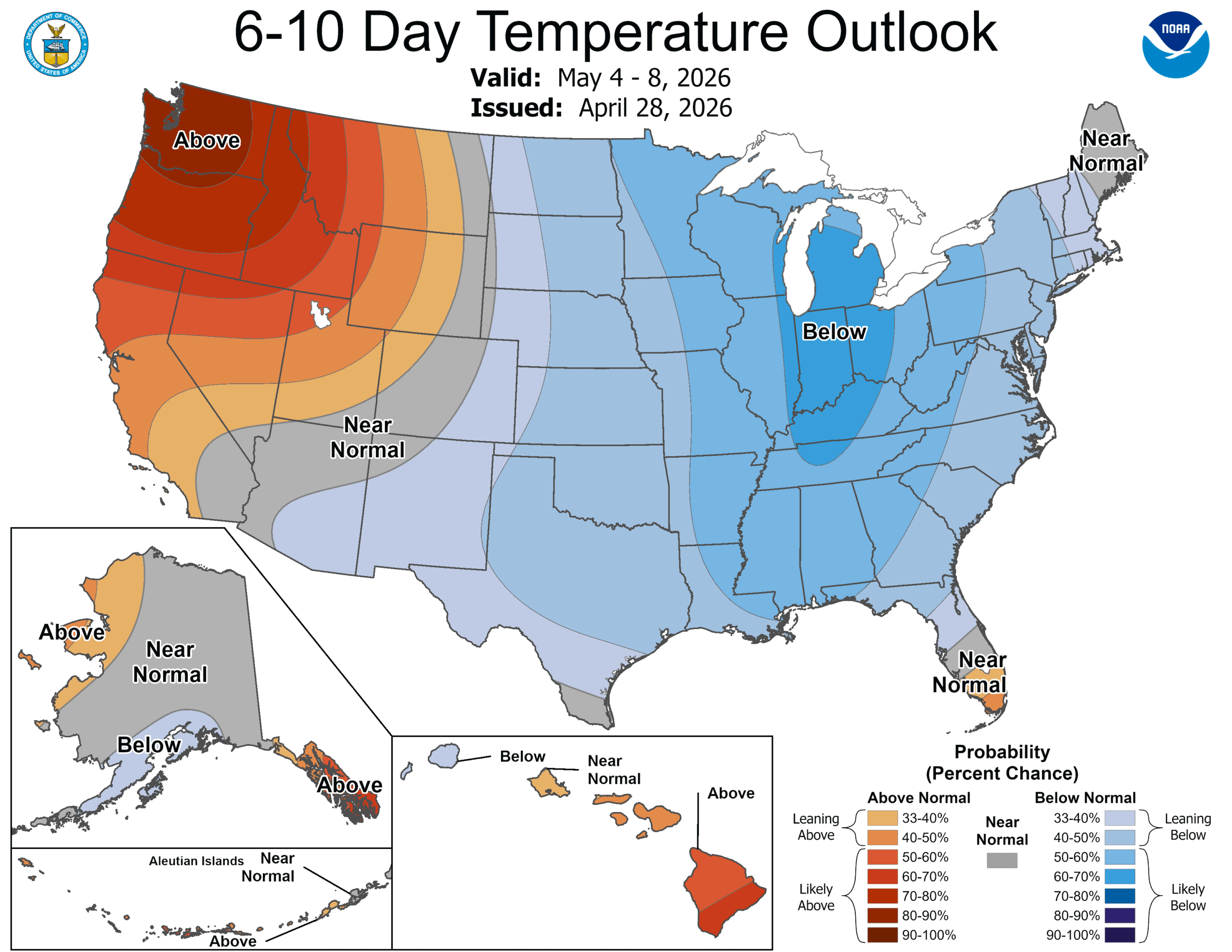
The jet flow is going to be bifurcated throughout the next couple weeks, with a strong jet running along the northern Gulf Coast. The Polar jet will be wavering along the Canadian border, often dipping into the US as a trough, ensuring some active weather, however the jet streak to the south will be an effective barrier to moisture rising into the continental US. We aren’t anticipating many soakers around the Great Lakes. This will do wonders for the drought in the southeast, though.
Even with successive waves from the northern jet, it’s really just seasonal thermal forcing that is going to break down the feature to the south and start allowing warmth and moisture back to the north. This isn’t expected to happen until around the 11th, though, which is why we have such a lengthy stretch of below normal temperatures East of the Rockies. It’s still nearly two weeks out, but the action of the northern jet by the 11th tells me that it won’t suddenly get hot in the northern tier, with ongoing showers and storms remaining likely, which will keep temperatures a little cooler if the showers are too widespread
If you are a fan of warm weather, this forecast is a bummer. If you are a storm chaser, this is also a bummer, as this should put a damper on what is historically one of the most active storm periods on the calendar. If you live on the West Coast, you can ignore everything above and enjoy the beach.