Salisbury, Maryland to Chattanooga, Tennessee

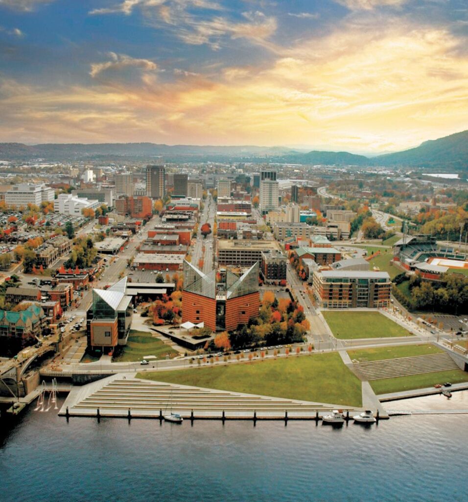
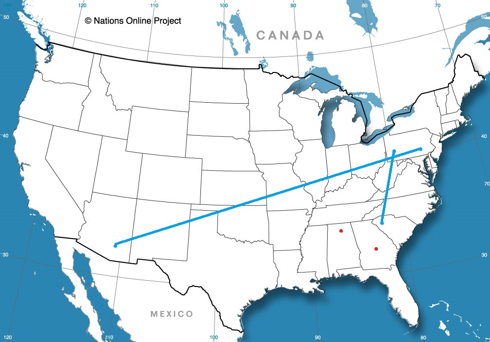
We were very close to a route requiring use of the Chesapeake Bay Bridge/Tunnel that connects the southern tip of the Delmarva Peninsula with the Virginia Beach area. Instead, we will slice through Washington and head right for the mountains. Depending on the time of da you run the route, you will get a variety of different options. Running it during rush hour makes it an 11 hour trek right through the heart of our Nation’s Capital, covering 721 miles. That is a pace of about 64.9mph, which is better than I expected. The route will be scenic, so let’s enjoy it, traffic and all.

Salisbury, Maryland

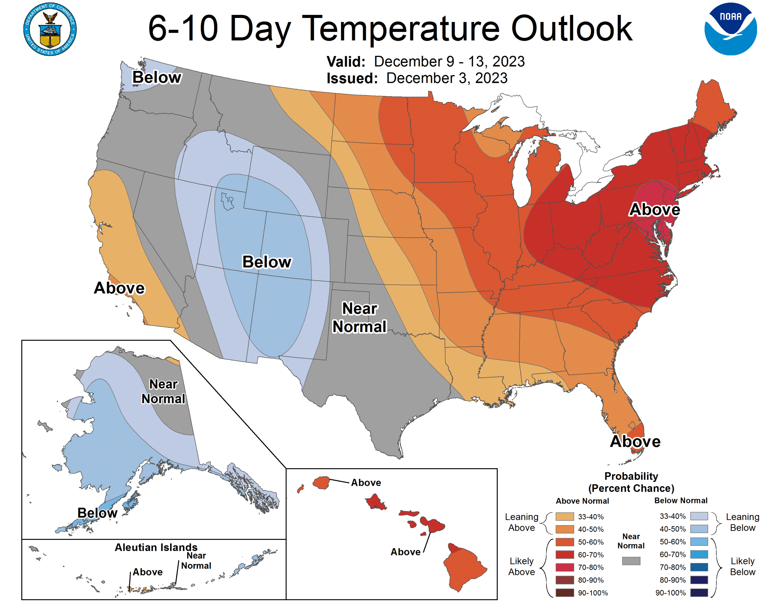
Taking a trip through DC and the mountains probably couldn’t be happening at a better time. Congress is about to call it a year, ensuring DC traffic will be significantly less burdensome, while the weather itself is going to be about as cooperative as it gets. A big ol’ dome of high pressure is planted over the Carolinas, and is bringing sunshine and unseasonably warm air to the Eastern Seaboard. It’s hard to complain about this kind of weather. Hold on tight after you get to Chattanooga, though. A strong system is organizing in the Gulf of Mexico, and will be very problematic to begin the week next week. Not a problem for this forecast, however!

Chattanooga, Tennessee

Lewiston, Maine to Salisbury, Maryland

This is going to be a 1 day trip that will touch 8 states! Sure, it will be a long 1 day, but that is still pretty incredible, considering we will be covering just 570 miles. Driving through the urban landscape of New England and the Mid-Atlantic, we’ll also only be slugging along at a 57mph pace. Plenty of time to take in all the sites.

Lewiston, Maine

Low pressure is looming as we approach mid-December. Winter has been slow in coming to the country, but a taste of it is going to be wrapping around on the northwestern side of this system. That does not include any part of our route through the East Coast’s largest cities. There appears to be a closure on the GW Bridge which might affect our route, but for the weather, this would just mean the southerly wind would be on our left rather than a headwind. Heck it might be warm enough in Salisbury to take a quick trip to the beach after we arrive, but before thar rain eventually gets there.

Salisbury, Maryland

Temperatures don’t dip so dramatically

We looked at Flagstaff in the last week of November, and found that temperatures were not what we would expect when thinking of Arizona. High temperatures in northern Arizona were about what the forecasters expected, but they were off the mark when we looked at the lows. Most outlets had the low dropping into the teens, but on the 27th and 28th, they were actually only in the mid 20s. Sure, not what you expect in Arizona, but also not quite as cold as meteorologists expected. Ironically, Weatherbug, who tends to skew towards the cooler side, ended up with the best forecast on a day where things were warmer than anticipated.
Actuals: Monday November 27th, High 40, Low 26
Tuesday November 28th, High 46, Low 20

Grade: A – C

Not much snow yet

I noted the storm getting ready to move into New England over the next 48 hours, but what I didn’t note was that interior New England is one of the few places across the country that already has snow on the ground. If you want snow, you had better also have a mountain or an upwind Great Lake.

Another note to the storm headed to New England… The element that is supposed to be introducing the cold air isn’t even cold enough for snow in Michigan. Rain is expected overnight through much of lower Michigan

A snowy start to December for interior New England

It’s been a pretty warm start to the winter, but a classically set up nor’easter is headed for New England tomorrow and Monday. There is the strong area of low pressure able to tap into Gulf Moisture, and attached occluded low bringing in colder air. Voila, you have the ingredients for a snow storm.

There is one thing that is not there though – enough cold air already in place. Because of the lack of chill to the air, the snow will fall abundantly, but is not going to make it to the coast.

Even if this isn’t going to be an impactful event for the largest population centers, it will certainly be a pretty good bit of news for snowmobilers and ski resorts in the area.

Thrown out of equilibrium

In the transitional seasons, air masses are much more different from one another. Cold air is significantly colder than the air it replaces in the spring and fall, and not as much in the summer or winter. And because the sun angle is lower, having a few clouds can really affect the temperature more than they might in the summer. All this is to say is in the fall, you had better have your timing right. In Monroe, Michigan last month, the timing for a wave moving through as a little off. Clouds filtered in on Sunday the 19th early in the day and suppressed high temperatures. A system rising from the south central US was moving more quickly than expected, and brought not only rain but a warm front that meant temperatures ended up warmer than anticipated. All in all, it wasn’t a well spotted forecast for anyone, but Accuweather had the best temperature forecast and was one of the outlets that correctly had rain on Monday.
Actuals: Sunday, November 20th, High 44, Low 34
Monday, November 21st, .32″ of rain, High 49, Low 39

Grade: C-D