All right! It’s finally time to get a forecast under our belt this month. We’ll do so with a trip to northern California, where last summer the concern was wind and wild fires. It’s been much wetter this year, so let’s hope the fire danger is mitigated.
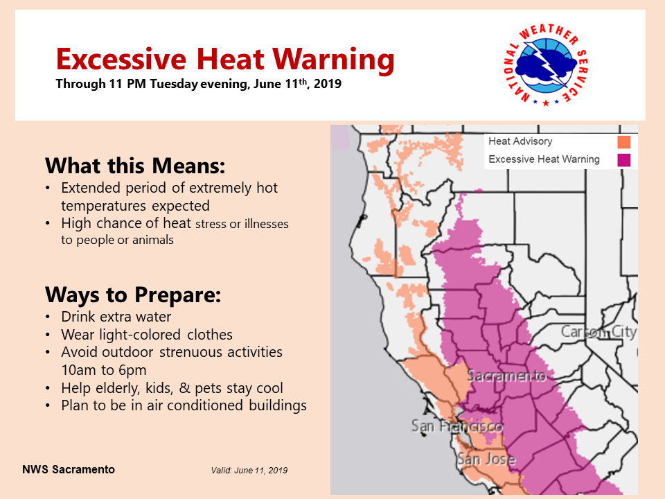
At 758AM, PT, Yuba City was already reporting 79 degrees under fair skies. High pressure dominated the west coast, and it promised to be a hot day in the central Valley. An excessive heat advisory was already in place.
There is a weak undercutting wave moving through the north Pacific that will arrive tomorrow, and may bring some high clouds and perhaps a dose of cooler weather on Thursday. The upper ridge will diminish through the period, but the low level thermal ridge isn’t expected to go anywhere, and even if temperatures moderate, it will still be hot.
Tomorrow – Fair, High 100, Low 67
Thursday – mostly sunny, High 95, Low 64
TWC: Tomorrow – A few passing clouds, otherwise generally sunny. Hot. High 103, Low 68
Thursday – Mostly sunny skies High 97. Low 64
AW: Tomorrow – Mostly sunny; hot; extreme heat can be dangerous for outdoor activities High 102, Low 68
Thursday – Sunny; hot; air quality will be unhealthy for sensitive groups High 95, Low 64
NWS: Tomorrow – Sunny and hot, High 101, Low 70
Thursday – Sunny and hot High 97, Low 67
WB: Tomorrow – Mostly sunny, High 101, Low 70
Thursday – Sunny, High 94, Low 64
WN: Tomorrow – Mostly sunny, High 101, Low 70
Thursday – Sunny, high 97, Low 67
FIO: Partly cloudy until afternoon. High 98, Low 71
Thursday – Clear throughout the day. High 94, low 65
Hot! Here is a look at the heat warnings, geographically, across northern California right now.


Comment (1)