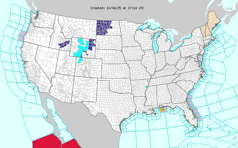
12:19PM: Without showing you the temperature or the radar again, here is another map that proves cold air is bellowing in behind the front in the middle of the country. Yes, those are winter weather alerts and advisories in western North Dakota and the central Rockies.
12:38AM: We’ve been talking about the tropics a lot lately, because this is the time of year we usually think about the tropics, had a forecast in Gulfport recently, and frankly, I’m going on vacation soon. Anyways, here is a late night reminder: Don’t put much stock in projections that are more than about 5 days out. There has been a potential tropical feature doing the hokey pokey in the models from the Bahamas to the Gulf late next week. (Right now, it has taken its whole self out)
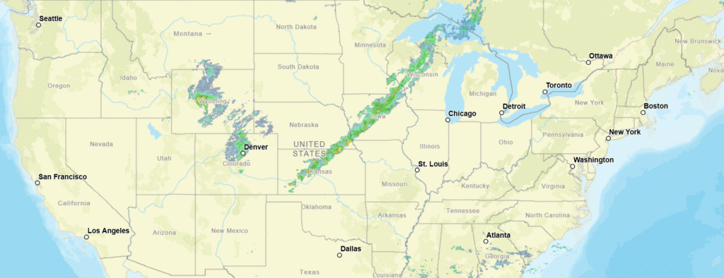
9:12PM: The change from above normal temperatures to something that is a bit closer in line to what we would expect this time of year is from about Houghton, Michigan to Dodge City, Kansas. Demarcated below.
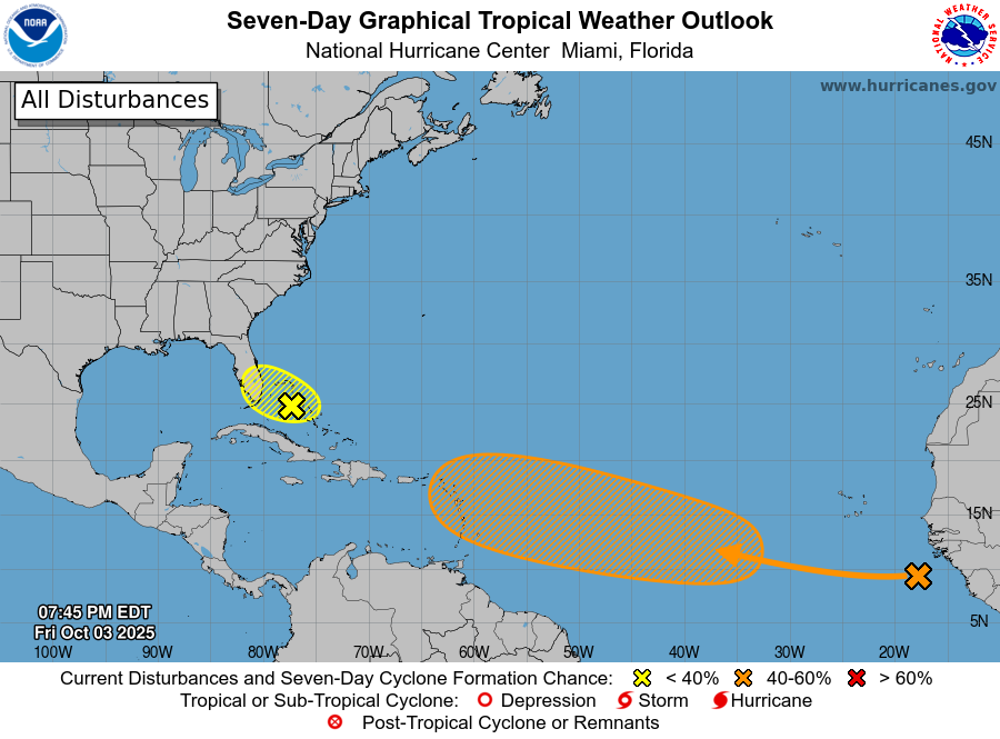
7:05PM: I’m not saying to panic, but I am saying to watch this orange area. The long term track keeps pulling it further eastward (away from the US), but still, keep vigilant.
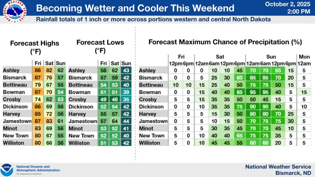
2:36PM It’s been very quiet nationwide, enough so that we have been focusing a lot of attention on a couple of storms in the Atlantic that have been pretty safely at sea. The first inkling of a changing pattern from the heat that has engulfed much of the middle of the country comes from Bismarck.
This will be a pretty decent little area of low pressure in the Dakotas, and will usher in cool air and a more active pattern for the eastern US, which should take us into the middle of October.
10:08PM: It’s getting cooler out there, absolutely, and even amid hot spells, there is one sure way to know that the atmosphere is chilling out. Cloud bases are getting lower. I had to keep looking at the radar to ensure it wasn’t about to rain today because of the lower deck of cumulus clouds.
2:01PM: More good news, especially if you are a fan of the NAM model: It is really showing Imelda taking a hard easterly turn before it reaches the Carolinas. Come on, NAM!
6:46PM Imelda is still unnamed in the central Bahamas. In even better news, the storm is even less likely to make a landfall in the US. It will still be impactful, of course, but less rainy and less windy than feared.
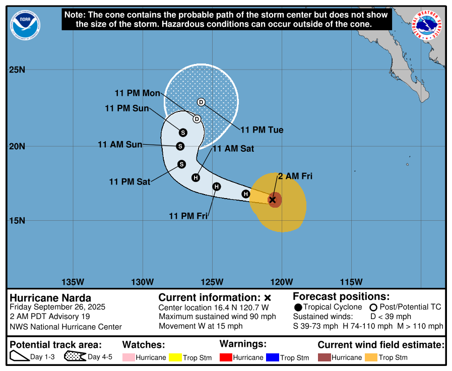
9:11AM. A lot more mental energy is spent on the Atlantic side of the tropics, and for good reason. The Pacific is generally more active, but after storms get going, there is just less out there to impact. Take a look at Hurricane Narda, which will do the typical tropical poleward curl and really only impact some fish. And that’s a fairly typical eastern Pacific lifecycle.
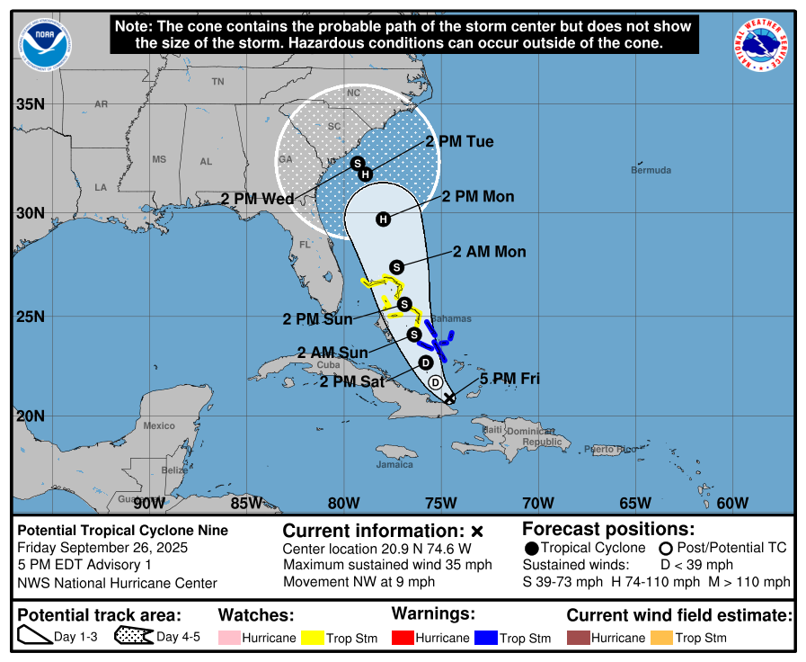
4:34PM. And back to the mainland. TS Nine has now developed near Cuba, as expected. It stands a pretty good chance at this point of landfalling between Charleston and Myrtle Beach as Tropical Storm Imelda, if the track remains approximately the same. The good news is that it will probably not be a hurricane when it does so. It does look to lumber through the region though, and heavy rain is going to be a problem in the Carolinas this weekend.
11:11PM Make a wish! With eyes turning to the Bahamas for a little bit of tropical development, we can all feel better about ignoring the local weathermen. This late September pattern is warm, and hasn’t really featured a lot of severe weather. The SPC outlook only has anything greater than general storms as a marginal outlook associated with the monsoon along the Arizona/New Mexico border.
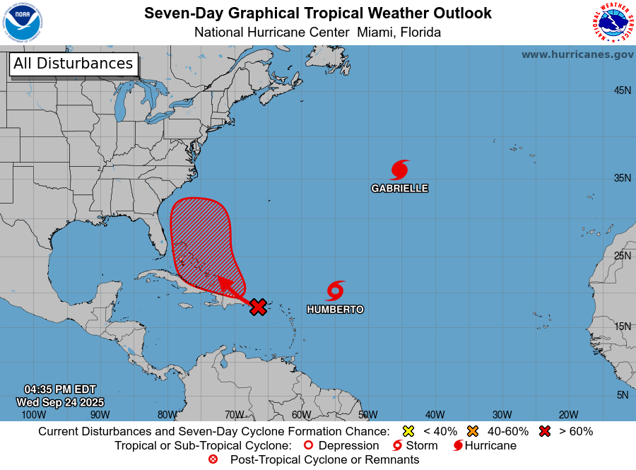
4:37: As it was when I wrote about the hurricane season earlier, it is the Atlantic that is active, rather than the Caribbean or the Gulf, and as I noted, the Atlantic itself is plenty hospitable for tropical development. We now have Humberto, and more pressing, an area that stands to sustain more development as it tracks through the Bahamas later this week.
8:36PM Here are the forecast tracks of a still unnamed storm. It will pass over the Dominican Republic overnight tonight, which will certainly slow down any real development. As it get into the Bahamas we are probably then looking at a Tropical Storm (Imelda), which then looks like a Cat 1 hurricane along the Outer Banks. Maybe. Stay tuned.