11:46PM Hey, go check out the Aurora! That is to say, if you live somewhere generally north of Mexico and in a cloudless, or cloud limited sky.
Updates 11/10
4:08PM: I can tell you that in the Upper Midwest this weekend, we saw some snow. That’s probably not a surprise for a lot of you because there is snow in the forecast for today as far south as the mountains of North Carolina and Tennessee.
9:29PM: Given the last update, I think it may be fairly easy to believe that there is currently no activity in the North Atlantic. Are we done with the tropical season?
Updates 11/3
3:57PM: Time for an advisory, if you need it: it’s November now, which means you need to start reviewing the WPC page for the heavy snowfall outlooks, as well as weaning off the SPC and NHC. Thank you, and apologies.
7:32PM: More from the WPC: All that incoming snow in the Pacific Northwest has been ascribed the atmospheric river label. It’s going to be snowy!
11:13PM: All this about the cooler weather inbound, I would be remis if I didn’t point out … It’s going to be warmer than normal for a healthy chunk of the country this week.
Updates 10/29
7:15PM: We are headed towards Halloween at the end of the week, and whether you like it or not, the weather looks to be on the warm side for a lot of the country. The core of the most above normal warmth looks to be around the Rockies, where Salt Lake City is looking at temperatures around 60 degrees. Trick or Treat!
Updates: 10/28
8:15PM Hurricane Melissa’s eye has cleared Jamaica. The storm has been weakened a bit, but is still a strong storm, now readying to landfall in eastern Cuba. Melissa will weaken further over Cuba, and then will impact the southern Bahamas and Turks and Caicos islands.
Updates 10/25
10:18PM: Well, the good news in northern Indiana is that light rain we were eyeballing in the forecast for Elkhart is on the way out. The bad news is that a feature in Texas may be a bit more virulent than anticipated initially, and could bring a spot of light rain to the area overnight tonight. Better than severe weather, though, as is being seen in the Lone Star State tonight!
Updates 10/21
9:55PM: At long last, we are back in action! The trend has been towards cool weather across the country. It’s in the 40s for highs along the northern tier, and if it isn’t down there yet, it will be soon. A particularly effective cold front is coming for New England. Even without prodigious rain, it will bring temperatures down to something more autumnal. Sorry!
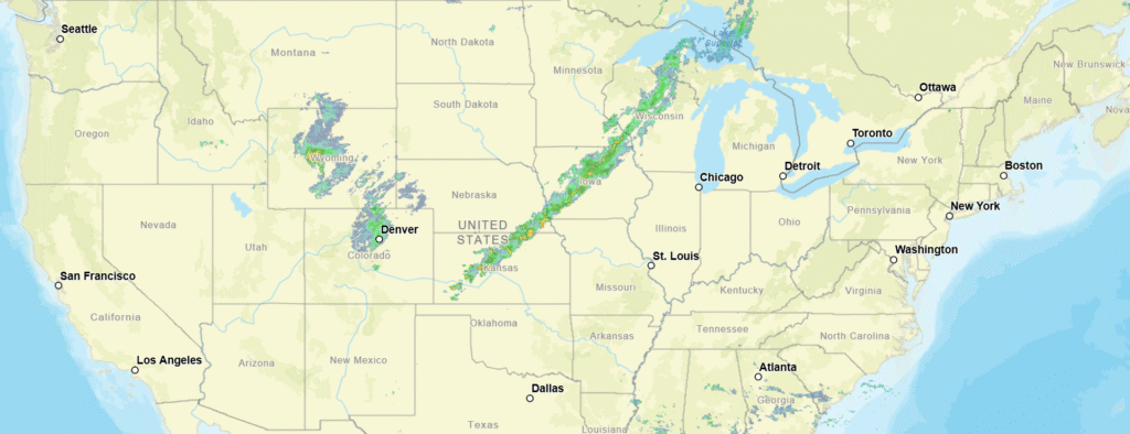
11:06PM: Just think, in a few weeks, this would all be snow. Well, actually not. All these light radar returns are actually upwind from the Great Lakes, which, as any local might be able to tell you, is not how Lake Effect Snow works.
Updates 10/15
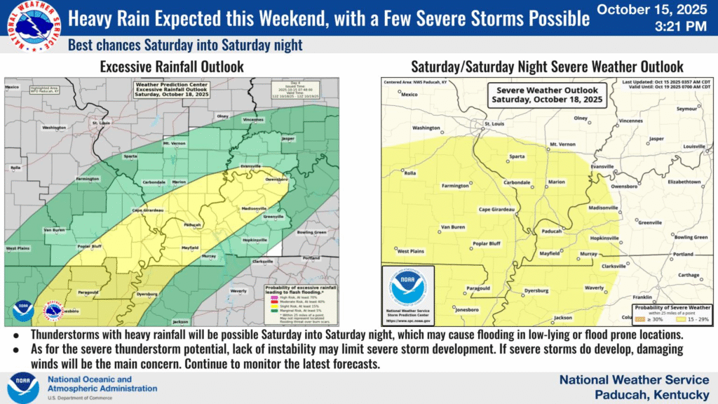
1033PM: Oh, hey, it does look like indeed the SPC will continue to operate during the shut down. There is severe weather possible for the middle of the country, as far northeast as Paducah, Kentucky.
Updates 10/6
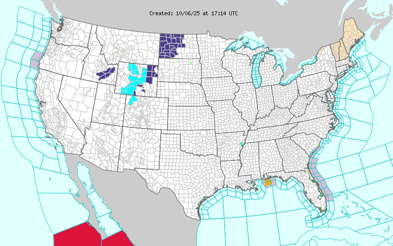
12:19PM: Without showing you the temperature or the radar again, here is another map that proves cold air is bellowing in behind the front in the middle of the country. Yes, those are winter weather alerts and advisories in western North Dakota and the central Rockies.
Updates 10/5
12:38AM: We’ve been talking about the tropics a lot lately, because this is the time of year we usually think about the tropics, had a forecast in Gulfport recently, and frankly, I’m going on vacation soon. Anyways, here is a late night reminder: Don’t put much stock in projections that are more than about 5 days out. There has been a potential tropical feature doing the hokey pokey in the models from the Bahamas to the Gulf late next week. (Right now, it has taken its whole self out)
9:12PM: The change from above normal temperatures to something that is a bit closer in line to what we would expect this time of year is from about Houghton, Michigan to Dodge City, Kansas. Demarcated below.