2:50PM: It’s hot, and starting to dry out out west. Because this time of year is the time most shortly following the rainy season, it’s not a particularly high time, climatologically, for wildfires. Having the dry heat now, though, doesn’t help down the road.
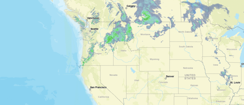
8:17PM: There is a cold front taunting the hot the sun baked southwest, lined up from northern Idaho to southwest Oregon bringing showers to the Pacific Northwest.
10:52PM The short term forecast isn’t changing. The long term forecast isn’t changing. Above normal temps for a lot of the country (except New England) but that doesn’t necessarily mean “hot” weather. It’s a cool 43, for example, already in Hastings, NE.
11:48PM: I’ll get into it a bit more later, but the SPC has made changes to the site. Like I said, more on the more significant changes soon, but also, there is an updated color palette for the maps, and I am into it.
3:27PM: Well, happy spring. It’s extraordinarily warm out west, but still quite brisk in the northeast. If you have been around meteorology enough, you know what that means!
10:33PM: Absolutely, we aren’t going to be worrying about snow in Appalachia like we saw in the Great Lakes over the last couple of days, or like we saw on the East Coast last month, but I’m here to tell you, wind knows no bound by temperature of latitude.
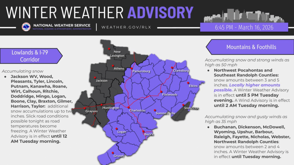
10:31PM: The snow is done in the Twin Cities, though the wind has arrived. While totals were not as dramatic in the Cities as the most dire forecasts, residents of Red Wing, Lake City and other towns in southeast Minnesota can attest that the storm still packed plenty of punch, with 20″ reported around those communities. It’s higher in central Wisconsin. But back to the Twin Cities. The tie ups go to show that getting much over 8″ is all the same. The 13″ I got here were plenty
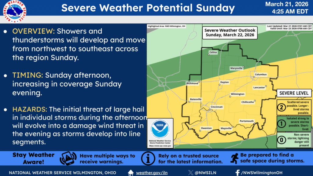
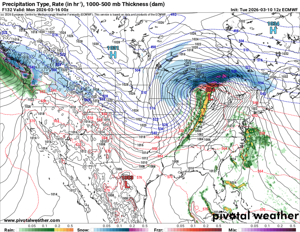
10:15PM: Here in Minnesota, we’re worried primarily about the overwhelming amount of snow and ice that is coming our way. As I noted, however, we’ve got a jump on the severe weather season as well for many parts of the country. The more traditional March storm zone will get it on Sunday. It will be a good day to remain vigilant in the Mississippi Valley, east to the Tennessee Valley.
10:27PM: Unfortunately, the pattern we are in is sticking around. The threat for severe storms will return from the southern Great Lakes southward. I expect a reduced tornado threat, and, yikes…. potential blizzard conditions in Michigan and Wisconsin
1:02PM: Oh, I did want you all to know: There will be a post later today, and it will probably not be specific to California.
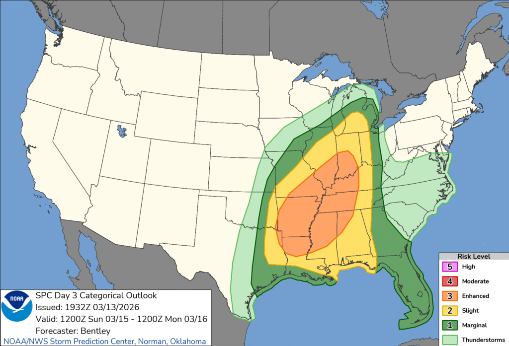
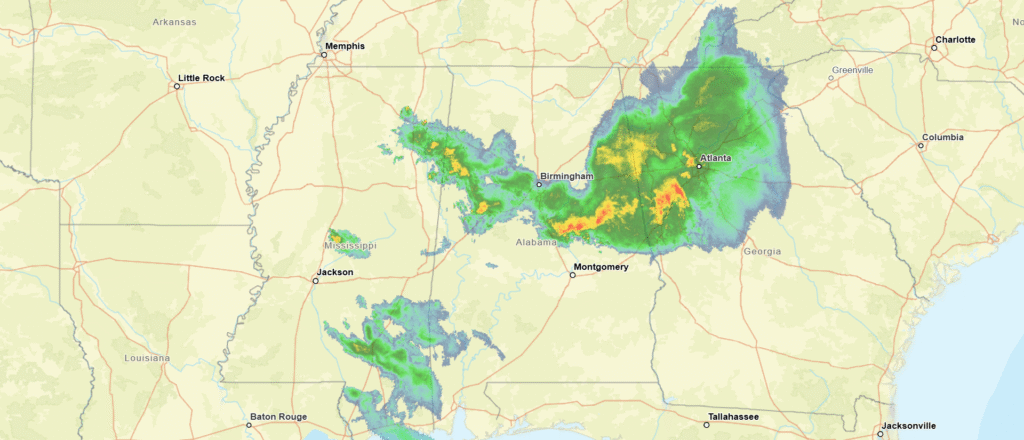
9:47PM: The storms are coming tomorrow for the Plains and Great Lakes. but tonight, storms are winding down in the southeast, just where we would expect them to be this time of year.
11:55PM, Late night random thought: The Weather Channel has proven to be successful because they got the weather part of it right first. Even on the back end, they’ve been right more often than others lately. They have reinvested in clear communication. Like them or not, they are good at what they do.
10:17AM: March is definitely the weather’s silly season. There were severe storms, as the SPC called for. The deadliest storms were a series of tornadoes in southwest Michigan that claimed four lives and injured several more while moving through commercial and residential areas of Three Rivers and Union City.
Meanwhile, in Minnesota, we awoke to fresh snow.
8:27PM: Everyone I know in the north is celebrating the potential 60s tomorrow. It’s great that they are even coming on the weekend, but be aware that cooler air is returning from the west at, oh, about 50mph.
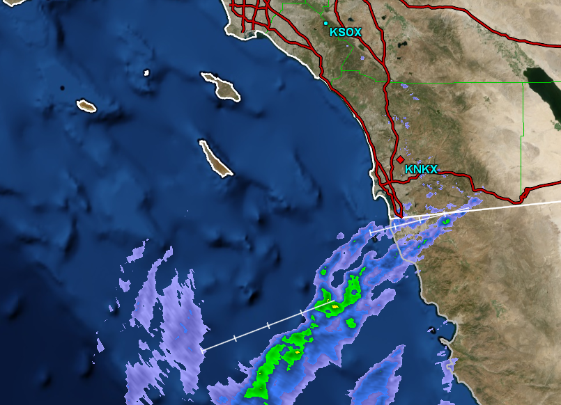
5:00PM: Severe weather is breaking out in the Plains again today, so please be sure to monitor your local weather service and stations. Elsewhere, things have returned to “nearly perfect” in southern California, save for some high winds in the hills north of Los Angeles. Thankfully, normal moisture has returned, and this wind isn’t coupled with a fire threat.