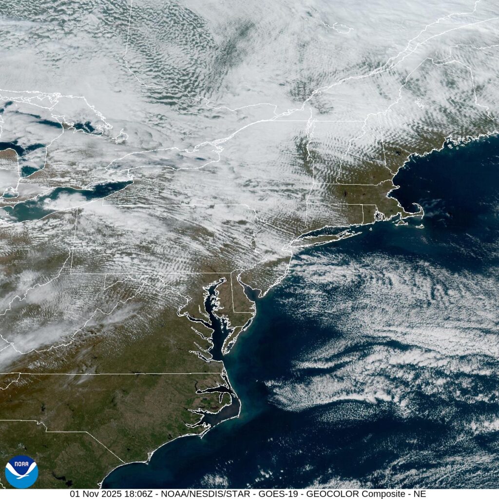
We are arriving in one of the busiest travel seasons of the year, as millions of Americans will travel over the river and through the woods to Grandmother’s house. The great news is that most of the winter weather that is forthcoming is steering clear of the major airports. A shortwave will be pulling out of the southern Plains and headed for the mid-Atlantic by Tuesday afternoon but this will bring primarily rain and maybe a low cloud deck, both problems for flight operations.
But rain and clouds aren’t a disaster, as the clouds and visibility won’t be as low as they would be with a snowstorm. Any weather delays are likely just going to be secondary to the volume and other issues that arrive at airports. It will be slow in some important areas because of the rain, but not a disaster by any stretch of the imagination. I’m talking about New York, Philadelphia and Washington, reaching parts of coastal New England on Wednesday. By Thanksgiving, it will be clear and crisp up and down the Eastern Seaboard.
Fortunately, the threat for snow isn’t going to be a problem for most of the country, especially air travelers. Unless, of course, you are going to northern Minnesota. The occluded portion of the feature that will be responsible for the rain out east is also responsible for winter weather alerts from Montana to the UP of Michigan. The heaviest stripe of snow will be in Northern Minnesota, and should be wrapped up by midday on Wednesdsay.
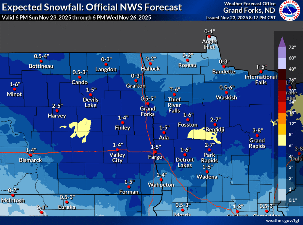
This isn’t a ton of snow, and the roads that it impacts aren’t well travelled. There won’t be volume issues in Bismarck or Duluth or Rhinelander, some airports that will see some of this snow. Lake effect snow will become a problem on Thanksgiving, so Cleveland and Buffalo are going to be tricky for day-of traveling, and perhaps returning home on Friday as well.