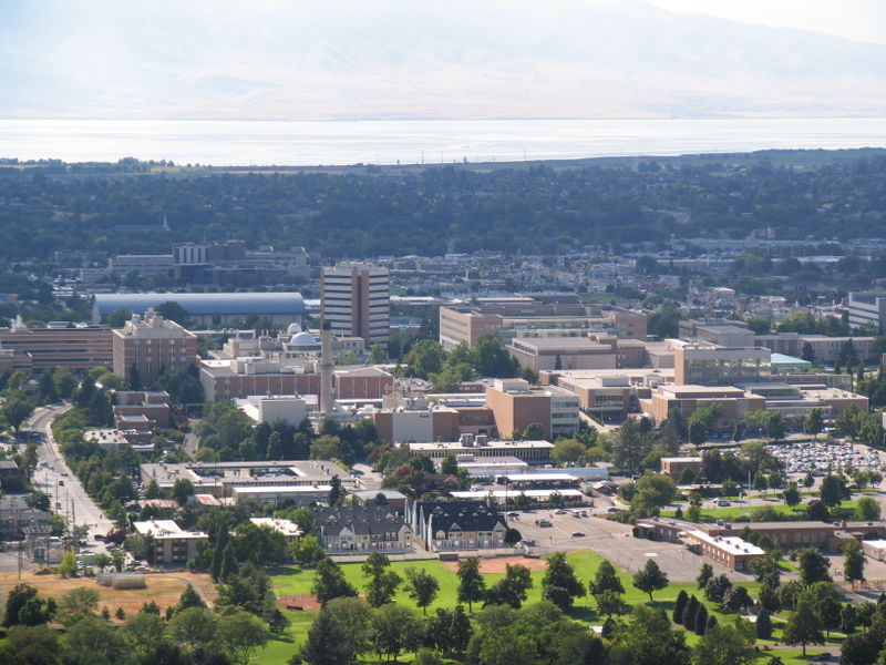
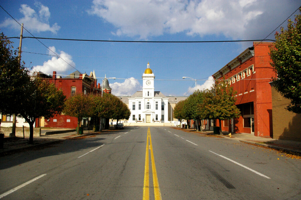
Tucson, Arizona to Albany, Georgia

We’re headed through the southern part of the country today. Well, for the next three days. It’s nearly a straight eastward shot covering 1758 miles. The pace will be 67.6mph, which means a pace of about 541 miles a day for the first two days, with a longer drive coming on the third day. We’re leaving from the desert, so that 10 hour drive will also happen to coincide with the most interesting weather as well.

DAY ONE (Sunday)

Tucson, Arizona

It’s time to hit the road on day one of our southern road trip, and as one might expect, the drive through the Desert Southwest is going to be pretty dry. Arizona and New Mexico, all the way to El Paso are going to be pretty dormant, however as the evening approaches, the dry line in west Texas is going to start looking a little more active. Maybe storms won’t fire as far south as I-20, but I wouldn’t rule it out. The real question is, will they fire far enough west for us to reach them on Friday night? Also not likely, but I wouldn’t rule it out. Let’s stop in Barstow, just past Pecos, for the night.

DAY TWO (Monday)
Saturday will be spent entirely within the state of Texas. All eyes will be on an area of low pressure in the northern Plains that will be making for very spicy weather way up there. In Texas, the return flow will be churning through Texas as things continue to bubble up in the Dakotas. For our purposes, that means scattered clouds throughout the day, and an increasingly unpleasant humidity as we make stops for gas. The threat for rain will be fairly low, however. We will make it to Kilgore, Texas, which is just to the southwest of Longview, for the night.

DAY THREE (Tuesday)
It’s going to be a long day of driving just north of the Gulf shore. The system will be continuing in the northern US and will have a more typical cold front draped through the Tennessee Valley. This indicates a decent return flow across the Gulf, meaning heat and humidity will return, but beneath high pressure. This may allow some more low clouds and fog along the parts of the route that are a little closer to the water. Albany will be hot and muggy, just like you expect it to be in South Georgia.

Albany, Georgia

Lake Havasu City, Arizona to Rockford, Illinois

It’s getting warmer which means it is getting closer to road trip season. This three day trek might follow the 1,797 mile path of someone returning from spring break. We will average 66.5 miles an hour and 532 miles a day, though we are really going to pack it in — 11 hours — on Saturday.

DAY ONE (Thursday)

Lake Havasu City, Arizona

This drive is one of beauty if you are just there to enjoy the scenery, as the sun will be shining, but as this is a weather blog, it may not offer the excitement we are hoping for. Alas, it is the Desert Southwest, and you get what you pay for. It will be a bit more interesting if you take in the entirety of the region, however. Low pressure in the Gulf of Alaska and a festering system in south Texas will squeeze our route, even bringing some clouds towards Albuquerque as we conclude our first day, though I-40 will stay clear.

DAY TWO (Friday)
That sluggish feature in south Texas is going to start wandering east, and remain out of our path, but we would be wise to note what is causing this wander. A strong area of low pressure emerging in the lee of the Rockies will start directing traffic across the Plains, and will bear watching all weekend. Our trip to Oklahoma City will be pretty uneventful, however, which is a nice thing to say when severe weather looms.

DAY THREE (Saturday)
It’s not going to organize terribly quickly, our large, troublesome area of low pressure. This means we don’t need to worry about a severe outbreak during our drive, but we will some isolated showers east of Rolla, MO, and more scattered showers and isolated thunderstorms north of Springfield as we get closer to the center of the system. Rockford will probably have rain, if not when we arrive, then soon.

Rockford, Illinois

Hinesville, Georgia to Poughkeepsie, New York

Off to the races we go, with a very I-95 dependent journey north along the east coast. It will take two days, the first longer than the second, to cover the 909 miles between our two cities. That will equate to a pace of 64mph, which is probably going to be slowed by traffic. Our goal for night one is 514 miles, which is more than halfway there. Wait…. Does this route go through New Jersey?

DAY ONE (Wednesday)

Hinesville, Georgia

A rainy area of low pressure that’s been bothering the southeast is finally off shore, and anyone driving the region tomorrow will enjoy pleasant conditions across the coastal Carolinas. We will pass into Virginia, and end the day on the north side of Richmond, in Ashland.

DAY TWO (Thursday)
A weak wave is going to spin out of eastern Canada, into New England. There shouldn’t be enough moisture at the surface to impact the roads, but from about Baltimore onwards, expect an uptick in wind and a bit more overcast. It will be at the gloomiest as we reach Poughkeepsie.

Poughkeepsie, New York

Harrisburg, Pennsylvania to San Luis Obispo, California

What are you doing this week? How about a 5 day trip to the West Coast? The drive covers 2,760 miles, which will lend itself to a pace of 67mph, and about 539 miles a day. I-40 is calling your name!

DAY ONE (Monday)

Harrisburg, Pennsylvania

The first day of our journey offers good omens. Sunny skies and above average temperatures await Monday in the Ohio Valley. There will be a bit of a northwest flow off the Lakes but it won’t be cold enough for a good Lake effect fetch. Just enjoy the scenery, and end the day in Indianapolis. Wow, even starting the trip with a stop in a real city with hotels and stuff! This trip is going to be great!

DAY TWO (Tuesday)e
As we enjoy the Circle City, a weak boundary, associated with a system moving through Canada, will slide through town, bringing a little sprinkle as we sleep. High pressure and more warm air will be in hot pursuit. It sounds exciting, but in effect, this just means we have more sunshine as we drive to Loma Linda, Missouri, just before the Oklahoma line.

DAY THREE (Wednesday)
Flow in the Southern Plains will be a bit more turbulent on Wednesday, but only aloft. More clouds can be anticipated, but we will steer clear of any showers. That stuff will happen over central Oklahoma, long after we are through. The day in Glenrio, Texas, which is on the line with New Mexico.

DAY FOUR (Thursday)
We are more than halfway through the week, and more than halfway through the drive. Our second to last day will again be marked by blue skies and comfortable temperatures. We get another good sized town in Flagstaff for our destination (as opposed to a border town)

DAY FIVE (Friday)
Models are picking up on a rogue feature in the Pacific that, if realized, might bring some low clouds and drizzle to Point Concepcion. The drive from Flagstaff to the Coastal Range before that will be terrific, like the rest of the drive. Rain won’t last long or be likely, frankly, but prepare for fog and low clouds if that low is hanging offshore.

San Luis Obispo, California

Laredo, Texas to Binghamton, New York

It’s a busy stretch of weather across almost the entire country, so obviously let’s just drive right through it. It’s going to take 3 1/2 days to cover the 1,965 miles between the two cities. Fortunately, we will have a lot of freeway time, which will mean a pace of 67.8mph, or 542 a day for those first three days.

DAY ONE (Friday)

Laredo is the county seat of Webb County, Texas, United States, on the north bank of the Rio Grande in South Texas, across from Nuevo Laredo, Tamaulipas, Mexico.

The most recent storm system to sweep through the country caused some nasty weather in the southeastern US last night, particularly with tornadoes in Alabama and Georgia. The feature is going to be bothering Labrador by the time we are hitting the road from Laredo, though, and we will have the benefit of relatively cool high pressure for the drive through the Lone Star State. Arrival in Louisiana will coincide with a return flow setting up, and the potential for some low level moisture, including mist and light rain from Lake Charles to our destination for Friday night, Cecilia. Don’t be surprise if this turns into some murky fog as we set out on Saturday morning.

DAY TWO (Saturday)
That return flow from the Gulf is going to find a ripe environment in the Plains for development. As we get started, precipitation will already have exploded from the Great Lakes, where snow is possible, south through the Tennessee Valley. We will drive through the day in the warm sector of this new feature. By the end of the day, the pivot point for the surface low will be centered around Cincinnati, with a cold front to Shreveport and a warm front stretched towards Washington. With this positioning, Fog will be possible in the morning, through our northerly turn at Slidell, but the clouds may start filtering back in as we hit some terrain in northern Alabama, calling it a night in Hammondville, Alabama, which will come right before we pass into Georgia and then Chattanooga.

DAY THREE (Sunday)
That rain, including some embedded thunderstorm activity is going to hit like a freight train overnight in northern Alabama. It will still be pouring as we start packing our things to hit the road on Sunday morning. The bulk of the severe activity will hit to the west and a little south of our stop in Hammondville, but flash flooding is severe weather too. Our drive through steep terrain for most of the day may be plagued by some lingering effects, as heavy precipitation will have moved through every section of our route. If there is good news, it is that precipitation will move too quickly to really add up. Still, bear in mind the slick roadways and embrace how much drier it is by the time we get to the eastern face of the Appalachians, where rain will cut off much sooner. The day will take us to Woodstock in northern Virginia, leaving a half day to Binghamton.

DAY FOUR (Monday)
In the wake of the most recent round of significant weather coming this weekend, brisk west wind will trigger an active lake effect regime throughout the Eastern Great Lakes, Mostly clear skies should dominate our drive, with an exception as we approach Binghamton, when some of that Lake snow may filter through.

Binghamton, New York

Lebanon, Pennsylvania to Williamsport, Pennsylvania

After so many long trips across the country, it’s so nice just to journey within one state. This Keystone State drive will last only a couple of hours and cover just 93 miles of rugged terrain. We are looking at a pace of only 42mph! Let’s roll on, I guess.

Lebanon, Pennsylvania

It’s currently snowing throughout out eastern Pennsylvania, which may lead to some lingering slick roadways, particularly the more lightly traveled and higher elevation roads. The precipitation will be wrapped up as we head out, but chilly wind with the fresh snow will make the drive, short that it may be, fairly challenging. Having a bit of sunshine will help, and the sun has a better chance of peeking out if we leave later in the day.

Williamsport, Pennsylvania

Brunswick, Georgia to Colorado Springs, Colorado

We’re taking a three day trek to start the weekend, headed from the coast to the mountains. Our drive will cover 1,766 miles, with the first two days concluding after 565 miles and a surprisingly brisk 70.6mph pace.

DAY ONE (Saturday)

Brunswick, Georgia

There is a bit of drizzle on the Georgia Coast tonight, but the vast feature responsible for it is moving along responsibly. It will be dry in Brunswick by morning, and the length of our drive will remain so. This is good news, because winter driving in Atlanta and Birmingham can be hairy when things go sideways. We’ll get through both cities just fine, and end our day in Fulton, Mississippi.

DAY TWO (Sunday)
A large, broad trough that’s been hanging out at the upper levels of the western US for a couple of days is going to dampen out which will kick a lot of the wintry weather back north, and allow the mid-south to remain warm and dry. We will see mostly sunny skies through Memphis and Tulsa, eventually settling into Hallett, Oklahoma without seeing much.

DAY THREE (Monday)
As the jet sets up a west to east course through the northern US, a strong boundary will also set up from the northern Rockies through the Dakotas. This is where the action will be. Oklahoma, Kansas and Colorado will be action free, and unseasonably warm.

Colorado Springs, Colorado

New Orleans, Louisiana to Brunswick, Georgia

We’re taking a trip along the route of the most recent blizzard. Of course, against convention, we will be taking a trip through the south and along the Gulf Coast. It will take only a day to cover the 615 miles between the two towns, and the good news is, no blizzard!

New Orleans, Louisiana

Low pressure is getting ready to pop in west Texas. There are already showers with a few embedded thunderstorms in the middle part of the Lone Star State, but things will really take off tomorrow. Fortunately for us, we are leaving in the morning, and will be clear into Georgia by the time the severe warnings start coming out in Louisiana, generally west of New Orleans anyways. Unlike earlier this month, the primary conditions in the southeast for our drive will be a steady southerly wind, bringing warm, moist air to the region. It will make the southeast feel like the southeast, and make this beach day feel closer to what it should. The 60s, instead of the 30s.

Brunswick, Georgia

Atlantic City, New Jersey to Santa Rosa, California

Wow, what a short trip! We are going from New Jersey to northern California, on a journey that is 2 full days shorter than the last one. We will cover 2,946 miles over 5 1/2 days at a pace of about 67 miles an hour, or 535.6 miles a day. Really, this is going to be a piece of cake, gang.

DAY ONE (Wednesday)

Atlantic City, New Jersey

Driving from Atlantic City to Santa Rosa is a job that seems like it should be done in a convertible. Probably yellow. All to say that a winters drive along this route seems cruel. It’s going to start very chilly as we depart from the Jersey Shore and cut through Pennsylvania. The major storm now on its way out of town is bringing strong northerly winds to the eastern Great Lakes. That is typically a good recipe for Lake effect snows, and sure enough, we will probably encounter some bands of heavy snow around the west Cleveland suburbs to Lorain. It will lighten up, but not disappear as we head on into Sandusky.

DAY TWO (Thursday)
Winds will taper off and so too will any lingering snow threat around Sandusky, giving us a clean start for the day. Still too chilly for that yellow convertable, though. We’ll head west through northern Indiana and Illinois, and will be between Cedar Rapids and Des Moines as our Thursday wraps in Brooklyn, Iowa. A weak clipper spiraling through the Upper Midwest will bring a threat for snow as we sleep.

DAY THREE (Friday)
The clipper won’t do much for accumulation, and will essentially leave southern Nebraska alone. As we get going on Friday, there might be extra traffic in Des Moines, but not enough to ruin our day. The sky will be clear, but the clipper will have brought in another batch of cold air. Expect our stops to be chilly, but will start to be a bit warmer when we stop for the night in Brule, Nebraska, in the first reaches of the Panhandle.

DAY FOUR (Saturday)
Another batch of disturbed weather will be arriving in the northern Rockies over the weekend. This feature is coming from the Gulf of Alaska, so will have spent a good deal of moisture before it arrives on the scene. Snow will probably still make an appearance throughout Wyoming, particularly on the western and northern faces of terrain, with plenty of clear air to appreciate as well. The mountain snow, valley dry pattern will continue into Utah, where we will stop at Emory, which lies in the Wasatch east of Salt Lake City.

DAY FIVE (Sunday)
We will leave the snow behind in the Rockies, because the Great Basin is going to be quite dry, and quite sunny. It will still be brisk, but we should drive through Nevada with no weather related concerns, though obviously one may need to contend with gambling temptations. Especially after leaving Atlantic City. Our day will end in Fernley, which lies just outside of Reno.

DAY SIX (Monday)
It can be dicey this time of year, passing Truckee, as you never know when you are going to get an 8 foot snow storm, but that won’t be a concern on Monday. We’ll be able to head closer to the Bay Area, and with the sun, we might be tempted to crack a window. It will be in the upper 50s or low 60s when we finally reach Santa Rosa.

Santa Rosa, California By JLankford – wikitravel, Public Domain, https://commons.wikimedia.org/w/index.php?curid=37654846

Peoria, Illinois to Anchorage, Alaska

Sure, you may note the extraordinary length of this trip, but I would like to note that we are driving away from a major winter storm by headed through Canada to Alaska. It will be a 3,620 mile journey, lasting 7 1/2 days. The amount of time spent rolling over 2 lane highways in Canada and Alaska will set the pace at only about 60mph, and our days will be through after about 482 miles. To the land of the Midnight Sun!

DAY ONE (Monday)

Peoria, Illinois

The toughest part of the day on Monday will be digging out of Peoria. Even that won’t be terrible, as the heaviest snow is falling south of Peoria, though that is a razor thin distance, meteorologically speaking. Peoria has about an inch at this point, and Springfield is closing in on 8. Snow or no snow on the ground now, there will be a few persistent flakes through the morning that plows will be working at scraping off the roads. The threat for fresh snow will end around Davenport, and the threat for driving through any areas that will have seen snow today will be done when we turn north at Iowa City. Unadulterated roads will be our pathway through Iowa, up to the Twin Cities. We’ll stop northwest of Minneapolis, in Albertville, Minnesota on Monday night.

DAY TWO (Tuesday)
The good news, as I sort of spoiled with the intro to this post, is that we will fully be into high pressure behind the major winter storm in the middle of the country. Bad news is it will be very cold in our drive from Minnesota into North Dakota. The day will end near Minot, in the town of Burlington, where temperatures will almost certainly be subzero when we hit the road on Wednesday.

DAY THREE (Wednesday)
We won’t be under high pressure on Wednesday, but I don’t think we will see any precipitation either. We’ll enter Saskatchewan, and pass Regina and Saskatoon, eventually reaching North Battleford, northwest of Saskatoon for the night. Low pressure will be skirting the southern border of the Northwest Territories on Wednesday, but it won’t be able to tap into any moisture, so all we will see is energy. It will be blustery on the Canadian prairies, but I think we will be hard pressed to find any fresh falling snow. The best chance will be a stray flurry as the night ends.

DAY FOUR (Thursday)
We will travel west bound through Canada, passing Edmonton on our way to Crooked Creek, Alberta. There is a patch of civilization around Crooked Creek that will offer some places to stay and eat, surrounded by oil fields and oil workers. Low pressure is looming over the Gulf of Alaska, but the Rocky Mountains will keep us in good shape for the time being. On the lee of the Rockies, it should even be warmer than it was at our previous stops.

DAY FIVE (Friday)
Don’t be surprised by a damp start to our Friday, with moisture clearing the Canadian Rockies and settling into Crooked Creek in the early hours. Snow will be a possibility for only a short while as we get moving, and head even further north into Alberta, and finally British Columbia. We’ll turn west at Fort Nelson, stopping at Summit Lake in northeastern BC. It will be clear and cold, and we still have 2 1/2 more days to go.

DAY SIX (Saturday)
Low pressure and storms buffeting southwestern Alaska, sending a cold front into the Panhandle will not bother us at all on Saturday, as we trek through northern British Columbia and southern Yukon. Our route closes at night, so it is key to make this drive during the day time hours. We’ll pull into Canyon City, just before Whitehorse, and call it a night. Maybe the Northern Lights will be out.

DAY SEVEN (Sunday)
Back in the USA! We’ll cross into Alaska shortly after midday, and will continue to be grateful the roadways mostly hug the valleys, because precipitation will first and foremost be on the coast, thanks to low pressure over the Alaska Peninsula, but also in the high terrain, where snow will fall on the peaks of Denali. We will stay dry, and it will be cloudy, ensuring that the already dark days will be grimmer than normal. We’ll pull in for the night near Chistochina, about an hour and a half south of Tok.

DAY EIGHT (Monday… again)
A resurgent round of snow fall will slam the Alaskan shores on Monday morning, and some of that will bleed north into the valley of the Chistochina River. We will face increasing snow for the half day of driving down toward the Cook Inlet. It will be snowy and a bit blustery in Anchorage as we arrive, though that seems to be the standard this time of year. Wow, 8 days. Maybe consider flying back.

Anchorage, Alaska