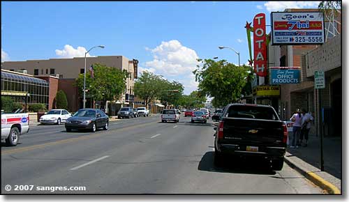
Portland, Oregon to Dover, Delaware

Confirmed: It is a long way from Portland to Dover. 2892 miles, in fact, and that distance will take us 5 days to cover, and that last day will be an 11 hour grind. The pace will be 67.2 mph, which translates to 538 miles a day. This is a long one, folks.

DAY ONE (Saturday)

Portland, Oregon

Low pressure will have moved inland from the Pacific Northwest as we depart tomorrow morning. Moisture will be able to clear the Cascades, but will begin to squeeze out moisture again as this instability reaches the Rockies. Rain will be tapering, but still possible in Portland to the Dalles, and we will be dry in the Columbia River Gorge. We will pop out again and head southeast towards Boise, where we will encounter a few more showers between Pendleton and Baker City. The higher terrain of Idaho is both well to the north of our route and well to the east. We will reach Wendell, between Mountain Home and Twin Falls, without fear of rain.

DAY TWO (Sunday)
Precipitation in the mountains always looks messy, but there is expected to be organization in the lee of the Rockies, which will clear the skies along our route. No worries crossing the Wasatch, except for running out of gas. Not many places to stop, and we will end the night in Table Rock, Wyoming, which might not be a real place.

DAY THREE (Monday)
This is going to be a weird point to refer to, but back in the Gulf of California, an old tropical feature will be making landfall, kicking some moisture from the south up into the Rockies. Some of this moisture is expected to bleed into the Plains, where it will intercept the tail of a cold front extending from Hudson Bay, and it may bring a light shower to south central Nebraska. That is a worst case scenario, though, and I don’t believe it likely. I think instead we will get some windswept prairie and a chilly time parking in Gibbon, for our stop on Monday night.

DAY FOUR (Tuesday)
This wasn’t on my bingo board, but yes, on this trip we will be dealing with some tropical moisture in Nebraska on Tuesday. Rain should be starting overnight in Gibbon, which is near Kearney, if you were wondering, and may be steady at times, all the way to Omaha, which will be the largest city we will have seen in days. The rain will lighten, and we will dry out around Bondurant, shortly after passing Des Moines. Cedar Rapids and the Quad Cities will be dry, and we will make it about a third of the way through Illinois, stopping in Spring Valley for the night.

DAY FIVE (Wednesday)
Because of the way this works we will touch parts of 7 states in 11 long hours. Fortunately, we should have unobstructed views of all those welcome signs, because high pressure will be building in the Great Lakes, pushing towards the mid-Atlantic. Temperatures will be comfortable for the season, and we will be exhausted upon arriving in Dover.

Dover, Delaware

Gulfport, Mississippi to Portland, Oregon

This drive will take 5 days, headed cross country over 2,567miles at a pace of about 67.5mph, and a target of 540 miles a day. If you are like me, perhaps you are wondering “how long would it take to travel from these two ports by sea?” According to my research: Over a month. Let’s take the car!

DAY ONE (Thursday)

Gulfport, Mississippi

Pressure is high across most of the country, which long time readers know, of course, means weather is pretty ok! The first drive of this trip will start with some low clouds, maybe some drizzle in Gulfport, but just a short jaunt inland will bring much cooler temperatures and clearer skies. we’ll make it to Forney on the east side of Dallas after what should be a pretty nice day in the car.

DAY TWO (Friday)
We will continue on our northwesterly voyage through what will probably be our driest and dustiest day. The route will carry us through west Texas and the Panhandles, before coming to an end in Campo, in far southeaster Colorado.

DAY THREE (Saturday)
Westerly flow throughout the Rockies is going to start inducing some surface low pressure on the lee. Jet structure is going to amplify the development of low pressure, and moisture in the southwest will draw into the Rockies. There is definitely a shot at precipitation on Saturday, and I would say it will increase around Fort Collins, and be the most likely at the end of the day, as we unload in Wamsutter, Wyoming.

DAY FOUR (Sunday)
Low pressure will work to consolidate overnight in Canada, and our route will dry out considerably. The precipitation on the west side of Wyoming may briefly be wet snow, so if you want to see that, get going early. Northern Utah and southern Idaho are going to be idyllic. We’ll stop in Meridien on the western side of Boise to conclude our drive.

DAY FIVE (Monday)
Low pressure will be scooting down the Pacific Coast into the Pacific Northwest as we wrap up our last day of travel. The low will bring the rain and low clouds that the Pacific Northwest is famous for, but it will be confined primarily to the area on the west side of the Cascades. The first remote chance of rain will be around Willow Lake, but the first real chances will be in The Dalles. Expect it to be a bit gloomy in Portland on our arrival.

Portland, Oregon

Pueblo, Colorado to Davenport, Iowa

Wow. I’m not sure you could find a longer, flatter stretch of west to east driving in the country. We will see a great deal of prairie over the day and a half drive. We’ll cover 953 miles, which will be traversed over at a pace of 70.1mph, which might be the highest I’ve seen. That means day one will be through after 561 miles, or so.

DAY ONE (Sunday)

Pueblo, Colorado

There isn’t much to say for the day on Sunday. High pressure in the center of the country will keep things dry in the Plains, and unseasonably warm. There is going to be a bit of zonal flow across the Rockies, producing showers and overcast for the first stretch along the Front Range, but clear skies the rest of the way, where we will stop in Odessa, Nebraska, near Kearney, for the layover.

DAY TWO (Monday)
It’s going to be a warm day for a late September drive, but otherwise uneventful, aside from maybe traffic and construction in Omaha and Des Moines. The directions should be pretty easy too. I-80 to the destination, and there it is.

Davenport, Iowa

Asheville, North Carolina to Richmond, Virginia

This drive is a short (for us) but beautiful drive from western North Carolina, and a city that is still recuperating from the impacts of Helene last year, to the capital of Virginia, a city that has been growing over the last twenty years. The towns are 372 miles and about 5 1/2 hours apart, and without a direct line between them. Nevertheless, we will still proceed at a rate of about 68mph.

Asheville, North Carolina

High pressure has built behind a cold front in the Appalachians. It will be a chilly day in North Carolina, but generally clear for the first part of the day. The cold air is riding the back of an offshore area of low pressure which will be near Virginia Beach as we head out on Wednesday. This low will cycle back moisture into the Coastal Plain, and starting around Middleburg, NC, we will start to see the chance for rain, which will stay with us the rest of the way to Richmond. Don’t be surprised if this rain is heavy at times. Bring an umbrella!

Richmond, Virginia

Lawton, Oklahoma to Atlantic City, New Jersey

I have a NASCAR race on in the background, which makes me think that we can cover the 1,529 miles of this trip in no time. Really, though, let’s play it cool and instead make the drive in about 3 days, leaving the third day the shortest. and drive at a safe speed of 68mph, and about 547 miles a day. We will save our poor choices for Atlantic City.

DAY ONE (Monday)

Lawton, Oklahoma

There is an eroding dry line that is washing out in the central Plains. This is producing some showers from about the Oklahoma City area to Springfield, Missouri, and there is no reason to think that this instigator will move much tomorrow. It likely won’t be as widespread as it is today. I would say the best threat will be in the higher terrain around the Ozarks, but should be fully wrapped up before we reach Sullivan, MO. Definitely before we hit Fenton, on the southwest side of St. Louis and our destination for the night.

DAY TWO (Tuesday)
Our weak trough is going to start to consolidate and turn around over night. It’s going to shift towards the Tennessee Valley, which should keep it juuuuuust far enough south to keep us dry for the day. There will be a few dark clouds dappling the sky as we continue east, and they will probably linger thorughout the day. Aside from maybe a sprinkle early in the morning as we pass through St. Louis, I think we are probably OK. The best bet for another shot of rain, albeit low, will come in the last couple of hours, from Columbus to Bannock, which is just outside of Wheeling, and our destination for the night.

DAY THREE (Wednesday)
That same trough will waste itself on the Appalachians and spread along the range. There will be some splashes of rain, particularly on the western faces of the range for the first part of the day. We’ll have rain through about Bedford, after which point the weak system will have a tough time transcending the Appalachians. The sun will be shining in Atlantic City when we pull in.

Atlantic City, New Jersey

Pine Bluff, Arkansas to Midland, Texas

This drive has all the elements of what I think makes a good road trip. It will take one long day, following only a couple of interstates. There is one major metro area to drive through, but also a long stretch in the open country. It will take nearly 10 hours to cover the 658 miles between our two destinations, covering the ground at a pace of 66.2mph. Hopefully traffic in Dallas-Fort Worth is forgiving.

Pine Bluff, Arkansas

Arkansas is going to be downright juicy on Thursday. Humidity will see dew points in the mid to upper 70s, and while guidance suggests most of the rain and thunder will be from Mississippi eastward, I wouldn’t rule it out during our drive to Texarkana. In fact, I would venture to say that the heavy atmosphere might lend itself to a stray storm as far west as Mount Vernon, Texas. The dew points will relent a bit west of Dallas, but the heat will still be there all the way in to Midland.

Midland, Texas

Modesto, California to Danville, Illinois

We are headed towards the middle of the country, on a drive that will spend quite a bit of time on I-80. It will take 4 days to cover this ground, because America is a big country. Expect a pace of about 69.4 mph, which is pretty great, actually. Hopefully, the weather will cooperate as well.

DAY ONE (Thursday)

Modesto, California

There is some signal that there will be an active monsoon, spreading as far west as the Cascades and northern Sierras. Not really the monsoon, I guess, at that point, but it will follow a similar diurnal pattern. I wouldn’t expect it to occur far enough or early enough in California to be a concern, and the drive through Nevada will be generally featureless, both with the weather and the man made structures. The day will end in Welcome, as we approach the Utah border.

DAY TWO (Friday)
The monsoon will make more sense on Friday, following the Front Range in Colorado and Wyoming, which we will approach on our second day on the road. We’ll make it to the Akal rest area west of Laramie, and we may see a spot of rain at the end of the day. Nothing overwhelming, surely, and definitely not anything that will substantially slow us down.

DAY THREE (Saturday)
The impulse coming away from the front range, the one that we approached at the end of our Saturday drive, will lurk through central Nebraska for much of our Saturday drive. There will be patchy clouds, some spots of rain, heavy at times, and an isolated thunderstorm. We will take our turn off of I-80 in Lincoln and make it to Palmyra for the night. By that point, those showers and storms should be ramping up, and we may be in for quite the stormy evening.

DAY FOUR (Sunday)
I didn’t realize when I was looking ahead to this forecast that we were spending none of our time on Sunday on I-80, and in fact, very little of our time will be on an interstate. We will make it across northern Missouri on US 36, but we will leave the weather in Nebraska (and maybe a bit in Iowa). The trough bringing storms to Palmyra will stall and provide some steadier rain for the eastern part of the Cornhusker state. By the time we have reached St. Joseph and turned on to 36, we will have reached the end of the precipitation for our journey. We will cross Missouri in mostly sweltering sunshine before crossing the Mississippi in Hannibal and finally slicing through the heart of Illinois to reach our destination in Danville. It will feel summery to end the weekend.

Danville, Illinois

Fort Collins, Colorado to Fort Smith, Arkansas

We’ve made it through the Holiday weekend, and are ready for wherever the road may take us. In this case, it is taking us to Arkansas. The drive will last 12 hours, the longest we are allowed to travel in one day during these trips, and we will cover 863 miles. On average, that is a pace of almost 72mph. Hard to stick your nose up at that.

Fort Collins, Colorado

This afternoon, a weak trough sweeping through the Front Range will touch off an area of thunderstorms in the Canadian Prairies, moving towards western Kansas. This will ensure that the atmosphere settles out a bit as we start out on Tuesday. We’re going to see sunny skies in Colorado and western Kansas, but will eventually reach the back end of the instability around Wichita. The bulk of any moisture or storm activity will be seen in Missouri, and we are going to be swinging south through Oklahoma. There will be some lare storms in northern Oklahoma, but by the time it really fires up, I suspect we will already be waiting in Fort Smith when it gets more showery in Oklahoma and across the border in Arkansas.

Fort Smith, Arkansas

Pueblo, Colorado to Santa Cruz, California

We are taking a two and a half day drive through the western US on this occasion. Expect heat, undulating terrain and a pace of 67mph, or so, with a daily goal of 537 miles. Driving in California is a challenge of it’s own, so we can plan a half day drive in the Golden State. Westward, ho!

DAY ONE (Wednesday)

Pueblo, Colorado

It’s getting busy in the Plains, with showers and storms offering quite a bit for storm chasers to enjoy. The storms usually show up in the afternoon and north of the Palmer Divide lately, and neither of those will apply to our time in Pueblo. In fact, eastern Colorado is looking at a respite from the stormy conditions on Wednesday, so, if anything, it might just be a bit dusty. We will head first south to Albuquerque and west to Petrified Forest National Park, all without a drop. It will be a beautiful drive, and undoubtedly a bit on the warm side.

DAY TWO (Thursday)
If the desert heat doesn’t much bother you on Wednesday, I have a guess that it may on Thursday. We will drive through the heat of the Mohave (in fact, stopping in the town of Mohave for the night) after getting out of the higher terrain of Arizona. Low pressure is setting up a bit in the Rockies, so there could be some light wind, but really, it will be fairly tame as compared to what it usually is (it will be around 100). Your tires aren’t going to melt.

DAY THREE (Friday)
The rise and fall of our drive through the Coastal Range will be the real climate winner for the day. Temperatures will drop to something more tolerable, chilly, even, when the wind is up. Monterey bay will be serene, and we will enjoy our time in Santa Cruz.

Santa Cruz, California

Jonesboro, Arkansas to Pueblo, Colorado

It’s a two day trek through the Plains between Jonesboro and Pueblo. We will cover 891 miles at a pace of a mere 61.1mph, of which very little wll e on the interstate. The first day will conclude after about 489 miles of motoring. This feels like a drive that should be done in an old pick up, doesn’t it?

DAY ONE (Thursday)

Jonesboro, Arkansas

I’ve recently been to Jonesboro, and it is a nice little town. It was a bit on the rainy side when I visited a few years ago, and it will be more of the same as we head out on Thursday morning. A bit of an upper level trough will help open up the Gulf, with moisture tracking through the lower Mississippi Valley. The northern terminus of rain shower activity will mirror our route. Showers will be off and on throughout the day, and we will reach the western edge of the rain fall activity by the end of the day, between Wichita and Hutchinson in the town of Haven.

DAY TWO (Friday)
All of this activity is going to be swept up and way towards the Ohio Valley, and ready to spend the weekend in New England, where all precipitation spends it’s weekend. This will give us a lovely, unaffected drive through Kansas. A bit of a lee trough is going to start cycling some air as we approach Pueblo, but it won’t impact us in terms of precipitation, instead producing some orographic thunderstorms in Wyoming, near the Sand Hills of Nebraska. No problem in Pueblo!

Pueblo, Colorado