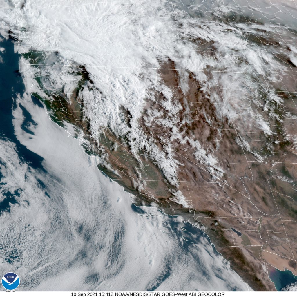
As is definitely the case across the west, northern California continues to withstand one of the worst droughts the country has seen, perhaps since the Dust Bowl. The fire season has been particularly devastating just to the south of Redding in recent years. With that as a backdrop, lets hope for weather that is favorable to fire fighting efforts.
At 653AM, PT, Redding was reporting clear skies wit smoke and a temperature of 69 degrees. Dew points in the Central Valley were higher than most northern Californians are accustomed to, hanging out in the mid 60s. Isolated showers and thunderstorms are expected this afternoon, thanks to a short waved low rotating through southern Oregon. Unfortunately, it looks backed by more energy than moisture, and as a result, red flag warnings are out for the northern California Sierras, as lightning may touch off more fires.
After the energetic bundle shifts out, the exit region of an upper level jet will remain in place along the Oregon/California border. High clouds will dot the skies of northern California, while cool, autumnal conditions will be just out of reach. Flow will be from the west, which will hopefully allow some smoke in the region to clear.
Tomorrow – Partly cloudy, High 93, Low 62
Sunday – Mostly sunny, High 96, Low 60
TWC: Tomorrow -A mainly sunny sky. High 92, Low 65
Sunday – Intervals of clouds and sunshine. High 95, Low 62
AW: Tomorrow – Mostly sunny and hot; smoke from area fires will lead to poor air quality High 94, Low 62
Sunday – Sunshine and hot; possible danger of dehydration and heat stroke while doing strenuous activities High 97, Low 60
NWS: Tomorrow – Sunny High 93, Low 65
Sunday – Mostly sunny, High 95, Low 64
WB: Tomorrow – Sunny, High 94, Low 65
Sunday – Mostly sunny, High 97, Low 63
WN: Tomorrow – Mostly sunny, High 92, Low 65
Sunday – Mostly sunny, High 95, Low 64
FIO: Tomorrow- Clear throughout the day. High 95, Low 70
Sunday – Clear throughout the day. High 97, Low 66
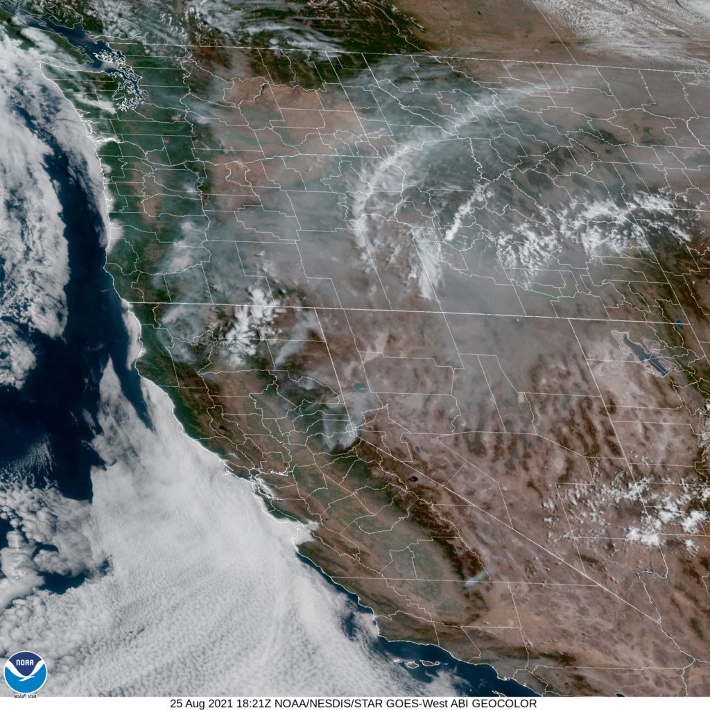
Here is the morning satellite imagery from Redding. It’s pretty cloudy to the north, and it’s tough to pick out individual smoke plumes. The smoke is there though.