Tonight’s forecast comes to us from a part of the country that just got through a wintry slap in the face. Are things soon to be on the up and up?
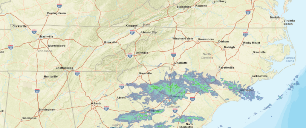
At 953PM, ET, Hickory was reporting mostly cloudy skies with a temperature of 32 degrees. a weak area of low pressure was working its way inland from the South Carolina coast. While this emerging feature is bringing the moisture, the already in place cool temperatures will ensure that the precipitation will be frozen, either as light snow, or perhaps a bit of sleet. Hickory should be at the western most extent of this threatening weather, but nevertheless, there is a winter weather advisory in place for the morning.
A southwesterly jet streak at the leading edge of a sharp trough is going to strengthen and draw northeastward. The precipitation tomorrow morning, if there is any, will be shortlived, but the cold air behind the feature will persist through the day. Weak flow will return at the surface as the jet structure becomes muddled aloft. It won’t necessarily be warm in Hickory on Tuesday, but surely, it won’t be as cold.
Tomorrow – Morning sleet, with a little bit of rain to finish, otherwise mostly cloudy in the afternoon High 44, Low 28
Tuesday – Partly cloudy, High 53, Low 26
TWC: Tomorrow – Freezing drizzle in the morning, then mostly cloudy late, High 45, Low 27
Tuesday – Some clouds in the morning will give way to mainly sunny skies for the afternoon. High 54, Low 29
AW: Tomorrow – Mostly cloudy and chilly with spotty drizzle High 42, Low 29
Tuesday – Milder with times of clouds and sun High 52, Low 30
NWS: Tomorrow – A chance of freezing rain before 8am, then a chance of freezing rain and sleet between 8am and 10am, then a chance of rain after 10am. Mostly cloudy High 43, Low 29
Tuesday – Sunny, High 51, Low 27
WB: Tomorrow – A chance of freezing rain in the morning. Mostly cloudy with a chance of rain. High 44, Low 30
Tuesday – Sunny, High 53, Low 30
WN: Tomorrow – Mostly cloudy with chance of a light wintry mix, High 43, Low 28
Tuesday – Mostly sunny, High 51, Low 27
FIO: Tomorrow – Possible light rain in the morning and afternoon. High 44, Low 30
Tuesday – Clear throughout the day. High 52, Low 28
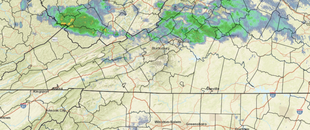
The Weather Service and Forecast.io agree with me: The clouds are going to slow down the cooling tonight, and it will actually be colder on Tuesday morning. Other than that, only Accuweather’s precipitation forecast really stands out. Here is the radar tonight, with precipitation falling as rain in South Carolina (where it is being noted)