This is a very exciting day for me in the forecast realm. Not very often we get to include a hyphen in the forecast city name!
At 954AM, ET, Winston-Salem was reporting clear skies with a temperature of 81 degrees. Clear skies were the boss, but dew points in the low 70s pointed to uncomfortable conditions and the potential for a few clouds today. Some low level convergence suggested a lee trough just to the west of the airport, and the threat for some afternoon showers and storms today, though high pressure dominated the broader map in the Carolinas.
This lee trough is going to be the primary factor over the next couple of days. There is colder, dryer air on the other side of the Appalachians, but the jet structure is well into Canada, and will not advance far enough to change the air mass in Winston-Salem. Expect scattered showers and storms in the afternoons through the mid-week. Surface low pressure in eastern Canada may eject some midlayer overcast into the Carolinas on Thursday, bringing temperatures down a tick or two
Tomorrow – Mostly cloudy with a chance for some pop up showers, High 90, Low 72
Thursday – Mostly cloudy and at times overcast. Scattered showers, High 86, Low 71
TWC: Tomorrow – Partly cloudy with afternoon showers or thunderstorms. High 87, Low 71
Thursday – Cloudy in the morning with scattered thunderstorms developing later in the day. High 84, Low 70
AW: Tomorrow – Clouds and breaks of sun with a thunderstorm in the afternoon High 90, Low 73
Thursday – Considerable cloudiness with a thunderstorm High 83, Low 71
NWS: Tomorrow – Showers and thunderstorms likely, mainly after 5pm. Mostly sunny, High 90, Low 72
Thursday – A slight chance of showers b73efore noon, then a chance of showers and thunderstorms between noon and 3pm, then showers likely and possibly a thunderstorm after 3pm. Partly sunny, High 86, Low 71
WB: Tomorrow – Mostly sunny. Showers and thunderstorms likely in the afternoon, High 88, Low 73
Thursday – Mostly cloudy. Showers likely with a chance of thunderstorms in the afternoon. High 83, Low 71
FIO: Tomorrow – Humid and mostly cloudy throughout the day. High 83, Low 75
Thursday – Rain overnight and in the morning. High 84, Low 74
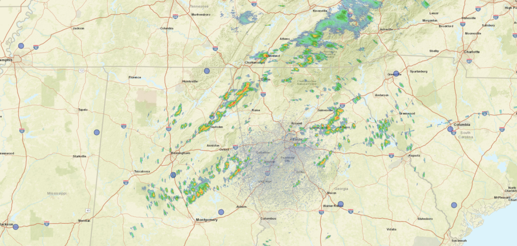
It will be nice to ratchet the heat down wherever we can. Some storms are just starting to pop up in the Blue Ridge Mountains to the west as we grabbed this satellite image.