There is a bit of cooler air filtering into the northern US, slowly but surely. Bands of training thunderstorms are expected in the Upper Midwest today. The threat for storms is in the hail and wind variety, particularly when they get going later today. The jet is lingering near the Canadian border, so don’t expect this action to move further south. Sure, it’s hot down there, but at least it isn’t stormy, right?
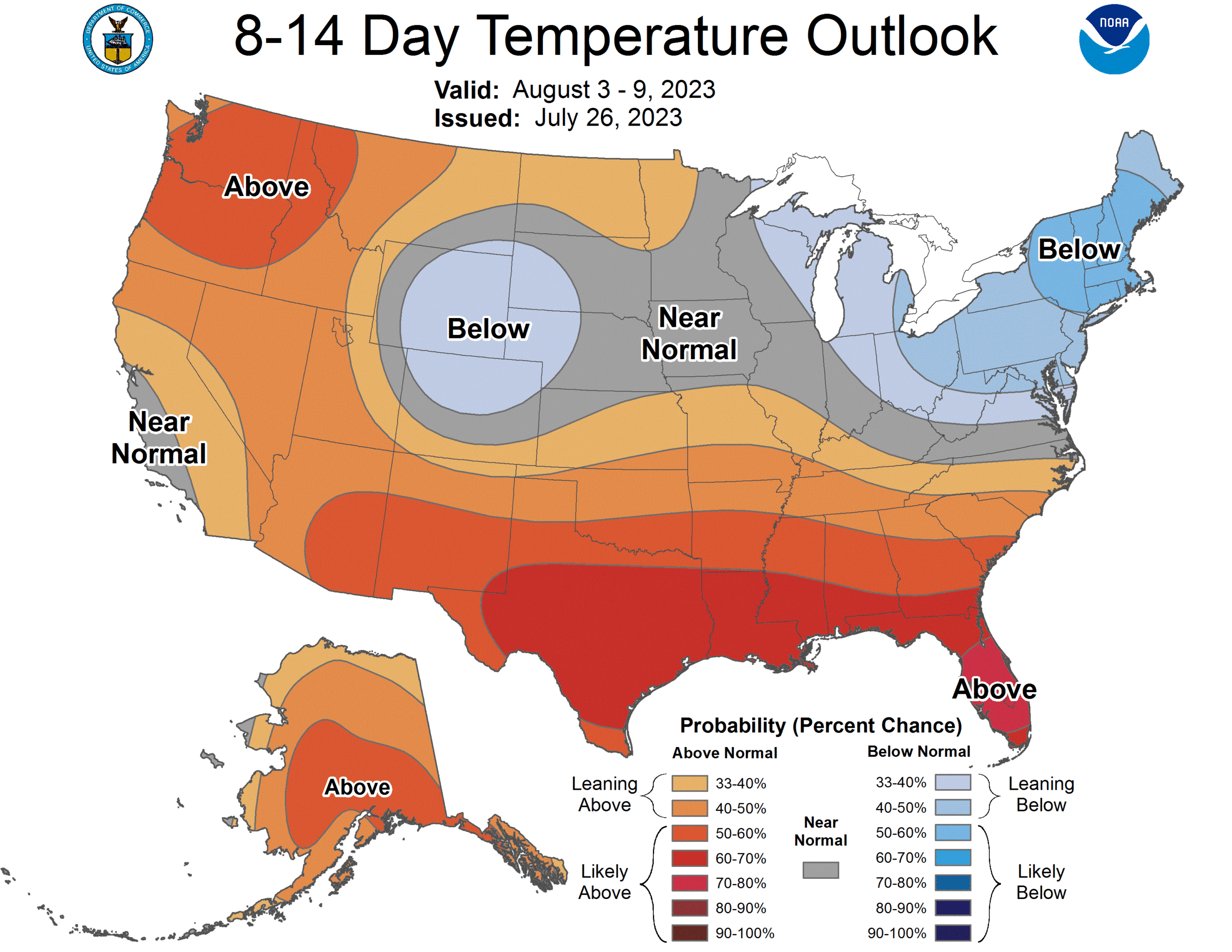
The heat is on across the country, as you have no doubt felt and heard about on the news. The really hot weather is expected to ease everywhere, but a true return to normal is coming for New England and California by the beginning of August. As luck with have it, that is the most populous part of the country
There is some heavy weather in the northern Plains this evening, including tornado warnings in South Dakota and Nebraska. Fortunately, this activity is in pretty remote terrain, which makes tomorrows threat more dangerous, even if the storms were at the same level as today’s, because Michigan, especially lower Michigan, is well populated.
Tornadoes and strong winds will be the primary concern, though hail is a threat as well.
The risk was marginal initially, but now we are up to a slight with severe hail storms and a severe thunderstorm watch in New York. As these storms pulse down, winds could take down some branches in the forested parts of the eMpire State.
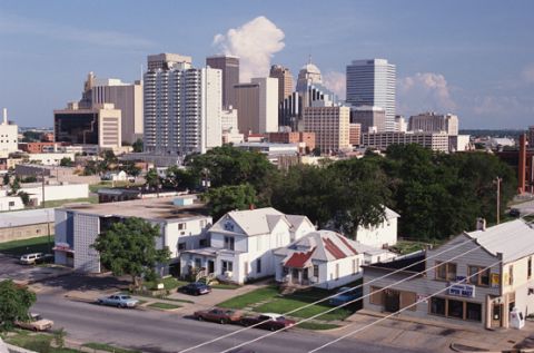
Louisville has a greater impact on the United States than you might expect. It’s home to Yum! Brands and UPS, and was the cihildhood home of Muhammed Ali and Diane Sawyer. The city is pretty proud of their history, so remember that next time you hear about the Kentucky Derby or Louisville Sluggers.
At 1058AM, CT, Louisville was reporting a temperature of 82 degrees and mostly cloudy skies. There is a weak trough moving through Kentucky this morning that is producing a band of cumulus from about Jackson, Ohio to Kentucky Lake. There may be a few showers associated with this this afternoon, but they will keep south of Louisville. A narrow trough over the Great Lakes is the parent of this trough, but the ridge of hot weather that most of the nation is experiencing will force that boundary and any hospitable air back to the northeast. There may be a passing shower on Tuesday as this air mass transition takes place, but by Wednesday, this dome of hot air will take hold and suppress any convective activity. Record highs are possible. Tomorrow – Isolated showers and storms, High 93, Low 71 Wednesday – Hot and humid, mostly sunny, High 96, Low 74
TWC: Tomorrow – Intervals of clouds and sunshine High 91, Low 69 Wednesday – Sunshine and clouds mixed (morning storms). High 95, Low 73
AW: Tomorrow – Humid with sun and some clouds; a thunderstorm in spots in the afternoon High 90, Low 69 Wednesday -Intervals of clouds and sunshine High 92, Low 73
NWS: Tomorrow – Isolated showers and thunderstorms after 2pm. Mostly sunny, High 89, Low 68 Wednesday – Mostly sunny, High 90, Low 73
WB: Mostly sunny with isolated thunderstorms, High 89, Low 71 Wednesday – Mostly sunny, High 92, Low 70
WN: Tomorrow – Partly cloudy with isolated thunderstorms, High 89, Low 68 Wednesday – Partly cloudy with light rain showers, High 90, Low 73
CLI: Tomorrow – Light rain showers, High 90, Low 72 Wednesday – Partly cloudy, High 95, Low 73
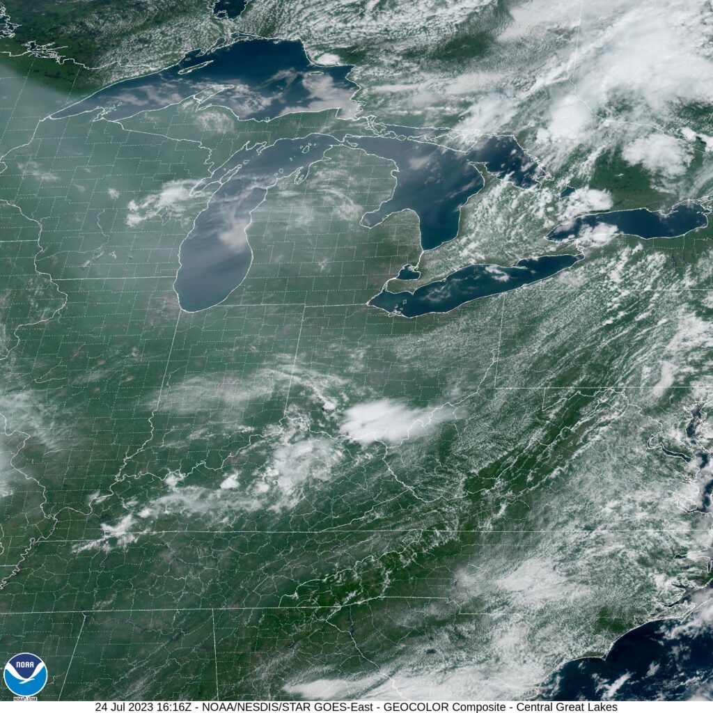
The most interesting part of this forecast for me is that WeatherNation has the same temperatures but a different precipitation forecast than the Weather Service. Take a look at the satellite imagery below, showing that band of clouds south of Louisville.
On June 9th, we put together a forecast for Denver. If you know anything about the city, you know that the airport is well to the east of town in the vast prarieland of the eastern part of the state. It’s otherwise barren country. Further west are the Rockies and the front range. Generally speaking, it’s a little bit cooler in the city than at the airport because of the terrain. A bit of a reverse urban heat island. This is all important background for the realization that downtown Denver, which is where the forecast verified, is different by a few degrees than the airport, which is the best source for model output statistics. So, we forecast, we went uphill and we verified. Clime, what with the algorithms and had the top temperature forecast, but their erroneuous rain forecast on the morning of the 10th meant Victoria-Weather and The Weather Channel claimed a share of the win as well. Monday July 10th, High 89, Low 60 Tuesday – July 11th, Hgh 92, Low 64
There isn’t a lot of organization to the weather activity with the current pattern, but it’s so warm, and so humid that they are likely to just pop up here and there. Unless you are travelling from Pittsburgh to Jackson and west to Oklahoma City, then you should be ok.
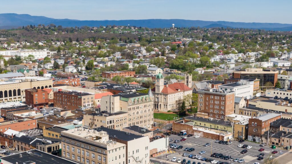
I’m looking a little bit at the Harrisonburg forecast from a few days ago, and I am reminded that, because of the combination of high population and density of vegetation, the region is very sensitive to wind storms. While in the Plains or Midwest, you see long track lines of severe weather with the heaviest storms, you get mottled spasms of wind reports out east like they did over the weekend in the Atlantic Coastal Plains.
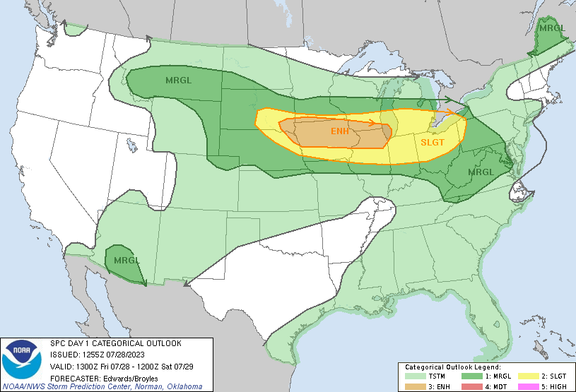
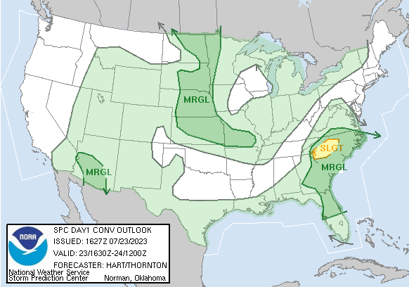
There is a tract of the middle of the country with a slight risk for severe thunderstorms tomorrow. There is a target for large hail and tornadoes in east central Minnesota and western Wisconsin that may bump the area to an enhanced risk tomorrow. The stretch in Tennessee to western Virginia where our road trip will drive through is in a marginal risk.
It’s time to take the first road trip in Victoria-Weather’s post Twitter era. Naturally, we should try to get to the center of the professional meteorology universe in Oklahoma City. We’ll take two days to cut through this tract of the country, which will cover 1212 miles. There is some mountaineering involved on this trip, but we’ll still manage a 68.3mph pace, which isn’t bad! We’re going to call it a night after 546 miles on day one, leaving a bit more work for day 2.
DAY ONE (Wednesday)
Harrisonburg, Virginia
High pressure has finally arrived to New England to help dry the area out a little bit. On the southern flank of this ridge, however, showers and storms were still active. That seems to be the trend for the day tomorrow as well. The threat for showers and maybe even an isolated embedded thunderstorm will be best in the morning, and in the terrain along the Virginia-Tennessee border. Things should stabilize later in the day, and we’ll make our way to the west side of Nashville to conclude out day.
DAY TWO (Thursday) A weak area of low pressure will be moving through the Upper Midwest towards the Great Lakes Wednesday into Thursday, and will drag a sweeping cold front into the Tennessee Valley. There may be a lingering shower as we leave Nashville, but after that, we will be able to reap the pleasures that summer has to offer us. Driving through Arkansas is a much more scenic trip than you might expect, so appreciate that, and keep the AC on for our arrival in OKC.