We’re headed southeastward to start the work week. Getting into the middle of November, a trek to the beach might be a good idea. It will take two days to get from Illinois to the Treasure Coast, covering 1162 miles. That will cover nearly 70 miles an hour, and we will over 554 miles on our first day, leaving a longer day for Tuesday. Beach day!
DAY ONE (Monday)
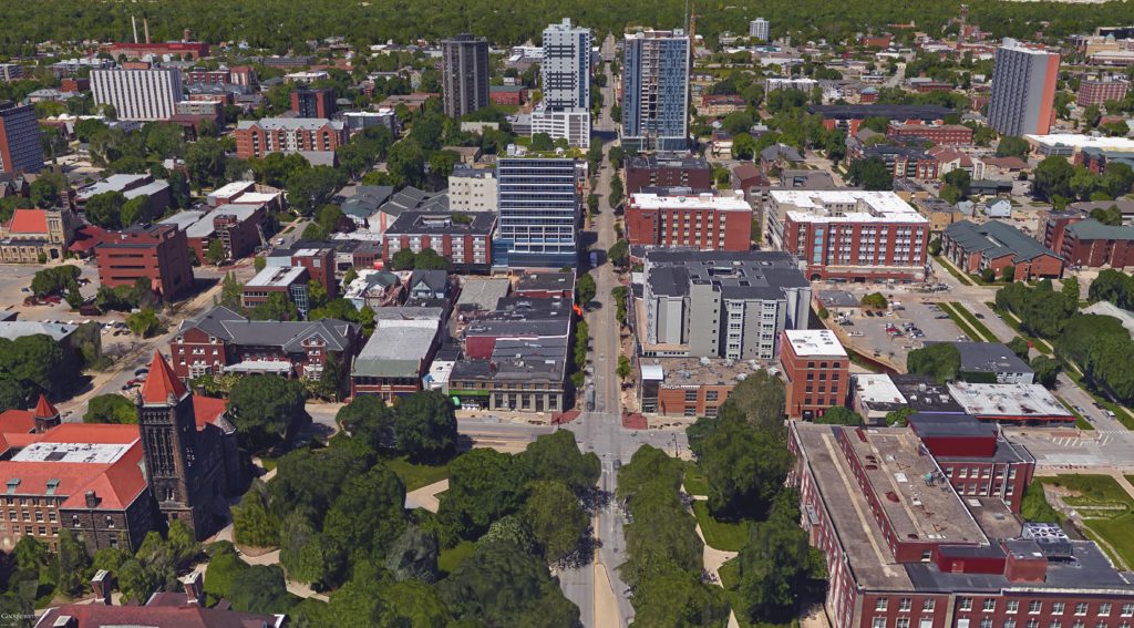
Champaign, Illinois
Low pressure in the Great Lakes has hooked up with the remnants of Rafael at this point, which is slowing the eastward traffic down a bit. By the time we get going on Monday morning, it will have dried out in east Central Illinois, and will be dry, if with some patchy clouds, for our route. The tail of the cold front, fused to the remnants of Rafael, will stall through Georgia, bringing about some mid to lower level overcast through the Smokey Mountains as we pass through Chattanooga. The day will conclude in Calhoun, just north of Atlanta.
DAY TWO (Tuesday) That low in the Gulf will refuse to go away, but will get forced apart by a burgeoning ridge of high pressure in the eastern two thirds of the country. The low moving out of the Great Lakes will be safely off in the Canadian Maritimes, and our drive on Tuesday to Sebastian will be done with very good conditions, save for all those Florida drivers to worry about.
Our road trip tonight takes us in a route that we normally wouldn’t for this trip, because of road closures still left by hurricane Helene. As it stands, this will be a two day adventure across the Appalachians and to the southern Plains, covering 1218 miles. This mountainous sojourn will be at a pace of 68.2mph, which is pretty quick, actually. The first day will end after 545 miles, which is a mighty bit of driving.
DAY ONE (Tuesday)
Rocky Mount, North Carolina By Harris Walker – https://www.flickr.com/photos/harriswalkerphotography/3342646285/in/album-72157615074534836/, CC BY 2.0, https://commons.wikimedia.org/w/index.php?curid=61707633
Our drive out of North Carolina will have to swing north because of road closures, and we will snake through Virginia. As we make our way through the southwestern part of the shape, the moist onshore flow wrapping around a ridge of high pressure will lead to at least some low clouds, but potentially some fog and mist, particularly from Hillsville to Wytheville. Eastern Tennessee will give us a bit of clear air in which to enjoy the sights. We will reach Lebanon, just before Nashville, and await a line of showers and thunderstorms that will dampen Lebanon as we sleep.
DAY TWO (Wednesday) Or will it? Instead of moving into Lebanon, Rafael’s presence in the Gulf will stall the front and allow it to wither. We will pass through a few showers between about Jackson, Tennessee and Little Rock, which may make passing through Memphis a bit of a headache, but we will see some clear skies in the Ozarks. We’ll trek into eastern Oklahoma with cooler temperatures and clearer skies than Tulsa has seen lately.
We are free of hurricanes for a couple of days, at least, so we can take a guilt free trip from Illinois to New England. The drive will cover 1,152 miles over the course of two days. The pace of the drive will be about 66.5mph, which is pretty good, considering it terminates in New England. The faster of the two days will conclude after 532 miles. Hurricane season is also foliage season, so New England is a perfectly reasonable place to visit.
DAY ONE (Sunday)
Springfield, Illinois
High pressure is parked over the southeastern part of the country. It was crucial to keeping Milton from moving any further north, and instead cutting across Florida and jetting into the Atlantic. The storm was very bad where it struck, but it missed out on a lot of geography, which is good news. Now after the ridge has performed it’s life saving duty, the northern fringe is pressing south, thanks to a strong wave skirting the Great Lakes. There is quite a bit of wet weather in Lower Michigan, ready to drift into northern Ohio. As we travel out of Illinois through central Indiana Sunday, it will be dry, but increasingly cloudy in Ohio. I think the rain will b in Pennsylvania be the time we get to the eastern part of the Buckeye state, but thre could be a small bit of damp in Palmyra (southeast of Cleveland near the Pennsylvania border), where our day will come to a close.
DAY TWO (Monday) A surprising amount of cold air will trail the cold front with the system moving into the Great Lakes. It will be chilly when we start in Palmyra, and there will be a few spots of showers peaking around the western exposures of the Poconos. Further north, higher terrain in New England will likely see their first snowflakes of the year. As the sun comes up, and the cold air settles in and snuffs out any instability, we will get into clearer air. The drive through Connecticut will be thick with traffic, I am sure, but it will dry and chilly until we reach Providence.
We’re headed Gulfward to start the new week. This drive doesn’t quite mirror our drive leading into the weekend, and will lead to a longer drive, lasting into a third day, while also at a pace that is faster, covering 67.5mph. This will allow us to cover 539.7 miles the first two days, leaving the rest of the 1519 miles for Wednesday.
DAY ONE (Monday)
Manchester, New Hampshire
In a manner that is frighteningly similar to the one seen on our way up to Manchester last week, a wave will be moving into the Mid-Atlantic just as we are driving through the area. The drive through New England and downstate New York should be dry, if increasingly cloudy. The threat for rain will pick up around Allentown, and will persist through the remainder of the drive through the Keystone State, as well as the snips of Maryland, West Virginia and Virginia we see (We will touch 8 states in all through this drive). The day will end with some light rain, as it will have been spotty throughout the afternoon, in Stephen City, Virginia, which is on the south side of Winchester.
DAY TWO (Tuesday)
A big lingering area of low pressure is hanging out in the Gulf Stream, and is slowing down any progress through the Eastern Time Zone. There won’t be an organized system, so to speak, but the lingering showers will turn into morning fog on Tuesday up against the Blue Ridge Mountains, with rain picking up pretty quickly again as the day begins. As we start to get into the mountains, we’ll eventually get to the western face of the mountains, in Tennessee, and we should start to enjoy some drier pavement from about Bristol to Chattanooga. It won’t remain entirely dry, as a reinforcing shot of cold air might bring some more wet weather to Tennessee as the lingering moisture starts trying to organize late in the day. We won’t spend much more than 15 miles in northwest Georgia, but we are still going to post up for the night in Slygo.
DAY THREE (Wednesday)
The NHC is monitoring a developing feature off the coast of Nicaragua, which will start drifting further to the north through the next couple of days. Models are starting to agree that it is looking more and more like it will become a tropical storm, and ultimately, a hurricane before making land fall, unfortunately probably along the Gulf Coast. Guidance suggests that landfall will come around Fort Walton Beach on Thursday, which furthermore means our drive on Wednesday towards the Gulf Coast will be very dependent on the pace of the storm. I suspect we will see a little bit of rain in Alabama, but it will clear out fairly quickly. Ironically, moisture will be flowing off shore, which isn’t generally a great way to produce a lot of storms, so I don’t think we will see much rain. In fact, I would say by the time we reach Gulfport, it should be dry. Won’t last, but my forecast doesn’t go beyond Wednesday.
These East Coast trips are perhaps even more susceptible to inclement weather. The weather isn’t worse, but the travel is more urban, and a bit of rain can really tie things up. We’ll take two days, including longer day on Saturday, to get from southwest Georgia to southeast New Hampshire. It’s a 1,245 mile journey, taken at a 63.7mph pace. The first night day will end, theoretically, after about the 510 mile mark, leaving a monstrous second day of travel.
DAY ONE (Friday)
Columbus, Georgia
The remnants of Tropical Storm Gordon, which brought heavy rain to the Carolinas is now drifting northwestward along the Gulf Stream. The rotation wrought by the storm throughout he Eastern Seaboard is continuing to bring some clouds and spotty rain showers, especially in northern exposures of the Appalachians, and even as far south as the Smokey and Blue Ridge Mountains. Fortunately, this does not include Georgia, but there will be some drizzle and overcast in the Carolinas, leading to additional slowdowns through the Piedmont and Charlotte. Traffic will be thinner, but the spits and starts of rain will continue to Christianburg, the city at the Blacksburg exit in Virginia.
DAY TWO (Saturday)
I’ve got something from the good news department: Our route is not taking us through DC, Philadelphia or New York City. This is great, because it means we will avoid all the traffic brought upon by a stationary boundary setting up between the remnants of Gordon and a wave rippling through northern Ontario. We are likely to see rain in at least 4 states, starting around Winchester, Virginia, continuing through West Virginia and Maryland, and continuing to Pennsylvania. The rain will start to wind down as we approach Allentown. Even after that point, however, we will be arriving in the moisture rich environment in the wake of Gordon. While the more widespread rain will be behind us, especially as we hit Connecticut and Massachusetts, the chance for a spit of rain can’t be ruled out.
Well, we are deep into the summer, so we should probably take on a road trip, right? This journey will cover 550 miles, and will last only a day. It’s just a shot down I-65 at a pace of 67.9mph. That’s cooking! Let’s cook down to Montgomery!
Bloomington, Indiana
Low pressure is going to keep churning through the southern Great Lakes tomorrow, with rain continuing to wind around the center of low pressure, we are going to have to navigate through a few showers and embedded thunderstorms, especially in southern Indiana. More isolated storms are going to pop up in Kentucky and Tennessee, but being later in the day, they will probably be a little bit spicier. Fortunately, this should be the last of the wet weather. Unless you are talking about humidity, because it will be unbelievably sticky, all the way down to Montgomery.
I like the road trips that are more or less diagonal across the country, but this one has some pretty well worn interstate routes to follow. The drive will cover 1326 miles, which we will spend 2 long days accomplishing. All those interstates mean we can travel at oer 68mph, and our first day will conclude after 545 miles, leaving plenty of meat on the bone for Wednesday.
DAY ONE (Tuesday)
Albuquerque, New Mexico
The day will begin beautifully in the Land of Enchantment, and we will head east through New Mexico, encountering little by way of significant weather along the way. Storms rumbling now will have a tough time petering out through the morning over west Texas, but as we shift into the Panhandle, things will finally begin winding down. This is because the dry line will start becoming active in eastern New Mexico. It looks like we will thread the needle! It should be hot and stuffy, but dry in Oklahoma City as we arrive for the night.
DAY TWO (Wednesday) Wednesday looks even better, which is great, given the long drive we have ahead of us. We’re going to cover 4 states, and may not see a cloud (though maybe to start the day would be our best chance.) Temperatures will be getting cooler as we go, but make no mistake – pack your sunscreen and plan on finding a pool.
It’s Friday, so it’s time to head to Albuquerque. Isn’t that all the logic you need? We’re taking a driver through Texas in a lot of two lane highways. Our drive will cover 657 fairly slow miles, at a pace of 62.9mph, but we’ll wrap this drive up in one day! We’ll even get an hour back, and our 10 hour drive will end a mere 9 hours after we start. Road
Killeen, Texas
This is a classic summer day in the south central US. The pavement will be melting because of the heat, but it will be sunny, and we’ll be able to drive without an interruption (aside from bathroom breaks — drink a lot of water with this heat) through the morning and early afternoon. The dry line is expected to set up somewhere in eastern New Mexico. I don’t think the likelihood we get clipped by a storm is very high, but if we see any rain, it will come between Fort Sumner and the eastern extent of the Albuquerque metro. I said no rain in the Albuquerque forecast earlier, and I’m standing by that!
Not only do we get a long road trip, we get one that moves diagonally across the country. It will take 5 days, and a with a long 5th day at that, to cover 2,829 miles, at a pace of 67mph. That means our regular 8 hour days will be through after 538 miles. This is going to be a long trek, but at least it ends at the beach!
DAY ONE (Friday)
Bend, Oregon
It’s getting hot out west, and we are certainly going to notice that a ridge is building into the region, at the very least. We’ll be driving through some pretty rural country between Bend and the Boise metro, and again after 84 splits from 86 and heads south to Utah, and the views should be, if not spectacular, then at least unspoiled by clouds. We’ll just cross into the Beehive State, and finish in Snowville, Utah after day one.
DAY TWO (Saturday) We will see the topography of our drive change pretty dramatically on Saturday. After starting the drive between some major mountain ranges, in the Great Basin, we will first hit the Wasatch in Utah and then start climbing the Rockies. All of this will be done in the sunshine, but some afternoon showers and storms in peaks of the Rockies might creep over I-70 by the end of our drive. We’ll end the day in Vail, Colorado, which is probably just as charming outside of ski season.
DAY THREE (Sunday) Low pressure is going to get going again in the central Plains, with strong storms again becoming likely on Sunday. This time, however, the threat is going to be further to the north. The storms will pop up north and west of us as we drive through Kansas, emerging only late in the day. They will leave the better part of Kansas alone during the day, but after we stop in Solomon, in the north central part of the state, we should expect some storms to rumble through that night.
DAY FOUR (Monday) The cold front is going to bog down in Missouri as the low shifts northward. Since the boundary did peel out of Kansas, though, we will be in some clear air through Kansas City, but after that, some scattered clouds with some embedded showers are going to be possible in the Show Me State, with the best chances coming between Columbia and St. Louis. We’ll make it to southern Illinois for our final night of the trip, stopping just north of Paducah, in Goreville, Illinois.
DAY FIVE (Tuesday) Now ahead of the front, into some summer time heat and humidity, the threat for showers and stors is going to pervade the entire day. The best chance for rain will show up between Knoxville and Asheville, but after that point, it will be the evening, and instability will be at it’s highest. Scattered showers and storms will be possible throughout the Carolinas. Fortunately at this point, that activity is going to thrive on the heat of the day, and the evening is going to be dry in Myrtle Beach.
It’s going to be a one day cross section of middle America. From northern Indiana to northwest Arkansas, we will take a long, 11+ hour day, covering 742 miles, for a pace of nearly 66mph. Indiana and Arkansas are closer than you think!
Elkhart, Indiana
A weakening system over the Great Lakes is getting drawn into the sphere of influence administered by a larger system trekking through the Gulf Stream. The weaker trailer is bringing some light rain to Elkhart tonight, but will be out of the picture by tomorrow morning. The feature is dangling a trough southward before it curls to the west, where it will lie stationary tomorrow. High pressure is building in over the north central US, but it won’t overpower the boundary and send it further south. Instead, the tail of the front will pass through the Ozarks, and while we will probably use our northern route to avoid any visibility issues, we will still enjoy them in their misty glory upon our arrival in Fayetteville.