
There was another deadly tornado event in the Great Lakes area on Tuesday. This time, a pair of tornadoes struck south of Chicago, near Kankakee and across the border in Lake Village, Indiana, where two were killed. Local authorities said that, where it not for advanced warnings before the storms struck. The weather impact will not be as further to the northwest over the next 72 hours, but also, we will be absent the forecast certainty.
I’m sorry? What? WHAT?!
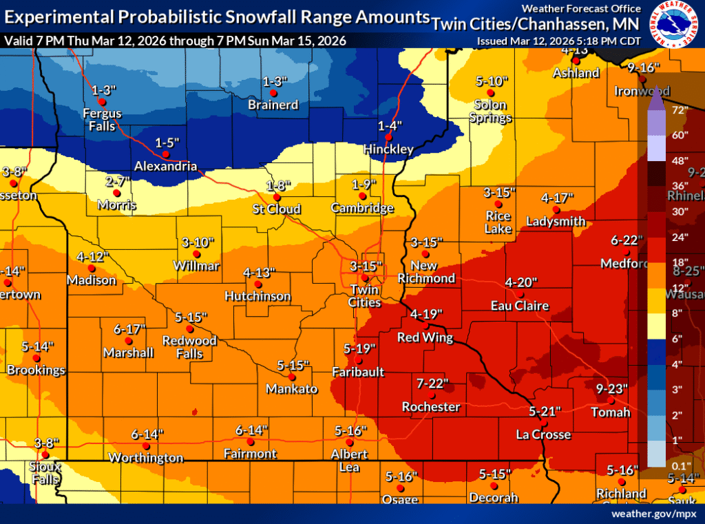
It has already started this evening in Minnesota, and this weekend will be…. something?
The National Weather Service has a feature in which you can see the percentage chance of getting over a certain accumulation level. In the Twin Cities, the chance of getting over 4″ is 71%, over 6″ it is 56%, but then over 8″ it is 46% and over a foot is 35%. If it snows over a few inches, Twin Citians may as well plan on a foot.
That’s no way to go through life!
There is a system moving into the Great Lakes tonight, and a stalled boundary that will linger in the region tomorrow, and a warm front that will fill in on Saturday. The real show will come on Sunday.
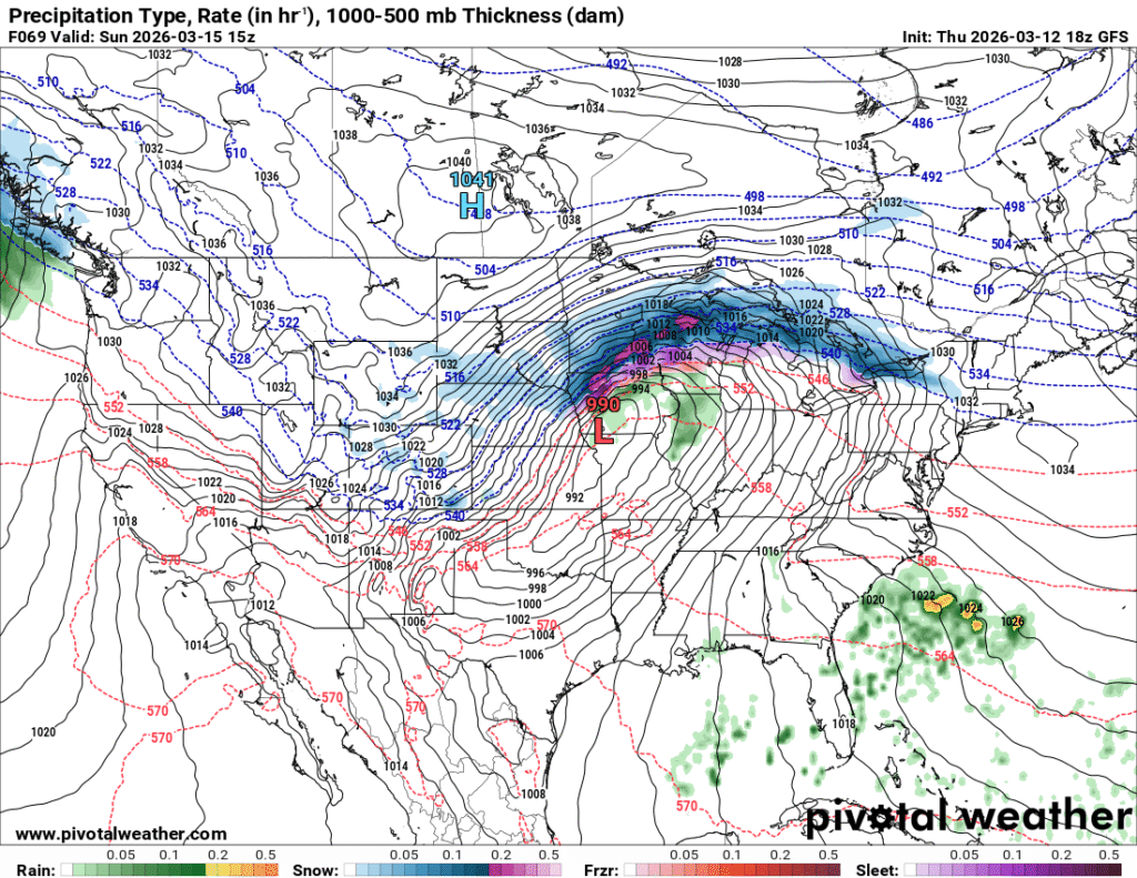
One way or another, that’s a lot of precipitation inbound. The uncertainty lies with the temperature profile, for one thing, and exactly where that heaviest band of precipitation will set itself up. I wouldn’t be surprised if there is a band maybe 20 miles wide that clears a foot and a half of snow, with the accumulation falling off significantly on either side of that band.
That’s probably the hedge that the NWS is also leaning on, and it will be tough to determine where that heavy band is going to set up, until it sets up.