
We’ve spent a great deal of our time and energy focused on the southeastern US, so we get to get a taste of something different this evening.
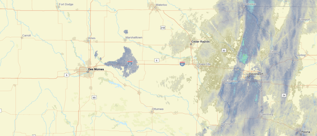
At 453PM, CT, Ames was reporting a temperature of 32 degrees with overcast skies. This is following a band of light snow that was related to a clipper moving through the Upper Midwest. An area of high pressure is moving through the Canadian Prairies, with a bit warmer air flowing under the upper level feature.
The Canadian ridge will sink back to the south tomorrow, and there is a chance for a band of flurries Late tomorrow, but the advancing area of high pressure will ensure that the day won’t be completely snobound.
Tomorrow – Increasing clouds with late flurries, High 31, Low 16
Tuesday – Mostly sunny,High 25, Low 14
TWC: Tomorrow – A mix of clouds and sun early, then becoming cloudy later High 31, Low 20
Tuesday – Partly cloudy. High 28, Low 18
AW: Tomorrow – Intervals of clouds and sun High 30, Low 18
Tuesday – Periods of clouds and sunshine High 26, Low 17
NWS: Tomorrow – Partly sunny, High 30. Low 17
Tuesday – Partly sunny, High 28, Low 17
WB: Tomorrow – Partly sunny. High 31, Low 22
Tuesday – Partly sunny. High 26, Low 18
WN: Tomorrow – Partly Cloudy, High 29, Low 17
Tuesday – Partly Cloudy, High 28, Low 16
CLI: Tomorrow – Overcast, High 33, Low 17
Tuesday – Mostly cloudy, High 28, Low 10
Here’s the radar imagery for Iowa, with our warm front already through town. Well, through the Hawkeye State, actually.
Comment (1)