This weekend saw much of the country paralyzed, with millions losing power, thousands of flights canceled, and recovery an ongoing battle. The snow is still actively falling in parts of New England, but the thaw is not ready to move in yet. Everything that was frozen this weekend remains so.
A deep and strong trough has been ebbing and flowing across the eastern two thirds of the country for a couple of weeks now, and at long last, the surae organization matched with what was going on aloft. Low pressure developed in the Southern Plains and was able to tap into Gulf moisture, while at the same time drawing very cold air from the Canadian Prairies.
As we saw with our forecasts in Florence and Rome, several days before the storm set in, there was already cold air in place. The storm, therefore, wasn’t necessarily marked by the great conflict of air masses, but rather the incredible amount of moisture that was able to blanket the country.
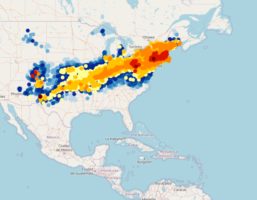
The area covered by freshly fallen snow, mapped below with the heaviest totals coming from western Pennsylvania to Massachusetts, is an elongated southwest to northeast line, starting in southern New Mexico and running to New England. It tells the story of the track of the storm, starting in the southern Plains and ending up in the Canadian Maritimes. A “Texas Hooker” to be sure. Snow was measured over two feet in some of the terrain in Pennsylvania, and well over a foot throughout Massachusetts.

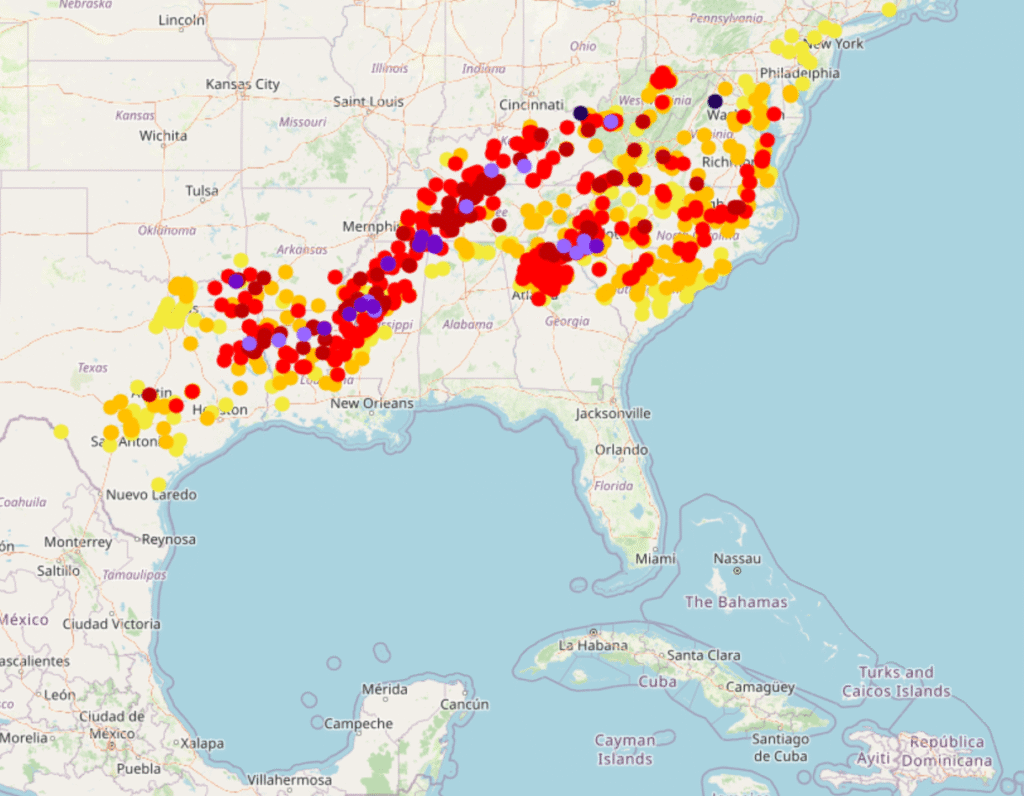
A broad area of accumulated ice, pictured below, is found on the southern fringes of this vast area of snow. This is where the most significant damage you have head about is showing up, from northern Mississippi, to Nashville and on to the Carolina Plains. I saw reports of up to 3″ of accumulated ice, which is devastating. Many places saw an inch, which is debilitating in itself.

The map of this storm tells us that much of the destruction was done by a stationary front, which became a weak, meandering warm front. The cold front associated with this rotating area of low pressure had little to do with what the storm wrought. There were several severe thunderstorm reports around the Florida Panhandle, but for all intents and purposes, this was purely a winter storm.
The cold air has of course eventually found it’s way in, and is keeping all these people buried under snow and ice in a deep freeze. For this particular occasion, the cold front has worked to exasperate an existing problem, rather than being the progenitor of the problems. Cold fronts generally have it easier when they want to raise a ruckus, and are pretty expert at it in the summer and spring, when they have warm air to work with. It takes a special blend of cool temperatures, and the right oscillating warm front to cause the havoc that this weekend’s storm did.
