11:27AM: The Great Lakes are at it again, resulting in some half foot accumulations just this morning. The unusual bit of news, though, is that there is a weak fetch off of Lake Superior, and that snow is in northeastern Minnesota. It’s definitely not captured by the models, and it is barely showing up on radar, but it IS identified in this local storm report. This is ski country, so I don’t think anyone is mad about it.
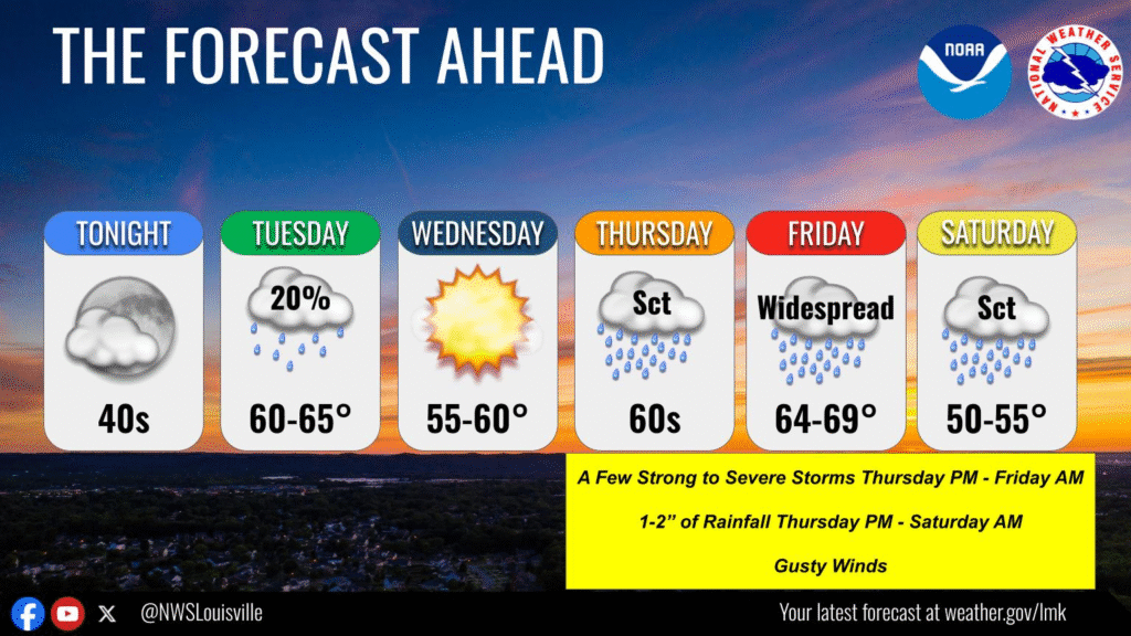
3:05PM: I mentioned in an update yesterday that the US was enjoying a bit of a reprieve from early season severe weather. That reprieve is nearing its end. Unfortunately, with the active pattern on either coast, it was just a matter of time, and the first hints of a bit of severe weather coming on the horizon are now showing up in Louisville’s extended outlook. This is Day 5 (January 9th) so things are absolutely still in flux.