
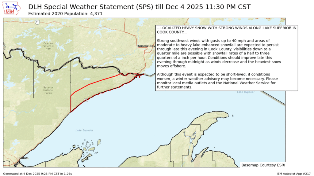
9:45PM: Lake effect snow is possible on either side of the Great Lakes, we just here about it more frequently to the east of the lakes, because that is the the prevailing direction of air flow in the Northern Hemisphere. Every once in a while, you get a northeasterly wind off of Lake Superior, and you suddenly have heavy lake effect in the Minnesota Arrowhead. The area is bound by a little bit of terrain, so the snow isn’t even showing on radar, and it is seeing some orographic forcing as well. This could be a pretty good dumping.
11:21PM The next system to batter the East Coast is, well, starting to batter! Look at the coverage on this rain!
