Mindy really took off on us. It looked like a fairly innocuous disturbance in the Gulf, but then over the course of a couple days, our forecasts in the area seemed to call for more and more rain. Tampa was clobbered by at least one big cell on Thursday, with a quarter inch of rain coming through, and rain falling on both days to end the workweek. Victoria-Weather and the Weather Service took the top forecast in Tampa, thanks to our belief that heat would still bleed through the storm clouds brought by Mindy. Actuals: Thursday – .23 inches of rain, High 90, Low 79 Friday – .08 inches of rain, High 90, Low 75
It’s the weekend, baby! And our drive is going to cover a lot of country at what is really the right time of year to be taking such a journey. Temperatures are usually perfect for keeping the windows down, while you can stop and take in football games on the weekend, or baseball games in the week. This drive will take 5 days, so plenty of chances to stop, and will cover 2782 miles. It’s a hike, but we will break it up into 543 mile chunks at a pace of 67.8mph. Day 5 will be the longest, but it is also the stretch with the fewest roadside attractions.
DAY ONE (Saturday)
Columbia, South Carolina
The eastern US needs to dry itself out, and it will get the chance on Saturday. High pressure is going to build across the southeastern US, at least at the surface. It’s strength will help guide Larry and Mindy northward, while temporarily preventing the development of more tropical activity in the Gulf. It’s not permanent, but it is going to last long enough. Expect now weather related impairment as we head from Columbia to Kuttawa in western Kentucky. It’s kind of a resort-y area, so hotels will be plentiful.
DAY TWO (Sunday) Low pressure is sliding through the Great Lakes toward eastern Canada, and a nearly stationary front will be left in it’s wake. It will try to bubble up some isolated showers and storms along the Minnesota-Iowa border on Sunday afternoon, but the ridge to the south is just going to be too much. Expect instead warmer than normal temperatures along our route, which will end in Dunbar, Nebraska, which is in the southeastern corrner of the state.
DAY THREE (Monday) Driving across Nebraska, at least to me, is fun. It’s really easy to figure out where you are, as the farmland leads to regularly intervals between towns, and you can move pretty quick, especially on a quiet day like Monday. There will be a spot of shower and thunderstorm activity late in the day though, as we approach the Wyoming border. Isolated thunderstorms will pop up in the front range, or until we are over Sherman Summit approximately. We’ll be on the other side of the high range and through Laramie to the Bath exit about 20 miles west of Laramie.
DAY FOUR (Tuesday) Storm activity will pick up in the Plains on Tuesday, so nice work getting out of there when we did. Some late showers and storms will pop up in southern Wyoming, but they should hold until we are into Utah. It looks pretty stormy in the Colorado Rockies too, but that is neither here nor there. In this case, “there” is outside of Wells, Nevada, where we will suspend our journey for the night.
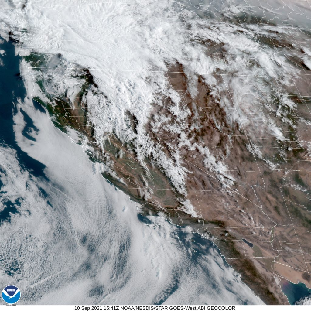
DAY FIVE (Wednesday) Hopefully, the rain that moved through the northwest today helped to quench some of the fires in Northern California and Oregon, but I don’t have high hopes. Temperatures will be dry, and the sky will almost certainly be tinged an unsettling color as we pass through Sierras into northern California and settle into the northernmost Central Valley, to park our butts in Redding.
As is definitely the case across the west, northern California continues to withstand one of the worst droughts the country has seen, perhaps since the Dust Bowl. The fire season has been particularly devastating just to the south of Redding in recent years. With that as a backdrop, lets hope for weather that is favorable to fire fighting efforts.
At 653AM, PT, Redding was reporting clear skies wit smoke and a temperature of 69 degrees. Dew points in the Central Valley were higher than most northern Californians are accustomed to, hanging out in the mid 60s. Isolated showers and thunderstorms are expected this afternoon, thanks to a short waved low rotating through southern Oregon. Unfortunately, it looks backed by more energy than moisture, and as a result, red flag warnings are out for the northern California Sierras, as lightning may touch off more fires. After the energetic bundle shifts out, the exit region of an upper level jet will remain in place along the Oregon/California border. High clouds will dot the skies of northern California, while cool, autumnal conditions will be just out of reach. Flow will be from the west, which will hopefully allow some smoke in the region to clear. Tomorrow – Partly cloudy, High 93, Low 62 Sunday – Mostly sunny, High 96, Low 60
TWC: Tomorrow -A mainly sunny sky. High 92, Low 65 Sunday – Intervals of clouds and sunshine. High 95, Low 62
AW: Tomorrow – Mostly sunny and hot; smoke from area fires will lead to poor air quality High 94, Low 62 Sunday – Sunshine and hot; possible danger of dehydration and heat stroke while doing strenuous activities High 97, Low 60
NWS: Tomorrow – Sunny High 93, Low 65 Sunday – Mostly sunny, High 95, Low 64
WB: Tomorrow – Sunny, High 94, Low 65 Sunday – Mostly sunny, High 97, Low 63
WN: Tomorrow – Mostly sunny, High 92, Low 65 Sunday – Mostly sunny, High 95, Low 64
FIO: Tomorrow- Clear throughout the day. High 95, Low 70 Sunday – Clear throughout the day. High 97, Low 66
Here is the morning satellite imagery from Redding. It’s pretty cloudy to the north, and it’s tough to pick out individual smoke plumes. The smoke is there though.
We took a look at two Florida cities recently, and when we looked at Gainesville, Mindy wasn’t really much of a consideration. Fortunately for our forecast consideration, the eventual tropical storm skirted north of the University of Florida campus, instead leaving isolated showers and storms in the region. If I need to spell it out further, there were actually some outlets that didn’t have rain in the forecast on Monday, which was definitely enough to change the overall balance of the day. Forecast.io would have won, had they put rain in the forecast — again, a forecast near an emergent tropical storm — but instead, it’s Weatherbug with the victory. Actuals: Monday -.01 inches of rain, High 89, Low 71 Tuesday – .01 inches of rain, High 86, Low 73
It’s a two forecast day here on September 8th. Let’s see if we can forecast better here than in Florida.
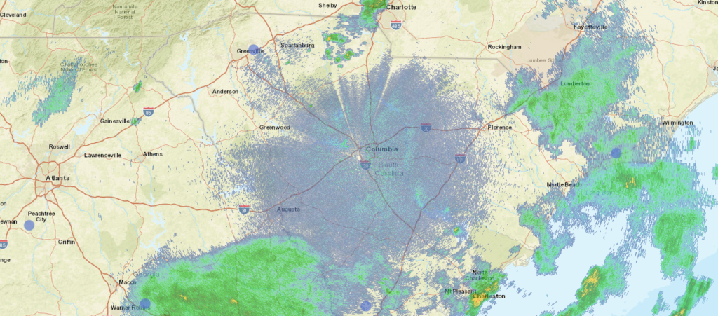
At 1056PM, ET, Columbia was reporting mostly cloudy skies and a temperature of 72. A slow moving cold front lay across the South Carolina Upstate, and was inching southeastward. Showers and storms have mostly wound down for the night, but the boundary’s presence will not allow anyone to take more rain out of the forecast. Tropical Storm Mindy sits over the northeastern Gulf, and will track toward the Carolinas by tomorrow afternoon, forecast to take a path south of Charleston, if it holds together as well as some guidance projects. Regardless of the storm’s strength tomorrow, there will be an increased threat of rain and storms with isolated tornadoes as circulation passes south of Columbia. On the positive side, the organization will help clear the region out more swiftly, and Friday looks like a dry day. Tomorrow – Scattered showers and embedded thunderstorms. Tornadoes possible in the area, High 84, Low 70 Friday – Becoming sunny, High 84, Low 64
TWC: Tomorrow – Showers early then scattered thunderstorms developing later in the day. High 81, Low 70 Friday – Partly cloudy skies. High 83, Low 61
AW: Tomorrow – Times of clouds and sun with a couple of showers; humid High 83, Low 72 Friday – Beautiful with times of clouds and sun High 84, Low 62
NWS: Tomorrow – A chance of showers and thunderstorms, mainly after 9am. Mostly cloudy, High 84, Low 72 Friday – Sunny, High 86, Low 63
WB: Tomorrow – Mostly cloudy in the morning then becoming partly sunny. A chance for showers and thunderstorms. High 82, Low 72 Friday – Sunny, High 82, Low 63
WN: Tomorrow – Partly cloudy with a chance of storms, High 84, Low 72 Friday -Mostly sunny, High 85, Low 63
FIO: Tomorrow – Humid and mostly cloudy throughout the day. High 83, Low 70 Friday – Clear throughout the day. High 84, Low 63
I feel pretty confident that there will be showers and storms in Columbia tomorrow, to some degree. It appears our computer overlords at Forecast.io disagree. Showers are winding down for the evening.
We’re headed to Florida for the second time in a row, and headed a bit closer to the ocean. Can you believe people live in cities that don’t touch the sea in Florida?
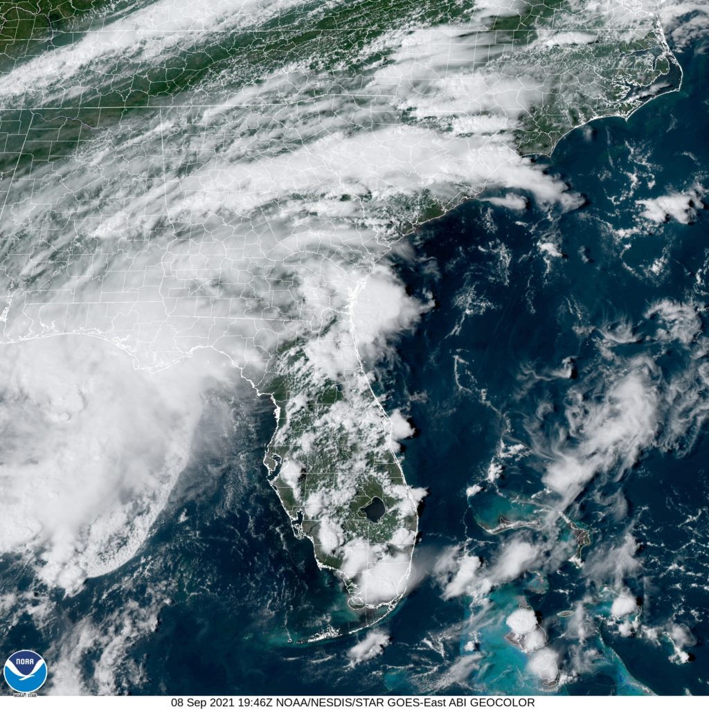
At 353PM, ET, Tampa was reporting a temperature of 93 degrees with mostly sunny skies. The interaction of three primary features will dictate the weather through the end of the work week in Tampa: Hurricane Larry in the north Atlantic, surface feature southwest of Tallahassee, and low pressure in eastern Canada. At this time Larry and the tropical low are helping steer much moisture away from Tampa, and south Florida is fairly clear this afternoon, aside from patchy clouds near the coasts. Larry and the low in the Gulf will interact with the Canadian feature, which is presently dangling a cold front through the southeastern US. The boundary will tap into the moisture of the low, and increase the thunderstorm threat tomorrow in Tampa. Larry will stall the boundary over the Atlantic, and turn to be subsumed by the Canadian Low. This will cause the boundary to stall across Florida, but will also interrupt the length of the boundary. Forward momentum and shear will be lost, but some scattered showers and storms will still be able to tap into the sea breeze and local moisture on Friday. Tomorrow – Scattered thunderstorms, High 89, Low 78 Friday – Isolated storms, High 89, Low 78
TWC: Tomorrow – Showers early, becoming a steady rain later in the day. High 86, Low 78 Friday – Mixed clouds and sun with scattered thunderstorms. High 88, Low 77
AW: Tomorrow – Intervals of clouds and sunshine with a thunderstorm; breezy High 87, Low 78 Friday – Widely separated morning thunderstorms; otherwise, mostly cloudy High 89, Low 77
NWS: Tomorrow – Scattered showers and thunderstorms. Mostly sunny High 88, Low 78 Friday – Scattered showers and thunderstorms. Mostly sunny High 89, Low 77
WB: Tomorrow – Partly cloudy with scattered showers and thunderstorms, High 86, Low 78 Friday – Partly cloudy with scattered showers and thunderstorms High 88, Low 77
WN: Tomorrow – Partly cloudy with scattered storms, High 86, Low 76 Friday – Partly cloudy with scattered showers, High 89, Low 76
FIO: Tomorrow – Humid and partly cloudy throughout the day. High 87, Low 77 Friday – Humid and mostly cloudy throughout the day. High 89, Low 77
I think a lot o these forecasts are too cool for tomorrow. I don’t think it will be as rainy as many suspect, and it hit the 90s today. We shall see. Here is the local satellite, with low pressure in the northeast Gulf, and clouds ringing the peninsula.
Central California was in the midst of a hot streak over Labor Day weekend, and Madera was no exception. My general rule of thumb for the heat, and with sunny skies is to always bet on the over. That is to say, it will probably be a little warmer than the forecast. Also, in clear dry nights, the temperature bottoms out a bit lower than the forecast. By following those two rules of thumb, Victoria-Weather was able to collect the victory in central California. Actuals: Sunday – High 100, Low 55 Monday – High 103, Low 61
Hey gang! Happy Labor Day, I hope you are enjoying this last breath of summer. Of course, it goes along with the first real weekend of college football, so one foot in the summer, one in the fall, and I think Gainesville is a good nexus for that. Warmth and college football.
At 1253AM, ET, Gainesville was reporting clear skies and a temperature of 75 degrees. Generally pleasant conditions were in place across the Sunshine state, with a few spots of clouds. Morning haze is probably on the horizon, given the typically high dew points and the clear overnight conditions. Low pressure was present in the Gulf of Mexico, but it doesn’t pose a likely tropical threat. Flow, however, was derived in part from the low in the Gulf, and was associated with via a long range of baroclinicity, with a system in Canadian Maritimes. The southwest to northeast flow is going to be a fixture over north Florida for the week. The threat for showers and thunderstorms will increase later in the week, but some pop up afternoon storms will be possible on Monday and Tuesday as well. Tomorrow – Mostly sunny, with isolated thunderstorms, High 92, Low 72 Tuesday – Scattered showers with thunderstorms, High 91, Low 72
TWC: Tomorrow – Except for a few afternoon clouds, mainly sunny. A stray shower or thunderstorm is possible. High 89, Low 71 Tuesday – Partial cloudiness early, with scattered showers and thunderstorms in the afternoon. High 90, Low 72
AW: Tomorrow – Periods of clouds and sunshine High 88, Low 71 Tuesday – Sun and some clouds with a thunderstorm in a couple of spots in the afternoon High 88, Low 72
NWS: Tomorrow – A 20 percent chance of showers and thunderstorms after 2pm. Mostly sunny, High 91, Low 69 Tuesday – A 50 percent chance of showers and thunderstorms after 2pm. Patchy fog between 7am and 8am. Otherwise, sunny, High 90, Low 72
WB: Tomorrow – Patchy fog in the morning. Partly cloudy with a chance of showers and a slight chance of thunderstorms, High 88, Low 72 Tuesday – Sunny in the morning then partly cloudy with a 50 percent chance of showers and thunderstorms in the afternoon. High 88, Low 73
WN: Tomorrow – Partly cloudy with isolated thunderstorms, High 90, Low 70 Tuesday – Partly cloudy with isolated thunderstorms, High 90, Low 72
FIO: Tomorrow – Humid and partly cloudy throughout the day. High 89, Low 72 Tuesday – Possible light rain in the evening. High 87, Low 73
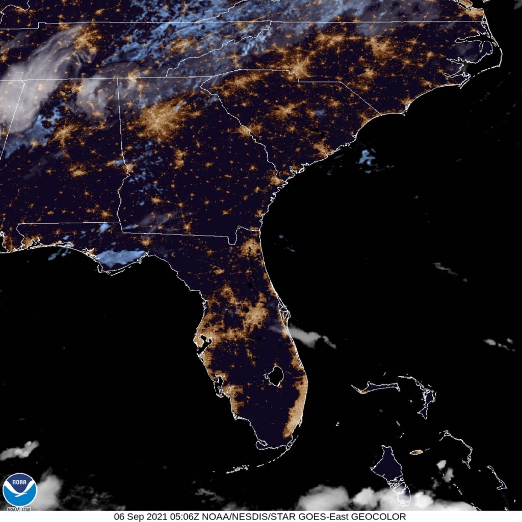
All of us are dancing around the same numbers. I am going warmer this afternoon, but others don’t believe the guidance like me. Anywho, here is the satellite imagery for this evening across Florida. Not much that far south.
While for many, it has been a long, hot summer, it’s actually been a bit truncated and cooler than normal in the southeastern United States. The remnants of Ida caused terrible destruction in the Northeast, all while trailing a cold front that developed as the storm became extra tropical, which tailed through north Florida as we forecast for Hinesville on Wednesday. As the work week concluded, Hinesville was able to enjoy some mild temperatures, along with the sunshine. It’s not often they get to see those two in concert, particularly in the summer. Also rare was Forecast.io’s solo victory. Actuals: Thursday – High 90, Low 73 Friday – High 86, Low 67
Hurricane Ida made her landfall at the end of August, and continued to the eastern Seaboard to provide devastating rainfall and flash flooding before she expired at the beginning of September. Ida was an extraordinary storm, both for the strength at landfall, (and the forecast accuracy as it arrived, which definitely saved lives) and the flash flooding rains, which led to the second flash flood emergencies ever issued by the New York City office of the National Weather Service — the first was earlier in the month with Henri. It exposed the poor infrastructure of the region, which is ill equipped for torrential rains. which will only become more likely as we head into the future.
We had a lot of forecasts in the month of August, and some were impacted by the broad scope of Ida. Otherwise, heat and a break to some drought issues in the upper Midwest were the theme for the months. The Weather Channel concluded the month of August with the victory, followed closely by Weatherbug, a tandem that owns a tie at the top so far in 2021.