When we put together our forecast for Syracuse a couple weeks back, I noted that I wasn’t buying into severe weather in the Syracuse area for the 7th and 8th. Truly, the severe weather did avoid Syracuse proper, though it was dicey in the Finger Lakes. Any good emergency response personnel will also tell you that flash flooding is severe weather too, and Syracuse got over three inches of rain during the two games of the forecast period, surely enough to cause significant problems around town. The Weather Channel was substantially better than the rest of this forecast, thanks in large part to a warm forecast on the 7th. Actuals: August 7th, 2.46″ of rain, High 87, Low 66 August 8th, .8″ of rain, High 71, Low 66
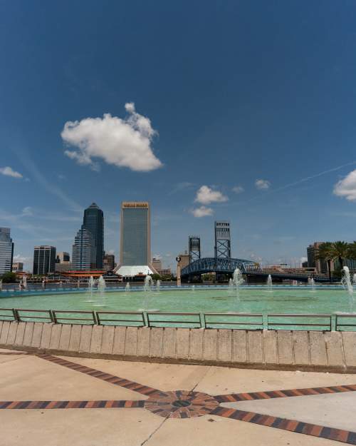
Let’s take a trip northeastward to western New York. Syracuse is a home to a journalism shool, so this is definitely not the first time the town has been written about.
At 854PM, ET, Syracuse was reporting a temperature of 73 degree with cloudy skies. An area of low pressure over the Great Lakes was driving a field of rain north, approaching Syracuse, presently southwest of a line from Batavia to Watkins Glen. The weak jet parenting this area of low pressure is going to steer the low laconically to the northeast. The heaviest shower and thunderstorm activity reaches only as far north as southern Illinois, and is not expected to press further to the north. Scattered showers will remain in the forecast for each of the next two days as the low pressure meanders through the region. AS the system continues to occlude, the precipitation will become lighter, but move more slowly. Expect things to finally start drying out Tuesday in the late afternoon, but clouds are expected to linger. Tomorrow – Scattered showers, High 81, Low 67 Tuesday – Light rain in the morning, becoming clearer, High 75, Low 67
TWC: Tomorrow – Scattered thunderstorms in the morning becoming more widespread in the afternoon. High 84, Low 68 Tuesday – Rain showers in the morning will evolve into a more steady rain in the afternoon. High 71, Low 66
AW: Tomorrow – Mostly cloudy and breezy; occasional morning rain and a thunderstorm followed by a thunderstorm in the afternoon High 82, Low 67 Tuesday – Windy with periods of rain and a thunderstorm High 73, Low 65
NWS: Tomorrow – Showers likely, with thunderstorms also possible after 4pm. Mostly cloud High 84. Low 67 Tuesday – Showers likely, then showers and possibly a thunderstorm after 11am. High 77, Low 65
WB: Tomorrow – Showers likely. Thunderstorms likely in the afternoon. Some thunderstorms may produce gusty winds with small hail, frequent lightning and heavy rain fall in the afternoon. High 79, Kiw 66 Tuesday- Showers. High 69, Low 63
WN: Tomorrow – Mostly cloudy with showers, High 84, Low 67 Tuesday – Mostly cloudy with scattered showers, High 77, Low 67
CLI: Tomorrow – Light Rain showers, High 82, Low 66 Tuesday – Drizzle, High 75, Low 68
I[‘m inclined to agree with Clime on this one. I don’t see much in the threat for thunderstorms given the occlusion and position of the area of low pressure. Here is the radar, with rain on the doorstep.
I-95 is a busy stretch of road in the Mid-Atlantic, but we will spend a lot of time on this famous freeway south of Washington, where it successfully avoids a lot of the busiest spots. It will take two days to get from Jacksonville to Syracuse, and will cover 1071 miles. The pace of the drive will be 67.2mph, and we will make it about half way by the time the first day ends. One day mostly on I-95, one day mostly not.
DAY ONE (Friday)
Jacksonville, Florida
It’s going to be a rough day in Jacksonville, and indeed along the East Coast today as the system that has wrought havoc on the lower Mississippi Valley and surrounding environs continues to march towards the Atlantic. Areas west of Jacksonville are presently under a tornado watch, and a slight risk of severe weather extends all the way north through Virginia. Essentially, our route for day one. But we are leaving tomorrow, and the boundary will already have passed by, leaving a post-storm tranquility to the area. Dry, calm, potentially well trafficked conditions will proceed as we head through Georgia and the Carolinas to Emporia, Virginia, tucked away west of Norfolk.
DAY TWO (Saturday) It will be chilly in Emporia when we arrive Friday night, but it is far enough south that we will duck any of the late storm flurries that will be persistent in Pennsylvania and New York on Friday. A little bubble of high pressure will emerge over the mid-Atlantic to start the weekend, but clouds associated with this feature have been stubborn. Don’t be entirely surprised if it stays cloudy and cool, especially north of Washington, and then through the remainder of the route to Syracuse.
Today we embark on a 5-day, cross-country road trip that’ll cover 2,337 miles. That’s a lot of snacks we need to stock up on! Let’s get a move-on, not a moment to waste!
DAY ONE
An area of low pressure is shifting through far southern Quebec/New England, with a cold front trailing through NY/PA back to the OH Valley. There might be an isolated rain shower lingering in the Syracuse area at dawn, but most of this activity should be off to the northeast of the city as we depart on our westward journey. The day should be dry but cloudy to start, then clouds clear out as we pass Buffalo and follow the shores of Lake Erie to Cleveland. From there we turn southward and end our rather uneventful start to the trip in Columbus.
DAY TWO
An area of low pressure looks to shift into the OH Valley to start the day, bringing some rain shower activity to the Columbus area as we head westward. Conditions improve a bit as we make it to Indianapolis, but a second round of showers is possible as we move through IL towards St. Louis as the tail end of a cold front works in from the north. Heavier stuff should remain off to the south as another area of low pressure lifts northeastward from the Lower MS River Valley, but keep an eye out on some shower activity as we pass St. Louis and finish the day in Rolla, MO.
DAY THREE
A fairly quiet day is expected today as our leg is between systems. Some clouds may increase during the afternoon hours as we head out of southwestern MO past Joplin. Southwerly winds are expected to increase as low pressure begins to intensify in the foothills of CO/WY, but conditions will remain dry as we finish our relatively short day in Oklahoma City.
DAY FOUR
Low pressure speeds off to the north of our route today as it moves through NE to IL, while the tail end of a cold front sags into OK. Cloudy skies and perhaps a shower or two will greet our morning as we start heading towards Oklahoma City, but nothing particularly heavy is expected. Cloudy skies continue as we pass Amarillo but late afternoon/evening storms look to stay north of I-40 as we press onwards into New Mexico. Our day ends in Vaughn, NM.
DAY FIVE
A dry day is in store as we finish our lengthy trip. While low pressure gets situated over the Four Corners region, precip should stay well off to the north over central UT/CO. Gusty winds, particularly in mountain passes, could make for some interesting sections as we head west out of Las Cruces along I-10, but shouldn’t be too bad as we finally make it to Tucson!