It was very foggy the last two mornings in Rocky Mount. Tuesday, the sky didn’t clear until nearly 11, but on Wednesday, it cleared a bit earlier. All this led to a warmer afternoon high, and the all important Vitamin D infusion. There was no rain, despite a little bit of moisture flowing in, all of which brought about the morning fog. Accuweather had rain in the forecast, and despite this, the temperature forecast was good enough to give them the victory. Actuals: Tuesday, High 79, Low 51 Wednesday, High 82, Low 53
Our road trip tonight takes us in a route that we normally wouldn’t for this trip, because of road closures still left by hurricane Helene. As it stands, this will be a two day adventure across the Appalachians and to the southern Plains, covering 1218 miles. This mountainous sojourn will be at a pace of 68.2mph, which is pretty quick, actually. The first day will end after 545 miles, which is a mighty bit of driving.
DAY ONE (Tuesday)
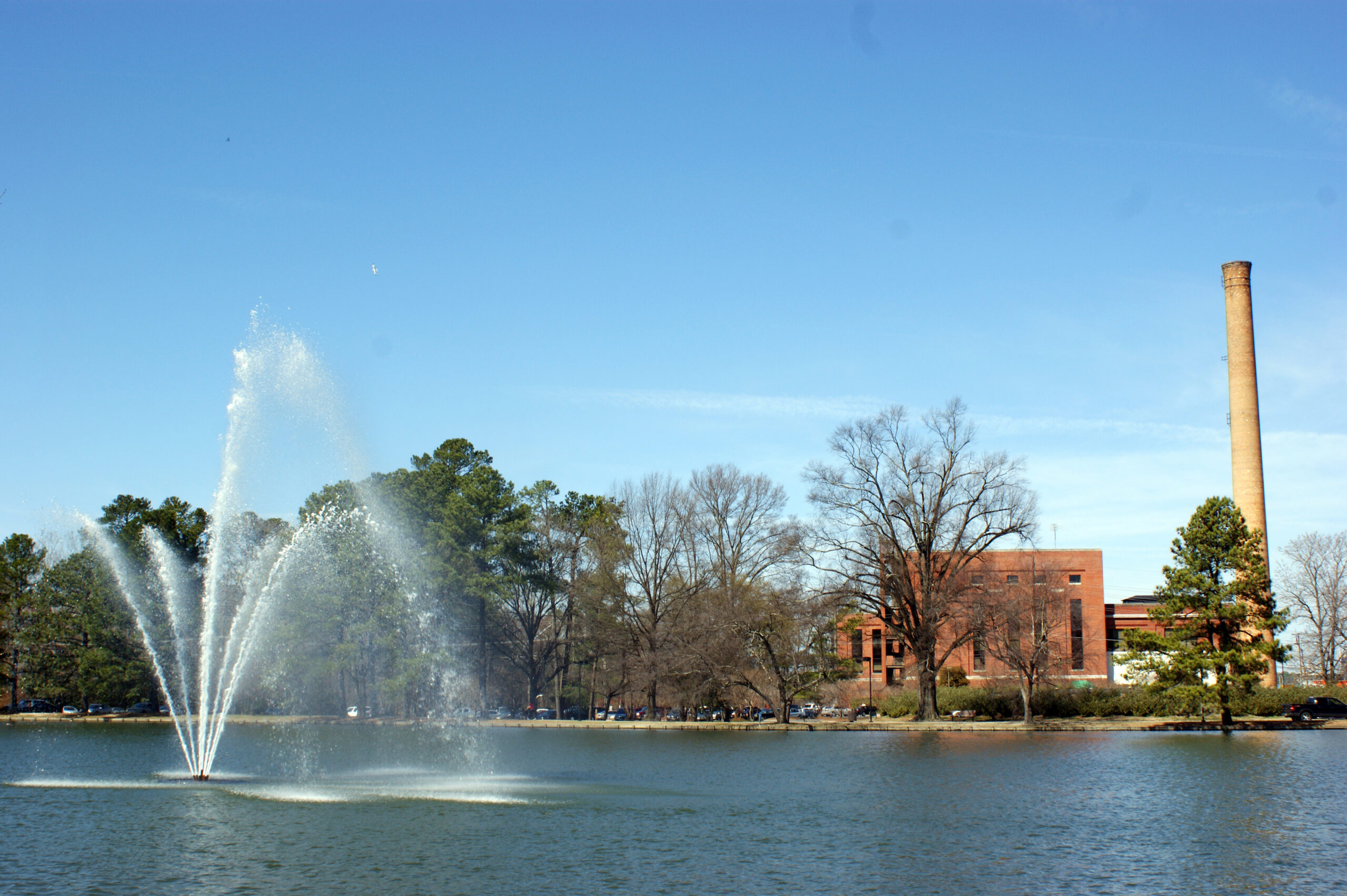
Rocky Mount, North Carolina By Harris Walker – https://www.flickr.com/photos/harriswalkerphotography/3342646285/in/album-72157615074534836/, CC BY 2.0, https://commons.wikimedia.org/w/index.php?curid=61707633
Our drive out of North Carolina will have to swing north because of road closures, and we will snake through Virginia. As we make our way through the southwestern part of the shape, the moist onshore flow wrapping around a ridge of high pressure will lead to at least some low clouds, but potentially some fog and mist, particularly from Hillsville to Wytheville. Eastern Tennessee will give us a bit of clear air in which to enjoy the sights. We will reach Lebanon, just before Nashville, and await a line of showers and thunderstorms that will dampen Lebanon as we sleep.
DAY TWO (Wednesday) Or will it? Instead of moving into Lebanon, Rafael’s presence in the Gulf will stall the front and allow it to wither. We will pass through a few showers between about Jackson, Tennessee and Little Rock, which may make passing through Memphis a bit of a headache, but we will see some clear skies in the Ozarks. We’ll trek into eastern Oklahoma with cooler temperatures and clearer skies than Tulsa has seen lately.
We keep tearing through forecasts in election swing states, Georgia, Wisconsin, Arizona and now North Carolina. It’s not intentional, but it’s certainly quite the coincidence.
At 553PM, ET, Rocky Mount was reporting a temperature of 66 degrees with fair skies. High pressure over the eastern seaboard was finally starting to be shoved off shore by a deep trough in the plains. Flow at the southwestern end of the ridge is bringing onshore flow, including a few clouds and light showers over South Carolina and Georgia. Overnight tonight, the flow will moderate, and Rocky Mount will stay dry overnight. The NHC is monitoring Tropical Storm Rafael, which is still south of Jamaica, but will move into the Gulf of Mexico through the forecast period. It isn’t going to be a significant landfalling event for the United States, however the moisture from the storm will be intercepted by the strong boundary moving through the Plains, blunting it’s progress and keeping the Carolinas dry through Wednesday. Tomorrow – Mostly cloudy, High 78, Low 52 Wednesday – Increasing clouds, High 78, Low 55
TWC: Tomorrow – Areas of fog early, then partly cloudy in the afternoon. Very warm. High 79, Low 52 Wednesday – Cloudy. Very warm. High 81, Low 56
AW: Tomorrow – Areas of morning fog; otherwise, very warm with sunshine and a few clouds; dry weather to get out and vote High 80, Low 52 Wednesday – Very warm with periods of clouds and sunshine; a shower in places in the afternoon High 82, Low 54
NWS: Tomorrow – Patchy dense fog before 10am. Otherwise, mostly sunny, High 79, Low 50 Wednesday – Partly sunny, High 80, Low 59
WB: Tomorrow – Mostly cloudy in the morning, then clearing. Patchy dense fog in the morning with visibility one quarter mile or less at times, High 80, Low 54 Wednesday – Mostly cloudy, High 79, Low 57
WN: Tomorrow – Mostly cloudy, High 78, Low 56 Wednesday – Partly cloudy with light rain showers, High 79, Low 61
CLI: Tomorrow – Partly cloudy, High 79, Low 52 Wednesday – Mostly cloudy, High 81, Low 57
Of our various forecasts of late, this was surely the easiest. Happy voting, and a happy end to election season!
We are traveling cross country this weekend, taking a solid 5 days through the northern US on our trek. It’s a 2,633 mile journey between the two cities in question, which we will do at a pace of 67.5mph. We’ll move quicker in the plains and slower through the mountains (Rockies AND Appalachians). All told, the goal will be 540 miles a day, at least through days 1-4.
DAY ONE (Friday)
Spokane, Washington
What a grimy, miserable pattern that is setting up in the northern US. It’s very busy, and it looks to be that way when we set out on Friday. A cold front will move ashore overnight, and light rain with valley fog will dot the northern Rockies through Idaho and about as far as Frenchtown, Montana, which is west of Missoula. If that wasn’t frustrating enough, the massive complex bringing severe storms to the Upper Midwest will rotate moisture and instability from the northeast — the northeast! — which will press up against the Front Range in Montana, bringing isolated showers and storms to a typically drier stretch of Big Sky Country. Isolated storms are possible, and overcast is likely from Missoula, through Butte and Bozeman and indeed on to Billings, where we will reside for the night. There is a silver lining, I guess, finding a large town to stop in for the night in Montana!
DAY TWO (Saturday) OK, so there is some good news. The low in the north central US is lifting almost due north, which is allowing some more settled weather to develop in the middle of the country. This will leave a pretty good day of driving as we finish the drive in Montana, cut across Wyoming and finally enter South Dakota. We’ll navigate our way to Kimball, in the middle of the state, and call it a day.
DAY THREE (Sunday) The good fortune will continue on Sunday, as winds will turn west-northwesterly behind an emerging cold front in the eastern Great Lakes. The big system, now in Canada, will start hustling off to the east, towards Hudson Bay by Sunday morning. A weak little trough will develop in the wake of the front, and could set off some very vague showers and storms in southeastern Minnesota and western Wisconsin by the late afternoon, but I would expect dry conditions in the Madison area as we end our weekend.
DAY FOUR (Monday) That little post frontal trough is expected to move it about our pace on Saturday. Fortunately, it won’t really get active at any point during the day, but particularly early on as we try to get through Milwaukee and Chicago. Clouds and little bit of light rain will become increasingly likely late in the day as we bound through southern Ohio. We’ll make it to Jackson, which arrives just before the Ohio River and a border with West Virginia.
DAY FIVE (Tuesday) All this worrying, and it looks like it won’t shake out too badly. Precipitation will be well off shore by the time we traverse Appalachia and settle into the Carolina Plain. Off shore breezes will even work to scour out the threat of morning fog that tends not to stay confined to the AM. Of course, it looks active again in the High Plains as we arrive in Rocky Mount, but maybe that is why we went to North Carolina instead of there?
Rocky Mount, North Carolina By Harris Walker – https://www.flickr.com/photos/harriswalkerphotography/3342646285/in/album-72157615074534836/, CC BY 2.0, https://commons.wikimedia.org/w/index.php?curid=61707633
Rocky Mount is on the opposite side of the country from our stops so far this week, and frankly, on the opposite side of North Carolina as where I might have expected.
At 1053AM, ET, Rocky Mount was reporting clear skies and a temperature of 65 degrees. A brisk north wind was helping to keep temperatures from sky rocketing in the clear May conditions. A strengthening ridge over the eastern half of the country promised good conditions for the coast, however a cut off low off the coast was producing off shore rain, and the northerly winds seen in Rocky Mount. The offshore low is going to sink to the south-southwest, following the coast and weakening as upper level support erodes. As the upper trough breaks down, the surface circulation and moisture will retrograde into the Carolina Plains. Expect increasing clouds overnight with haze and fog for the morning tomorrow. The increasing low layer moisture will ultimately lead to scattered showers in the evening and throughout much of the day on Friday. Tomorrow – Cloudy with chances for morning fog and light rain in the PM, high 70, Low 56 Friday – Cloudy, scattered showers, High 76, Low 61
TWC: Tomorrow – A few showers early with overcast skies later in the day. high 68, Low 56 Friday – Scattered thunderstorms in the morning becoming more widespread in the afternoon High 76, Low 59
AW: Tomorrow – Mostly cloudy with a shower in the area, mainly later High 66, low 58 Friday – Cloudy, humid and warmer with showers and thunderstorms High 75, low 60
NWS: Tomorrow – A chance of rain, mainly before 10am, then a slight chance of showers after 1pm. High 69, Low 28 Friday – Showers likely, then showers and possibly a thunderstorm after 2pm.High 75, Low 60
WB: Tomorrow – Cloudy. A chance of showers in the afternoon. high 66, Low 58 Friday – Showers likely in the morning, then showers with a chance of thunderstorms in the afternoon, High 75, Low 60
WN: Tomorrow – Cloudy with chance of light rain, High 70, Low 53 Friday – Cloudy with showers and chance of thunderstorms, High 76, low 56
FIO: Tomorrow – Rain until morning, starting again in the evening. High 67, Low 56 Friday – Rain throughout the day. High 75, low 59
Nothing is on shore yet. The north wind cutting out will help with the temperatures on Friday, even if clouds and rain are overhead.