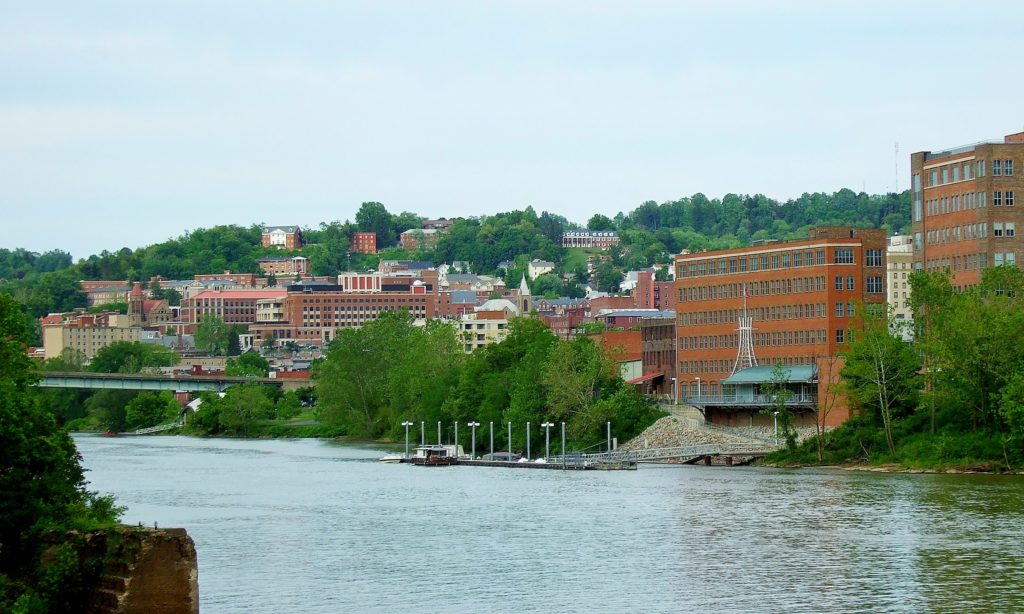
Today we embark on a 2-day, 677-mile trek through the Appalachians to the Deep South. We could probably get this one in one very long day, but we’re gonna take our time and enjoy some scenery!
DAY ONE
High pressure is found over the OH and TN Valleys, keeping much of the region dry into the Central and Southern Appalachians. A sunny day is expected as we head south out of Morgantown through WV and through western Virginia. Continued pleasant but hot conditions are anticipated for the rest of the day as we end this leg in Knoxville.
DAY TWO
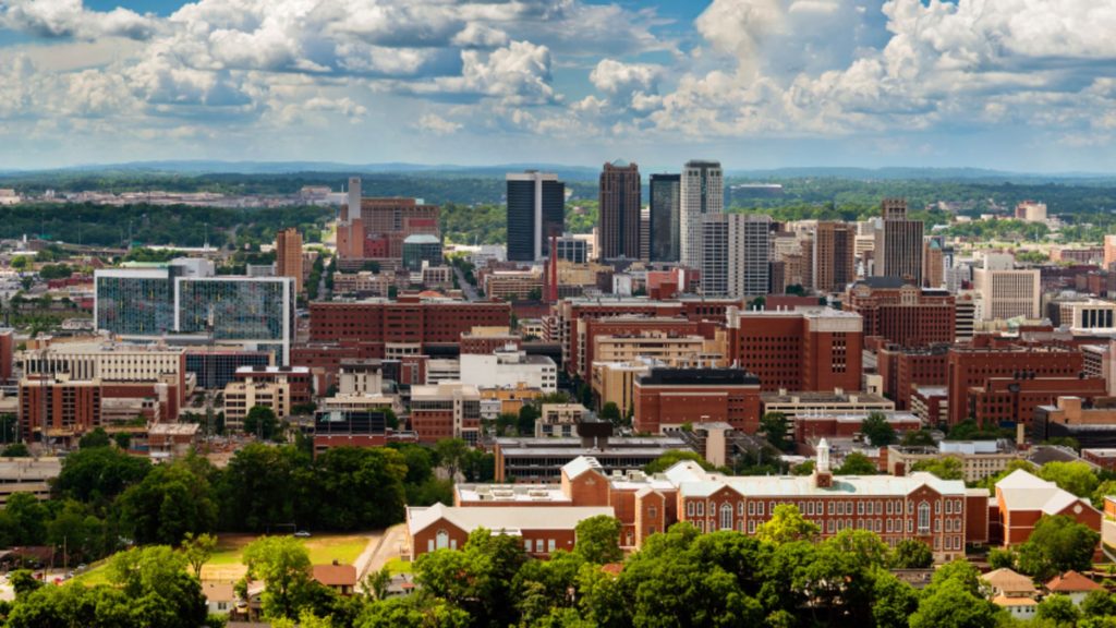
As high pressure continues to control the region, more sunny skies and dry conditions are expected for the rest of the trip. Temperatures are expected to hit the triple digits as we head past Chattanooga into Alabama and eventually into Birmingham, but at least the trip will be dry!
As we head into the latter part of the workweek, lets head off to Appalachia and see what Morgantown is up to the next couple of days!
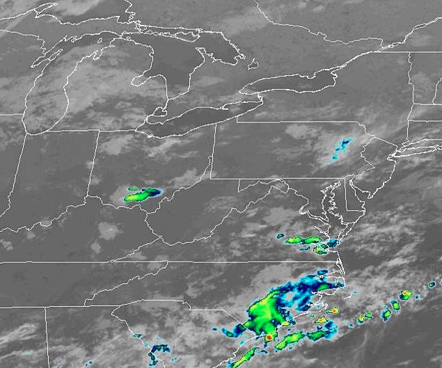
At 1153pm EDT, the temperature at Morgantown, WV was 70 degrees under fair skies. A weak area of low pressure is traversing the OH Valley region and looks to be the instigator of some afternoon thunderstorm activity. Nothing particularly severe is anticipated, just some good ol’ fashioned summertime thunderstorms. Activity should dwindle down late evening as the system pushes off to the east. Friday looks to be on the dry side with perhaps some isolated shower activity staying up in the mountains to the east.
Thursday: Increasing clouds in afternoon, scattered thunderstorms possible. High 84, Low 64.
Friday: Decreasing clouds in afternoon. High 84, Low 66.
TWC: Thursday: Afternoon thunderstorms. High 85, Low 64.
Friday: Partly cloudy. High 84, Low 64.
AW: Thursday: A strong afternoon thunderstorm. High 85, Low 66.
Friday: Periods of sun. High 86, Low 67.
NWS: Thursday: Scattered afternoon showers and thunderstorms. High 86, Low 65.
Friday: Isolated early morning shower, otherwise mostly sunny. High 87, Low 65.
WB: Thursday: Chance of thunderstorms. High 83, Low 64.
Friday: Partly cloudy. High 84, Low 65.
WN: Thursday: Partly cloudy with scattered showers. High 86, Low 65.
Friday: Partly cloudy. High 87, Low 65.
FIO: Thursday: Partly cloudy, few showers. High 86, Low 62.
Friday: Partly cloudy throughout the day. High 87, Low 66.
Quiet conditions are found around Morgantown this evening, with some shower activity found over southern OH. We can expected some more activity tomorrow but then taper down for the weekend.
See, we’re definitely back! Now we even have the alliterative verification titles and everything. This is certainly a fitting one for Morgantown, where temperatures reached a balmy 65 degrees yesterday, and without any of the rain that had been a potential. The springtime warmth comforted The Weather Channel, especially, as they claimed victory. Actuals: Wednesday – High 60, Low 23 Thursday – High 65, low 39
Hi! Morgantown is the home of the University of West Virginia, but is actually way closer to Pittsburgh than any of the other population centers of West Virginia. Does that influence the weather in any way? Almost certainly not!
At 1253PM, Morgantown was reporting clear skies and a temperature of 39 degrees. Dry air was pushing into the area as a strong ridge of high pressure was settling into the Great Lakes. There was still a tumultuous pattern at the upper levels, but it was not reflected at the surface. The machinations at the very top of the continent will ultimately bear watching for most of the northern part of the country. An area of low pressure developing in the Northwest Territories, headed into Nunavut will dangle a cold front into the Great Lakes through midweek, headed towards the Appalachians for the end of the week. It will be motivated by a surprisingly strident batch of cold air, though most of the local moisture will come from the Lakes. All this is to say the boundary, despite the cold air, will be slow moving and not terribly rainy. Morgantown should be in the clear until Friday. Tomorrow – Sunny, High 55, Low 25 Thursday – Increasing clouds, but warmer, High 67, low 41
TWC: Tomorrow – Partly cloudy skies. High 57, Low 26 Thursday – Mainly cloudy. High 64, Low 39
AW: Tomorrow – Plenty of sun; milder High 58, Low 27 Thursday – Partly sunny; breezy, mild High 67, Low 38
NWS: Tomorrow – Sunny, High 56, low 27 Thursday – A slight chance of showers after 2pm. Mostly sunny, High 66, Low 36
WB: Tomorrow – Sunny, High 55, Low 27 Thursday – Partly cloudy, A slight chance of showers in the afternoon, high 64, Low 39
WN: Tomorrow – Mostly sunny, High 57, Low 27 Thursday – Partly cloudy with isolated showers, High 66, Low 36
FIO: Tomorrow – Partly cloudy starting in the morning, continuing until afternoon.High 59, Low 30 Thursday – Mostly cloudy starting in the morning. High 65, Low 41
Even if it does rain, that’s a pretty great forecast. Tranquil today.