On back to back verifications, we’ve had forecasts that overestimated forecast highs. Because of wind off San Pablo Bay, Napa was colder than forecasts expected earlier this week, and now in Johnstown, the forecast highs were also on the lower side. This time thanks to topography and clouds that settled into the valleys surrounding the Alleghenies. The difference between Johnstown and Napa is that two outlets embraced this possibility. Weatherbug took another victory, but Victoria-Weather wasn’t far behind. Actuals: Friday, High 66, Low 52 Saturday – Rain reported, not measured, High 66, Low 54
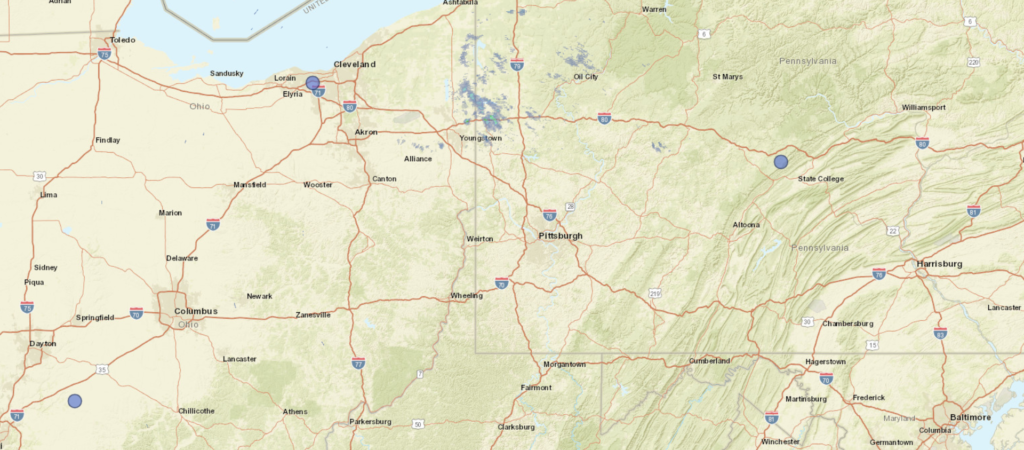
Cross country road tripping is the name of the game today, as we start on a 5 day journey. It is a 2,607 mile voyage which we will cover at a pace of 68.6mph, which is indicative of all the freeway time we are spending. That means a 549 mile a day pace for days 1-4, with a shorter drive to finish things off thanks to our blistering pace.
DAY ONE (Friday)
Napa, California
Low pressure over the Gulf of Alaska is pretty much just hanging out in place, and a cold front is becoming mostly stationary in the Pacific Northwest. This is all good news for people chugging along I-80, as we will be on Friday. It will make it hard to leave Napa, though, but driving through Sacramento and Reno will be a bit easier. Our drive will take us to Death Star Valley. Ope, sorry, Star Wars fan. That should be the Deeth/Starr Valley exit in northeastern Nevada.
DAY TWO (Saturday) The drive through the west will take its typical winding path through Salt Lake City then continue on into Wyoming. There isn’t a lot going on… BUT WAIT! There is a hint that the monsoon might be getting organized by this weekend. If that happens, there is an extremely remote chance at an isolated storm popping up over south central Wyoming by the end of the day. We’ll end the day at Cooper Cove, north of Laramie for our Saturday night stop.
DAY THREE (Sunday) Lee troughing is going to be fast in developing over central Nebraska, ready to turn towards the Upper Midwest, but it won’t tap into much moisture until it is closer to the Great Lakes. Surface high pressure will be in rapid pursuit, with some convergence and resultant thunderstorms over the Panhandle late in the day. We will already be in Ashland, about 30 miles before Omaha, when the day is through.
DAY FOUR (Monday) The next big storm is going to be brewing in the northern High Plains by the beginning of next week. A warm front may be expressed with a few spotty showers from Omaha to Cedar Rapids, but it certainly won’t be a cumbersome delay or terribly heavy precipitation. Dry air — well, rain free air — will be the name of the game for the rest of the drive to the Granger/Mishawaka area on the east side of South Bend, Indiana. It’s going to be hot and humid, so finding a place with a pool, or at least functioning air conditioning, will be a priority.
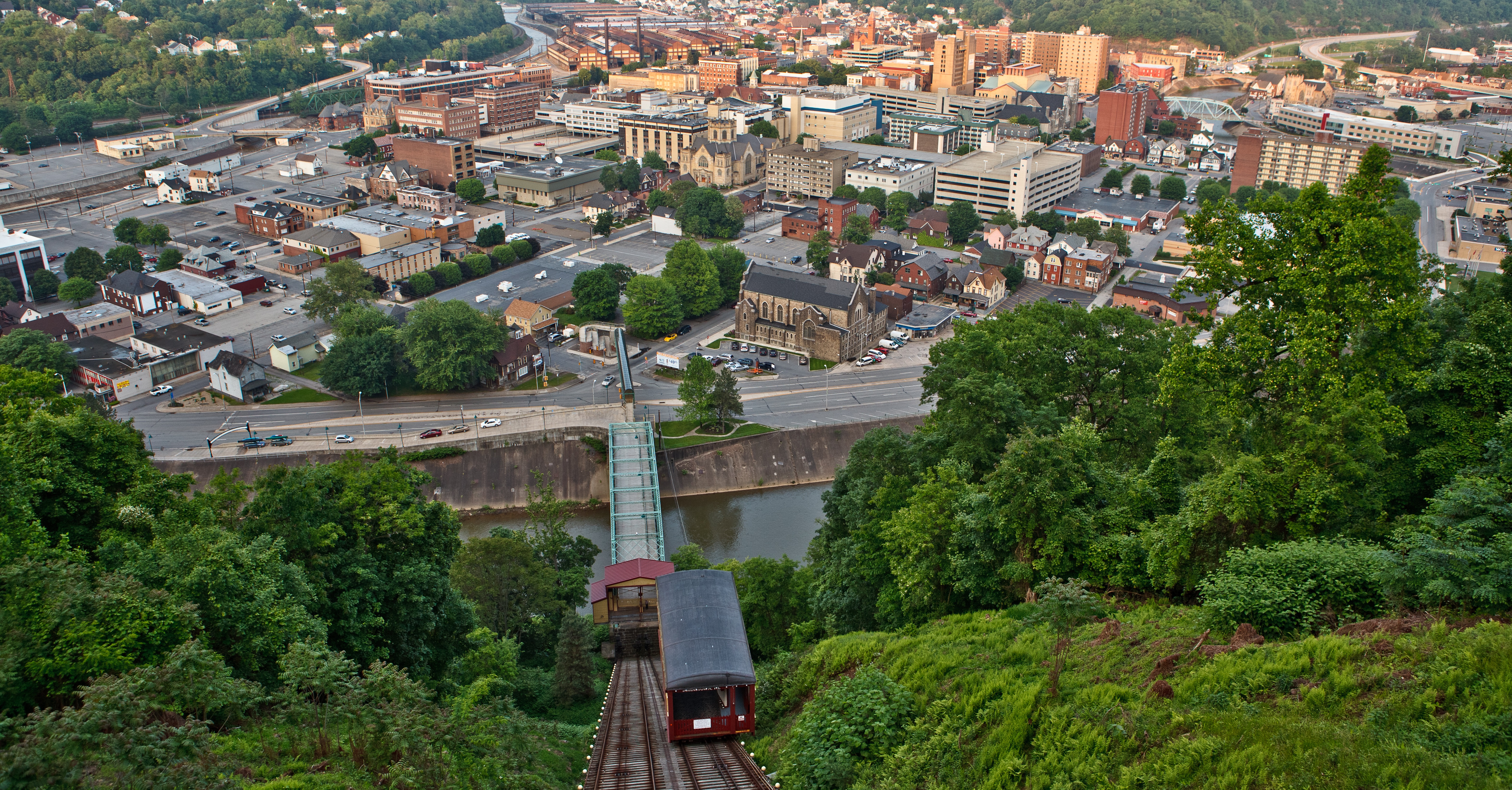
DAY FIVE (Tuesday) Expect to finish strong, especially through Ohio, where it should be mostly cloudless. There will be a line pretty near the border with Pennsylvania where clouds will become more likely. Pittsburgh and Johnstown look to be in a bit of a damming situation, which means temperatures are going to be noticeably cooler than those that we will arrive from.
I feel like it’s been a while since we swung through the Mid-Atlantic, and I don’t think Johnstown is a town I’ve forecast for in the past, or at least recently. Very exciting!
At 949AM, ET, Johnstown was reporting a temperature of 55 degrees with light rain showers. There were only a few showers leftover from a stormy overnight, which brought hail south of down through the night. The lingering area of low pressure is presently centered over western Pennsylvania, but is expected to shift to the northeast. Even as the low transitions northeast through New England, overcast and light rain are possible in Johnstown. As Friday arrives and the low shifts into the Canadian Maritimes, real clearing is expected to take hold. Expect a pleasant end to the work week. The next impulse rippling along the jet stream is going to find a supportive environment for development in the southeastern US. Don’t expect much precipitation to come out of it in Pennsylvania, but the northerly flow off the Lakes rushing towards low pressure in the Carolinas will lead to an environment conducive to mid to low overcast and a few shots of drizzle. All told, Saturday looks to be a hair on the cool side. Tomorrow – Partly cloudy, High 72, Low 54 Saturday – Mostly cloudy with some light afternoon showers possible, High 65, Low 55
TWC: Tomorrow – Intervals of clouds and sunshine High 73, Low 54 Saturday – Considerable cloudiness with occasional rain showers. High 69, Low 55
AW: Tomorrow – Some sun, then turning cloudy and warmer High 72, Low 52 Saturday – Mostly cloudy with a shower in the afternoon High 72, Low 55
NWS: Tomorrow – Sunny (late rain), High 79, Low 55 Saturday – Rain, mainly between 8am and 2pm, then a chance of showers and thunderstorms after 2pm High 71, Low 59
WB: Tomorrow – Mostly sunny (late rain), high 70, Low 53 Saturday – Rain likely, High 66, Low 56
WN: Tomorrow – Partly cloudy, High 72, Low 51 Saturday – Mostly cloudy with light rain and isolated storms, High 71, Low 53
FIO: Tomorrow – Partly cloudy throughout the day. High 74, Low 52 Saturday – Light rain until afternoon. High 68, Low 56
The start of the rain, and the persistence of the overcast to start the weekend are going to tell the tail of this forecast . A look at the current radar doesn’t really show a whole lot at the moment.