I think the southwestern US is fascinating, geographically. It’s so different than where almost everyone in the country lives, especially when you have to pass from one population hub to another. It will take one long day to cover the 703 miles this drive will take. Our pace will be at 68mph, which is perfect for driving through the desert.
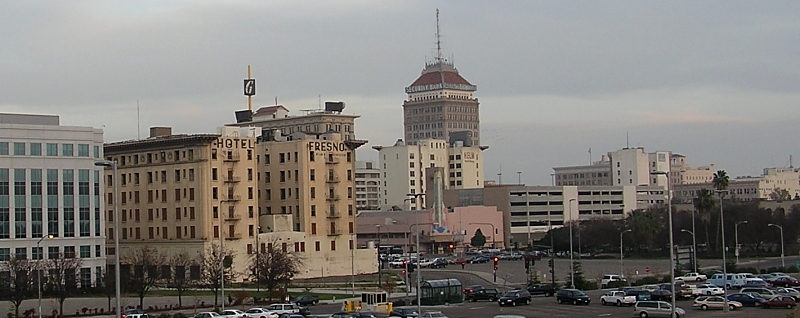
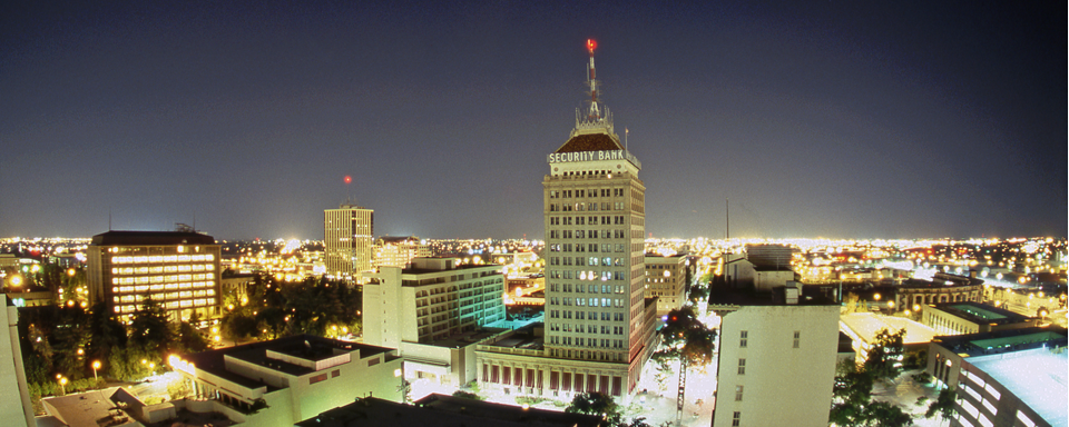
Fresno, California
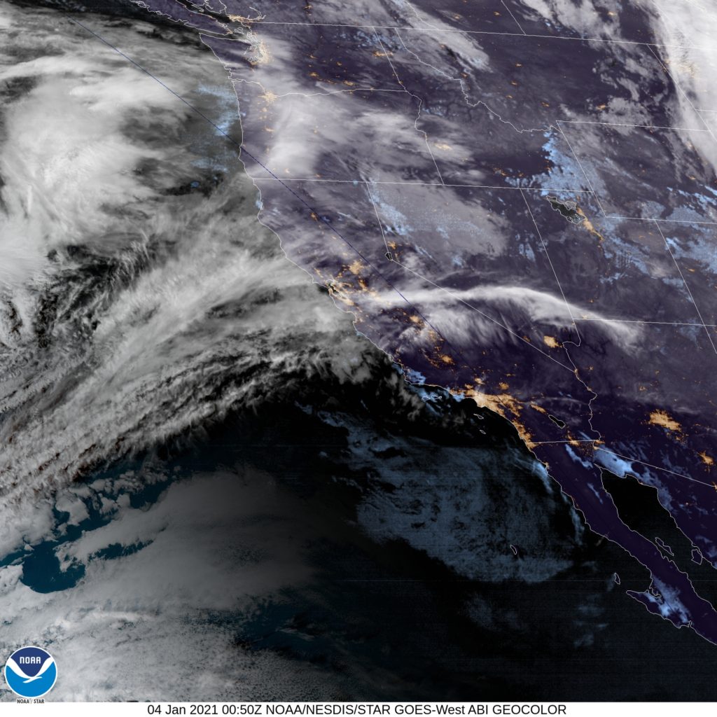
Almost the entire country is sitting within an upper level trough. One part that isn’t is the west coast, where a sharp ridge is working to keep the Gulf of Alaska low at bay. Skies will be mostly sunny through southern California and western Arizona, but not completely clear. Valley fog will take a while to burn off initially, but should be out of the picture by the time we reach Bakersfield. With northerly jet flow particularly strong in the region, expect Arizona to be seasonably cool, if not a bit chillier, with cloudy skies possible, particularly west of Phoenix. Tucson is going to be a nice place to be this time of year, but may be a bit cooler than expected upon our arrival.
All right everyone, it’s time to get in our first 2021 forecast, which will take us to the state of the last forecast of 2020 – California. Let’s go!
At 453PM, PT, Fresno was reporting a temperature of 58 degrees with mostly cloudy skies. A large Gulf of Alaska storm system is looming off the Pacific Coast, ready to move inland, and prefrontal southerly flow ahead of the system has already arrived, bringing additional moisture and the overcast presently in the area. The primary thrust of this system will arrive on in the late morning tomorrow. The system will swiftly move through northern California, and be out of town shortly after nightfall on Monday. Most of the precipitation will be found north of Fresno, and snow will fall in the mountainous terrain due north of town. A bubble of high pressure will trail this ridge, making for a decent enough Tuesday, but with the spectre of more inclement weather on the horizon. Tomorrow – Mostly cloudy with a few shots of rain, High 59, Low 45 Tuesday – Clear and calmer, High 58, Low 41
TWC: Tomorrow – A mix of clouds and sun in the morning followed by cloudy skies during the afternoon. High 63, Low 44 Tuesday – Intervals of clouds and sunshine. High 59, Low 42
AW: Tomorrow – Sun and some clouds High 58, Low 43 Tuesday – Intervals of clouds and sunshine High 58, Low 41
NWS: Tomorrow – A 40 percent chance of showers, mainly after noon. Increasing clouds, High 58, Low 41 Tuesday – Areas of fog before 10am. Otherwise, partly sunny, High 56, Low 42
WB: Tomorrow – Mostly cloudy in the morning then cloudy with a 50 percent chance of showers in the afternoon, High 61, Low 47 Tuesday – Mostly Sunny. Areas of fog in the morning, High 58, Low 45
WN: Tomorrow – Mostly cloudy with scattered showers, High 59, Low 44 Tuesday – Partly cloudy, High 56, Low 41
FIO: Tomorrow – Areas of fog before 10am. Otherwise, partly sunny, High 61, Low 43 Tuesday – Clear throughout the day. High 63, Low 41
Here is a look at a particularly busy West Coast satellite. There are a lot of clouds coming to the California coast tomorrow, but it’s moving fast, given the size of the system.
Just to provide some context for just how big these United States are, we will be staying entirely west of the Mississippi and remain in states that border either the Gulf of Mexico or the nation of Mexico, and we will still be traveling 1,842 miles and taking 3 long days to get where we are going. We’ll even take interstates, so we’ll cover 68mph, and 546 miles per those first two days, and we’ll STILL have a lengthy 11 hour day to finish with.
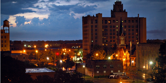
Monroe, Louisiana
DAY ONE (Wednesday) There is a stout ridge of high pressure in the southeastern United States, and most of the precipitation for the next couple of days will be ridge riding on the north side of this dome, meaning very hot, dry and mostly sunny weather in the southeast, including in Louisiana and east Texas. The western edge of this dome will be in west Texas, but we will stop in Childress, before we run into the associated showers and thunderstorms. Hopefully, the AC works in the hotel.
DAY TWO (Thursday) As is the nature of shower activity on the backside of high pressure, it won’t be moving anywhere, but it’s coverage will probably expand through the day on Thursday. Expect some showers and storms through Amarillo, and as we cross into New Mexico, rain will lighten, but persist. In fact we may see rain persist right up to Tijeras, butting up against the foothills of the mountains surrounding Albuquerque. We’ll be in the clear, however, by the time we reach New Mexico’s biggest town, and will drive in sun to Manuelito, just before the Arizona line.
DAY THREE (Friday) High elevation rain showers may encroach the hills east of Manuelito, but that will be the only threat for this long finishing day of our trek. Strong low pressure is going to develop in the Rockies, kicking up a Santa Ana wind that may necessitate a firm grasp of the steering wheel. particularly as the day reaches it’s final stages, and we turn north into the San Joaquin Valley. Fresno will be mild and could be fairly breezy.
We took a look at the central Valley in California early last week, and it was a pretty tough verification. Not, perhaps, in the way you think. Fresno wasn’t going to see much weather, and it’s position on the west coast led the lot of us forecasters to rely heavily on model guidance. As a result, there was a FIVE way tie at top of the leaderboard, and the other two outlets, The Weather Channel and Weatherbug were only a degree behind. The trend was for a cooler Tuesday than models indicated, so the forecasts were consistent, they were consistently too warm. Actuals: Monday High 102, Low 72 Tuesday – High 99, Low 70