December started in quite the dreary manner in the Cascades. It had been foggy in Corvallis when we investigated on the 4th, and the forecast was for the fog to start breaking down a little bit. It did not. Not even a little bit. Victoria-Weather was the least optimistic, but that paid off, because it was pretty gloomy. The forecast wasn’t good for any of our forecasters, and the weather wasn’t good for any of the residents, as it never cleared out to start warming up. Actuals: December 5th, High 36, Low 30 December 6th, High 37, Low 28
It’s a classic cross country trek today, as we voyage from west to east over the course of 5 days. It’s 2813 miles between the two cities, and our pace will be about 67mph. Our 8 hour drives every day (for the first 4 days, anyway) will be about 535.8 miles. It’s December, so let’s hope the weather holds!
DAY ONE (Thursday)
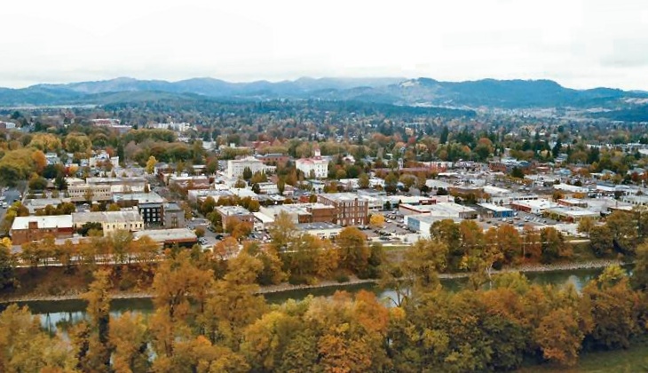
Corvallis, Oregon
Long days are ahead, and we will be losing hours as we had eastward. Day one will see us pass from Pacific to Mountain time, and also from damp to dry conditions. A bundle of energy is moving into the Oregon coast overnight, and some of the light rain and fog is going to linger in the Cascades as we start the day. If we climb high enough, we will probably see some flakes as well. The moisture looks to be trapped east of the Cascades, about as far east as Juntara. If we can make it to Juntara, we will make it to clearer skies. The crossing into Idaho will be fine, as will navigating the Boise area. The drive will end in Tuttle, in southern Idaho.
DAY TWO (Friday) The system won’t maintain it’s energy as it presses eastward, partially because of the terrain, and partly because the stronger energy is consolidating southwest of Vancouver Island. Still, there may be some valley fog in Idaho, especially early, but northern Utah and southern Wyoming are under high pressure. The day will end in Elk Mountain, Wyoming.
DAY THREE (Saturday) As we rest in Elk Mountain, the atmosphere will be churning in the Plains. An area of low pressure will begin to emerge in western Kansas and start pulling cooler air southwards and moist air to the north. We will be chasing the precipitation by late afternoon in Nebraska, and never quite catch it, but this development will introduce some chillier temperatures. Bundle up as we conclude the day in Pleasant Dale, Nebraska, just west of Lincoln.
DAY FOUR (Sunday) False alarm, everyone! The wet weather and what not that had been feared is going to march further east much quicker than we will. Whew! This will be the most civilization we will have seen on this trip so far, as we will pass through Omaha, Des Moines, the Quad Cities and end up in Chicago by the time the day is in. It will have rained in Chicago in the morning, and who knows if that will lead to carry over traffic concerns, but if we get too exhausted, it’s all right because South Holland, just before the Indiana line, is our destination for the evening.
DAY FIVE (Monday) It appears as the Plains are just fixing to be active this December. Low pressure is developing in the southern Plains (again) on Monday. It will be stronger and rainier than the previous version, and a little bit further to the east. Could we catch some of it? If we do, that would be bad luck, and also, we should get out of any rain before we reach South Bend. The drive through Ohio will be dry, and we won’t have any precip problems in Pennsylvania. Maybe a lingering spot of valley fog as moisture from the initial low works it’s way into New England, but otherwise it will be unseasonably pleasant in Lancaster as we arrive.
Thanksgiving is behind us, and now Christmas awaits, and in between a busy few weeks. Travel can get sticky in the Northeast around the holidays, and everyone knows it, but what about the Northwest?
At 615PM, PT, Corvallis was reporting low clouds and fog, as well as a temperature of 32 degrees. Temperatures are undoubtedly suppressed by the low clouds, as near the coast it was 10 degrees warmer. The low blanket was seen inland, as flow was wrapping westward from an upper level ridge, and burying any moisture near the surface. The ridge aloft is going to be reinforced by an off shore jet ridge over the next couple of days which will help fog and low clouds begin to burn off a little more efficiently, however the ridge started settling in earlier today, and if anything, the low level moisture has become even more pernicious. Still, expect the area to remain precipitation free, and eventually some sunshine will break through before the weekend arrives. Tomorrow – Overcast, with a few breaks of sun, High 40, Low 30 Friday – Mostly cloudy, High 45, Low 30
TWC: Tomorrow – Cloudy skies early, followed by partial clearing. High 44, Low 30 Friday – Mainly cloudy. High 46, Low 32
AW: Tomorrow – Low clouds and fog, then perhaps some sun with a shower in spots in the afternoon High 44, Low 27 Friday – Low clouds High 46, Low 31
NWS: Tomorrow – Widespread dense fog, mainly before 10am. Areas of freezing fog before 7am. Otherwise, cloudy through mid morning, then gradual clearing, high 47, Low 29 Friday – Areas of fog before 10am. High 48, Low 33
WB: Tomorrow – Mostly cloudy in the morning, becoming partly cloudy. Widespread fog in the morning, High 41, Low 31 Friday – Areas of fog in the morning. Partly sunny, High 44, Low 33
WN: Tomorrow – Partly cloudy with a light wintry mix, High 44, Low 32 Friday – Partly cloudy with a light wintry mix, High 46, Low 33
CLI: 404, not found
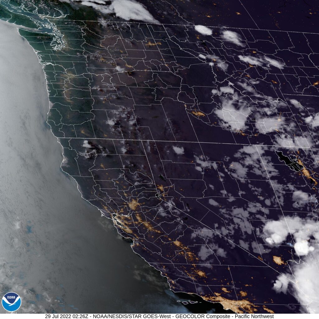
It’s been a while since a forecast didn’t show up. It looks like Clime is fully on the fritz, as I punched in a bunch of sits, and nothing appeared for me. Nothing is appearing for anyone in parts of Oregon this week, given the clouds and fog in the area, visible on satellite below.
This is an interesting trip to me, one that will cover 3 days and 1,639 miles. We’re hitting a lot of open territory. Big Sky Country, as some have called it. We’ll carry a pace of 65.6mph and break the trip into 524.5 mile segments, with a little extra for day three. Drive fast, the speed limit allows it!
DAY ONE (Saturday)
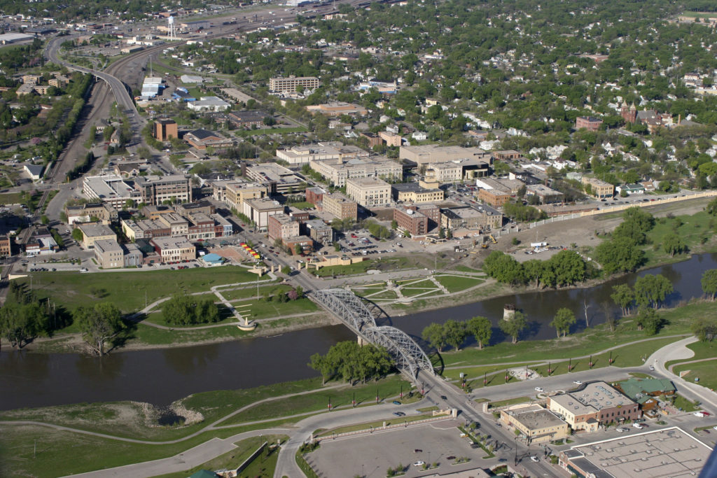
(May 17, 2006 Grand Forks, ND) Ð Aerial view of Grand Forks mitigation project building new levee walls, burns and pumping stations protecting the city from the Red River.
Photo by Brenda Riskey/UND
A surface wave centered over Minnesota is kicking up light rain all throughout Minnesota, encroaching on the Red River. High pressure is going to strengthen and squash the disturbed weather to the southeast. It’s going to be a little chilly, relatively speaking, to start the day, but it should warm quickly in western North Dakota. Eastern Montana will be sunny and warm, and in honor of the drive on Saturday, and the rest of the journey to come, we will stop in Miles City, Montana.
DAY TWO (Sunday) Eastern Montana is wide open pastures and prairies, and becomes mountainous around Butte and Helena. We’ll run into showers and thunderstorms right here, where the prairies run into the Rocky Mountains. The storms will be widely scattered and may even be dry, and when we start getting to western exposures around Missoula and westward, the threat will significantly lessen. We’ll make it to the Clark Fork River Crossing near Tarkio for the end of the night.
DAY THREE (Monday) Another shorth wave is moving ashore Sunday night, and some more of those spotty, potentially dry storms in the chimney of Idaho. It’s going to be dry after that in the Pacific Northwest. Fortunately, the Gulf of Alaska gyre is reforming, but for the time being, sit’s still hot in the Pacific Northwest
The Pacific Northwest is had a hot spell at the end of July. Sure, it was not quite as long lasting as the one that came last year, but it was just as hot. Last Friday in Corvallis, hit 99, and was 96 on Saturday. As I said, fortunately, temperatures aren’t still that warm, but they lasted long enough that wild fires really exploded in southern Oregon and northern California. Hopefully, they are more well behaved than in recent years. The forecast in Corvallis was overheated, but a fairly well behaved. The Weather SErvice and WeatherNation drew level on the verification. Friday – High 99, Low 62 Saturday – High 96, Low 62
Most of the people that live in Oregon live along in a north-south corridor adjacent to the Cascades. Oregon State is in Corvallis, and the town and the school are well within the corridor.
I’d be remiss if I didn’t note the historic flooding in the Ohio Valley. St. Louis recently broke a single day record for rainfall, while eastern Kentucky is seeing a rising death toll thanks to flash flooding caused by the deluge. Our thoughts are with those affected by these disasters.
At 656PM, PT, Corvallis was reporting a temperature of 89 degrees with clear skies. Salem and Eugene, on either side of the city, were reporting temperatures of 95 degrees. Of course, along the coast with the Marine layer, temperatures were hovering in the mid 50s with clouds and fog. There was no forecast for that haze to press further ashore. Flow over the western US is fairly stagnant, with any jet structure only found well to the north, originating in the northern Yukon. As a result, heat has been allowed to build in the Pacific Northwest. While the Gulf of Alaska low was currently absent, a weak wave shifting closer to the shore will bring some cooler air late on Saturday, to be joined by some clouds. Tomorrow – Hot, High 96, Low 60 Saturday – Partly cloudy, High 95, Low 59
TWC: Tomorrow – Mainly sunny. High 98, Low 61 Saturday – Some clouds in the morning will give way to mainly sunny skies for the afternoon. High 97, Low 61
AW: Tomorrow – Blazing sunshine and hot; possible danger of dehydration and heat stroke while doing strenuous activities High 97, Low 60 Saturday – Blazing sunshine and hot; possible danger of dehydration and heat stroke while doing strenuous activities High 96, Low 61
NWS: Tomorrow – Sunny and hot, High 98, Low 61 Saturday – Sunny and hot, High 97, Low 62
WB: Tomorrow – Mostly sunny, High 97, Low 60 Saturday – Mostly sunny, High 93, Low 61
WN: Tomorrow – Mostly sunny, High 98, Low 61 Saturday – Mostly sunny, High 97, Low 62
FIO: Tomorrow – Humid throughout the day. High 93, Low 65 Saturday – Humid throughout the day. High 93, Low 63
It’s hot, but fortunately, the heat won’t be as intense or as resilient as last year’s heat wave. It is expected to break by the end of the weekend. For now, you can certainly see the clear skies over most of Oregon, but the intrusion of low clouds and fog over the coast is evident as well.