With the ongoing heat across much of the country, it seems almost cruel to revisit our forecast for last month in Bremerton. Wet weather was rotating through, with low pressure that became hung up in the Canadian Rockies. The rain was done by Sunday, the 28th, but temperatures along the Puget Sound were unable to clamber out of the 60s. How refreshing! Temperatures were all fairly even, but the Weather Service and Weathernation were square there, and with the precipitation forecast to earn a forecast tie. Actuals: June 27th, .03″ of rain, High 65, Low 50 June 28th, High 65, Low 48
We are going to the top left corner of your map of the United States tonight. I assume your map is like mine, and has Alaska with Hawai’i in their own insets at the bottom of the page.
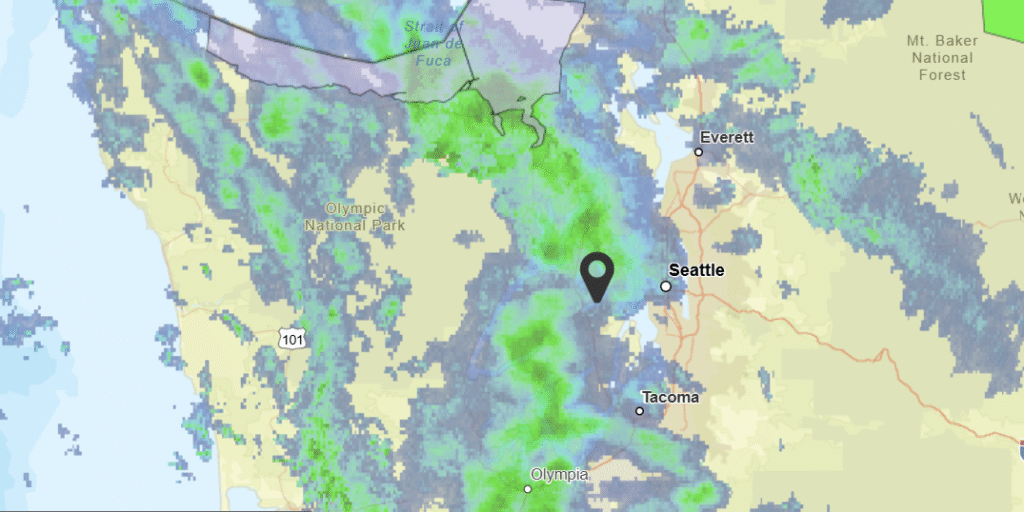
At 1156AM, PT, Bremerton was reporting a temperature of 57 degrees with overcast skies. Temperatures were kept in check by the cloudy skies. A strong jet curled around Vancouver Island into the Pacific Northwest, leading to regionwide instability. As the jet curls inland, steady bands of rain will continue across the Olympic Peninsula and Puget Sound, particularly through tomorrow. Surface organization is always murky in the Pacific Northwest, so the best indicator of the future precipitation in the region will be the upper level flow. As the jet moves inland, it will weekend rather than successfully advect eastward. Whatever surface circulation lingers will move a bit inland by Sunday, with light shower activity continuing to spin back into the terrain of the Cascades and Olympic Mountains, resulting in ongoing fog and clouds, with intermittent drizzle for Bremerton. Tomorrow – Scattered showers through the day, High 67, Low 51 Sunday – Isolated showers, with overcast skies and haze, High 66, Low 52
TWC: Tomorrow – Mostly cloudy. High 68, Low 50 Sunday – Overcast. High 69, Low 50
AW: Tomorrow – Mostly cloudy with a couple of showers High 67, Low 51 Sunday – Mostly cloudy High 69, Low 51
NWS: Tomorrow – A 40 percent chance of rain, mainly between noon and 4pm. Partly sunny, High 64, Low 51 Sunday – Mostly cloudy, High 66, Low 51
WB: Tomorrow – Partly sunny. A chance of rain in the morning then a slight chance of rain late in the morning. A chance of rain in the afternoon High 66, Low 51 Sunday – Mostly cloudy. High 67, Low 52
WN: Tomorrow – Partly cloudy with scattered showers, High 65, Low 51 Sunday – Mostly cloudy, High 67, Low 51
CLI: Tomorrow – Rain Showers, High 66, Low 47 Sunday – Light rain showers, High 67, Low 47
This will be interesting, as Bremerton doesn’t do a great job of reporting rain in their observations. Let’s see how it all plays out! Check this out: I started writing this last night and grabbed a still of the radar then. Not much changed!
This has been a tough time in American history, and in Bremerton, Washington, on Tuesday and Wednesday, the weather decided to mimic the mood. It was cloudy and drizzly across Puget Sound through the middle of the week, exactly the solemn and somber atmosphere this era needs. The Weather Channel and Weatherbug ended up sharing honors. Actuals: Tuesday – .31 inches of rain, High 45, Low 37 Wednesday – .15 inches of rain, High 49, Low 32
Granted, the world is in flux, and long distance road trips are frowned upon at this moment in time, but the shipping needs of the country ensure that there will be people covering this kind of ground. Even without that necessity, seeing daily cross sections of the weather has its benefits. This drive will cover 5 1/2 days of mostly empty freeway, covering 2917 miles. That means our pace will be 66.3mph, which means Chicago is really going to slow us down. The days will be consumed by 530 miles of travel. Buckle up and here we go.
DAY ONE (Wednesday)
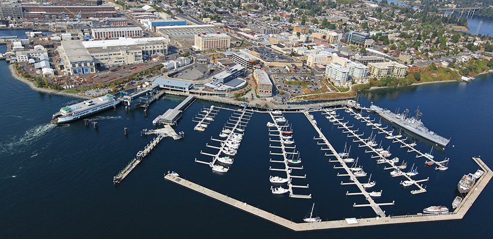
Bremerton, Washington
Its a gloomy day down in the Puget Sound, and it’s not going to change through tomorrow morning. The deteriorating feature that is bringing the gloom to Bremerton is going to squeeze a few flakes into the Cascadian peaks, with additional activity over northern Idaho that will dissipate into the early afternoon. The mountain tops may be obscured as we reach Montana and pass through Missoula to Clinton, but at the surface it should be dry.
DAY TWO (Friday) We will emerge from the high country of the Rockies into the vast emptiness of Big Sky country. Sure, we’ll pass through Billings and Butte and Bozeman and a few cities that don’t begin with a B, but otherwise we will be firmly in no mans land. We are east of the Rockies, so downslope flow should give an artificial bump to the temperature early in the day, but a developing feature over te central Rockies will bring temperatures back down again. Not much for clouds, and probably nothing for precipitation on the day, which will end at exit 192, where there is a rest stop and a historical marker, but no easily accessed inhabited areas. Social distancing!
DAY THREE (Saturday) The rest of the drive in Montana, as well as that in North Dakota will not be terribly challenging, though east of Jamestown, we might notice increasingly blustery conditions. This is owing to that big area of low pressure that we talked about in the central Rockies. It looks like it will deepen quickly and bring Minnesota and the Upper Midwest an interesting weekend. Starting not long before we wrap up the day, there might be a few flakes, and coupled with the increasing wind, it will certainly compel us to pull off the road near Ashby, Minnesota.
DAY FOUR (Sunday) I think a heavy stripe of snow is possible between Fergus Falls and St. Cloud, Minnesota overnight, with the rest of the region blasted by wind and rain. The entire system is going to shift away from the western Great Lakes by the afternoon on Sunday, so our challenge will be driving along that first hour or so, hoping the warm spring means no snow sticks to I-94. The pavement will be wet through the Twin Cities, but should have had plenty of time to dry before we hit Wisconsin. The day will end in Poynette, north of Madison.
DAY FIVE (Monday) The 5th day of our trip will be clearer and more well populated than the first stretch. We’ll pass Chicago, Indianapolis and Dayton on our way to Frankfort, Ohio, all under the protection of a ridge of high pressure. IT’s not going to be a warm ridge, necessarily, but it will be dry.
DAY SIX (Tuesday) Yet another round of low pressure is developing to our south and will be shifting to the northeast during the day, intercepting our route over West Virginia. Driving Charleston can be a bit challenging, because there are no straight lines and it’s hilly, so be careful and keep both hands on the wheel. The rain will tail off for a bit as we descend into Lexington, Virginia, and will remain in our rear view as we approach Richmond. Don’t worry, though, the rain will show up later.
The world seems to be hunkered down thanks to the insidious Coronavirus. One of the first hot spots was the Seattle area, but in Washington State, at least, the spread has been predominantly confined to the Seattle area. Bremerton, which is just across Puget Sound from Seattle, and Kilsap County have only reported 20 positive tests, opposed to the hundreds across the Sound. With all this going on, meteorologists still need to be aware of the weather, and share that information with you. So lets get to it then, shall we?
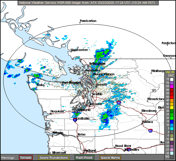
At 1019AM, PT, Bremerton was reporting a temperature of 45 degrees with mostly cloudy skies. An already landed area of low pressure is moving southeast from British Columbia, bringing the overcast from Georgia Strait into Puget Sound, while also introducing some snow to the Cascades and Olympic Mountains. The surface low will deteriorate as it presses further into Washington, and the sharp angled upper trough will deepen to the southwest, ensuring cooler conditions and more overcast, at least through the day tomorrow. The jet over the center of the country will strengthen and lead t development well to the east of Washington State, but the trough aloft will encourage the sinking air aloft, and the Puget Sound will remain socked in with low clouds, fog and some light drizzle through Wednesday. Tomorrow – Some light rain, otherwise overcast, High 50, Low 36 Wednesday – Overcast with some fog and a bit of light rain, High 50, Low 33
TWC: Tomorrow – Cloudy with occasional rain showers.High 48, Low 36 Wednesday – Mostly cloudy in the morning then periods of showers later in the day. High 50, Low 33
AW: Tomorrow – Cloudy and cool with a couple of showers High 50, Low 37 Wednesday – More clouds than sun with a shower in places in the afternoon High 51, Low 34
NWS: Tomorrow – Showers likely, then showers and possibly a thunderstorm after noon. High 48, Low 39 Wednesday – A 40 percent chance of showers, mainly after noon. Partly sunny, High 51, Low 37
WB: Tomorrow – Rain showers likely in the morning, then rain showers and a slight chance of thunderstorms in the afternoon. Rainfall amounts a tenth to a quarter of an inch possible, except higher amounts possible in thunderstorms, High 47, Low 36 Wednesday – Partly sunny. Patchy fog in the morning. A slight chance of rain showers in the morning then a chance of rain showers in the afternoon, High 48, Low 34
WN: Tomorrow – Mostly cloudy with light showers, High 48, Low 39 Wednesday – Partly cloudy with scattered showers, High 51, Low 37
FIO: Tomorrow – Possible light rain throughout the day. High 48, Low 35 Wednesday – Partly cloudy throughout the day. High 48, Low 33
A look at the radar shows some showers scooting north of the Olympic Peninsula, but louder returns in the Cascades. Another lovely day for the Puget Sound.