
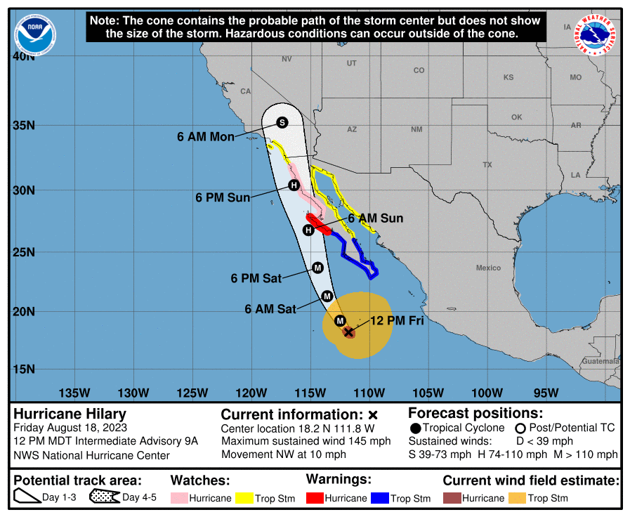
The North Atlantic is finally getting a bit more active, with a few waves that the NHC is monitoring, but right now, the storm that looks the most likely to have the next impact on the US is Hilary, in the eastern Pacific. Hilary at present is a major hurricane, but as she moves north, note that she will start diminishing fairly swiftly. The Pacific is a colder ocean, and her course along the Baja Coast will further blunt the storms intensity. Nevertheless, flash flooding and a few isolated tornadoes are probably going to come for SoCal and western Arizona as next week begins.
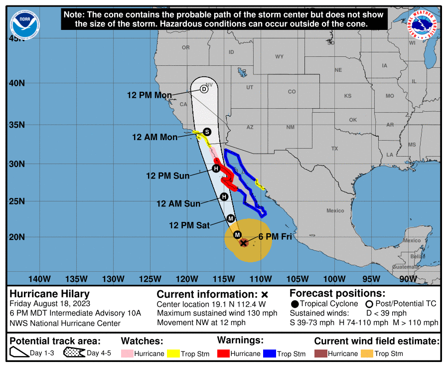
8:10 PM Update – The latest projection for Hilary takes her a little bit further to the west, which is bad news for the Southwest. Less time along the coast means that she won’t lose intensity quite as quickly, and there may be a bit more rain, a bit more wind as she moves into the Desert.
130AM Update – Those TS Watches in SoCal are the first to ever be issued for the region.
10pm Saturday Update – Hilary has been downgraded to a Category 1, and will be a tropical storm fairly soon. Like we talk about fairly often with severe weather in the east, this storm will be even more catastrophic because it is coming to a well populated area unaccustomed to tropical weather. The torrential rains will not be well handled, and residents should be prepared to contend with flash flooding.