We are approaching Christmas, and to celebrate, we have a one day road trip. There is some weather looming for the route in question, but for now, the pace for the 542 mile trek is going to be about 66mph. We’re spending the most time in West Virginia on this trip, so you know there are going to be hills.
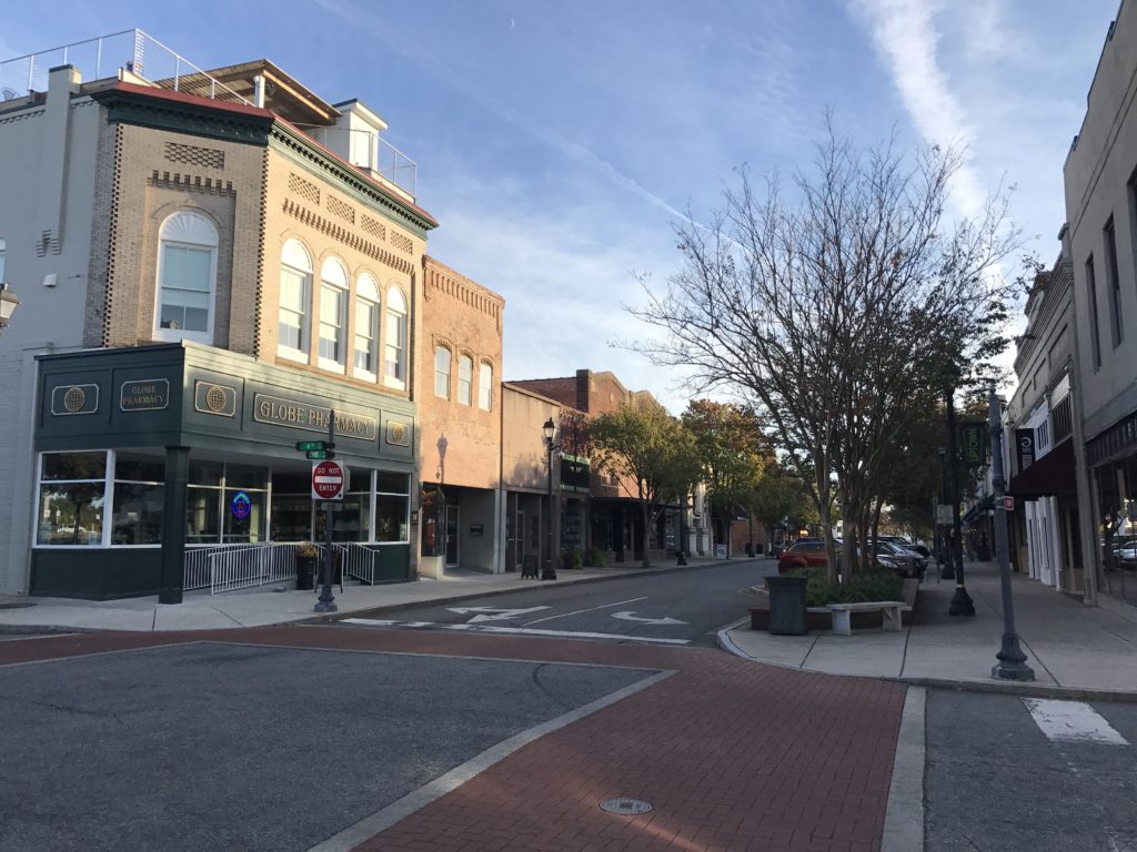
Greenville, South Carolina
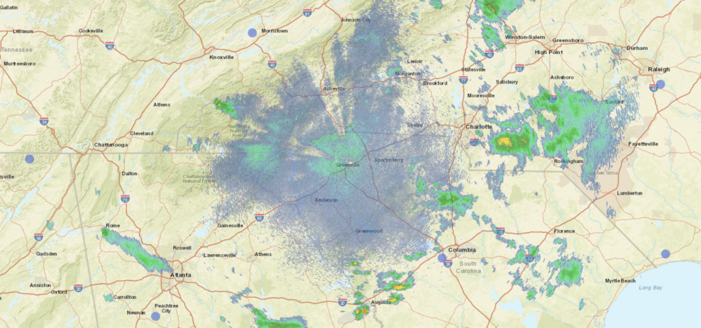
Low pressure will be moving from the Gulf of Mexico to the Bight of Georgia overnigh.t. Heaviest precipitation will be downstate, but there will be significant rain coming from the region. There might be a bit of clearing shortly after we leave Greenville, but it will catch up, as this feature is really moving. The thereat for rain will undulate through the day, but will become steady, albeit lighter as we cross from West Virginia to Pennsylvania. There is an inverted trough that isn’t bringing the robust moisture that we will follow north to Pittsburgh, but it does offer some measure of reliability. Fortunately, it will still be too warm for snow, so expect some more light rain as we proceed into Pittsburgh.
Last week, the combination of Nicholas and low pressure in the Great Lakes finally started moving out of the country (to be replaced this week, of course) and brought a quick burst of cool, autumnal air to our forecast spot in Greenville, South Carolina. Sure, it rained on Wednesday, but the day after was heavenly. So too were the forecast. With some action to contend with, the scores on these forecasts were really quite good. Accuweather ended up claiming the win. Actuals: Wednesday, 9/22 – .31 inches of rain, High 80, Low 62 Thursday – High 75, Low 54
Autumn arrives tomorrow, but it always comes a little later to the southeast than the rest of the country. How summery will the end of September be?
At 853PM, ET, Greenville was reporting a temperature of 70 degrees with overcast skies. In the ever unraveling saga of Nicholas, he is finally being dragged north towards the Eastern Great Lakes, but a plume of remnant moisture extends from western Pennsylvania to central North Carolina. Of more interest is a sharply digging upper level trough that is reaching into the Lower Mississippi Valley this evening. While the remnants of Nicholas are east of the Appalachians, cyclogenesis will be very autumnal thanks to the trough over the next couple of days. AS the trough rotates a bit and moves east, the latent moisture left by Nicholas will be expressed as widespread showers with some isolated embedded storms. The low generated by the trough is fully evolved, even dropping a cold front that will press through Greenville tomorrow evening. The air behind the front will be dry and refreshing after so many days with rain in the forecast. Tomorrow – Scattered showers, with thunderstorms more likely in the afternoon and evening. Cooling quickly. High 79, Low 63 Thursday – Sunny and nice, High 76, Low 56
TWC: Tomorrow – Thunderstorms. High 78, Low 64 Thursday – Sunny. Less humid. High 75, Low 54
AW: Tomorrow – Mostly cloudy with a couple of showers and a thunderstorm; much cooler than recent days High 80, Low 64 Thursday – Nice with plenty of sunshine High 75, Low 54
NWS: Tomorrow – A chance of showers and thunderstorms before noon, then showers likely and possibly a thunderstorm between noon and 4pm, then a chance of showers and thunderstorms after 4pm. Patchy fog before noon. Otherwise, cloudy, High 79, Low 62 Thursday – Sunny High 76, Low 52
WB: Tomorrow – Cloudy. Patchy fog in the morning. A chance of showers in the morning then showers likely with a chance of thunderstorms in the afternoon. High 78, Low 63 Thursday – Sunny, High 74, Low 56
WN: Tomorrow – Mostly cloudy with light showers and chance of storms, High 79, Low 62 Thursday – Sunny, High 76, Low 53
FIO: Tomorrow – Rain in the morning and afternoon. High 77, Low 63 Thursday – Clear throughout the day. High 77, Low 51
All those lows tomorrow are going to be midnight lows. The coming cold front is going to be pretty aggressive. Just this weak smattering across the area right now.
It’s not a long trip from these two towns in eastern North Carolina. This trip of less than 2 hours will merely be a leisurely Sunday drive (assuming the weather cooperates). We will cover 110 miles at an almost 63mph pace, and be in Fayetteville by lunch time. Let’s see what will happen.
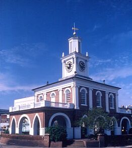
Greenville, North Carolina
The tail of a continually weakening trough is bringing some showers and thunderstorms to the Tarheel state today, but guidance suggests the activity will be significantly weaker tomorrow morning thanks both to the fact that that trough IS weakening, and that we will be going in the morning, when the heat of the day will be absent. Indeed, this will be a leisurely drive! Stop for ice cream on the way, you have my permission.
Are you ready for a lengthy trek cross country? We are heading from the northwesternmost state in the land to the eastern part of North Carolina, and will take us 5 days to make that trip. This is the perfect summer road trip, if you ask me. The mileage will hit 2810 miles, for a pace of about 67mph, with the first 4 days ending after about 535 miles, with a 10 hour day coming on Sunday. Let’s get to North Carolina by the end of the weekend, shall we?
DAY ONE (Wednesday)
Kennewick, Washington
Sometimes, in the eastern-US focused weather community, we forget that in the summer, that constant thunderstorm threat we are used to just doesn’t exist for a big part of the early summer. Such is the case this week in the Pacific Northwest. Quiet weather will allow us to take in the scenery from Washington, through Oregon and Idaho until we reach Howell, in the Utah panhandle.
DAY TWO (Thursday) The seasonal monsoon is preparing to develop in the southern Rockies, and indeed some guidance is pointing towards thunderstorms in the Colorado Rockies. Fortunately, we will not be traversing the Colorado Rockies, instead passing through Wyoming before ending up in Bushnell, in far western Nebraska. Rain is not expected to obscure our day.
DAY THREE (Friday) Nebraska us a long, arduous state to pass through by car, but if you like driving and identifiable benchmarks, then Nebraska is for you. We’re headed off the road for Nebraska City, then south through Iowa and Missouri, where we will stop in St. Joseph. Nebraska is going to be in fine shape. Lingering humidity will likely lead to morning fog, that I would hope will burn off by the time we reach St. Joseph.
DAY FOUR (Saturday) A slow moving, lingering trough extending into the Ohio Valley will make things a bit drearier on Saturday. By the time we reach southern Illinois, clouds with a stray sprinkle will become increasingly likely, with a rogue stroke of lightning not out of the questions. This will continue eastward, as we call it a day in Carefree, Indiana, which is west of Louisville.
DAY FIVE (Sunday) It’s just the time of year, but more wet weather will be possible on either side of the Appalachian range, but with low pressure developing in the Great Lakes, the better chance for rain or even a rogue thunderstorm will come up in eastern Kentucky and before we reach Charleston in West Virginia. There will be a healthy rain shadow in North Carolina, but we are headed far enough east, some oceanic flow will lead to isolated storms along the coast, including in Greenville, as we arrive, exhausted, at the end of our long day, at the end of our long trip.