
It’s Friday, bit I still have this forecast for Boulder to shoulder.
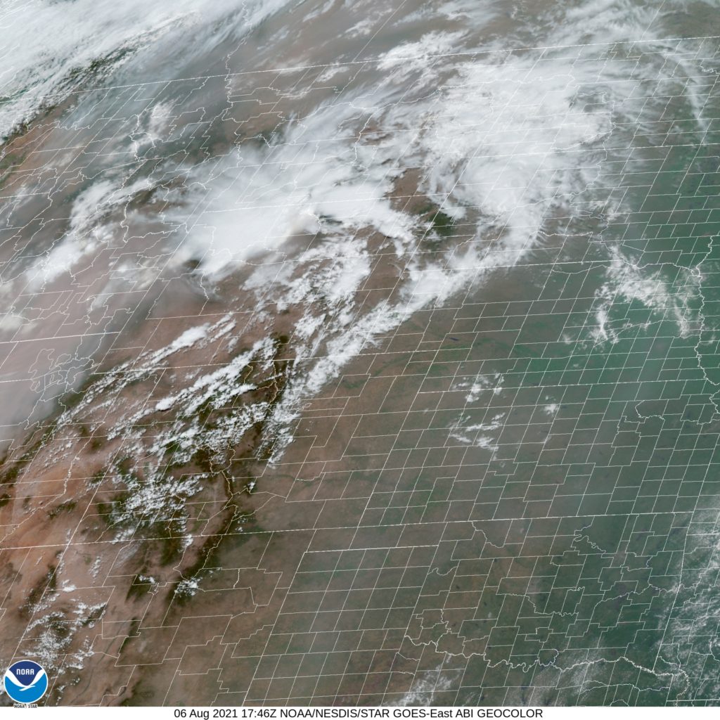
At 1120AM, MT, Boulder was reporting a temperature of 86 degrees with partly cloudy skies. There were air quality alerts in the mountains and front range, with red flag warnings along the Kansas and Wyoming borders. Meanwhile, there were a couple of showers beginning to bubble up, with heavier activity to the east of Steamboat Springs. The showers and storms today are a product of an upper level trough sweeping through the northern US.
The wave is fairly weak at the upper levels, however given the heat and humidity in the plain, there will be plenty of juice for organization. The low developing in the lee of the Rockies will help reengage dry air in the Boulder area, with a northwesterly flow also likely to exasperate the smoke in the air. At least there should be some cooler temperatures tomorrow, but the sun will let things heat up again on Sunday.
Tomorrow – Partly cloudy and hazy, High 85, Low 62
Sunday – Mostly sunny but hazy, High 92, Low 62
TWC: Tomorrow – Intervals of clouds and sunshine. High 88, Low 62
Sunday – Except for a few afternoon clouds, mainly sunny. High 94, Low 61
AW: Tomorrow – Nice with plenty of sunshine; wildfire smoke will cause the sky to be hazy High 87, Low 66
Sunday – Partly sunny High 92, Low 62
NWS: Tomorrow – Areas of smoke. Sunny, High 88, Low 61
Sunday – Sunny, High 93, Low 59
WB: Mostly sunny. Areas of smoke. High 84, Low 61
Sunday – Sunny, High 91, Low 61
WN: Tomorrow – Partly cloudy with areas of smoke, High 88, Low 60
Sunday – Sunny, High 93, Low 59
FIO: Tomorrow – Partly cloudy throughout the day. High 89, Low 65
Sunday – Clear throughout the day. High 94, Low 64
Take a look at the satellite imagery, and just how milky the image is, even in areas without cloud cover. Another smoky summer season.
Comment (1)