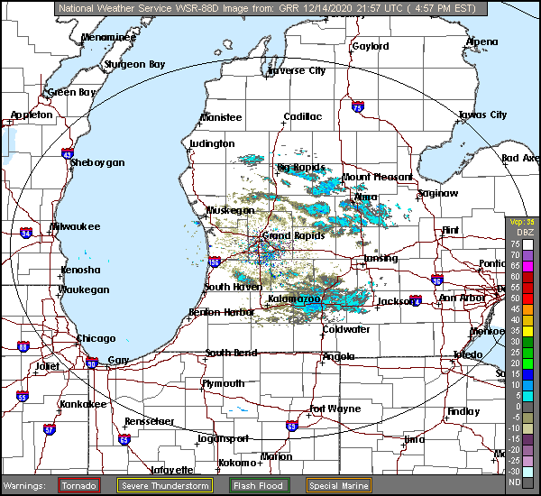
Welcome back to Victoria-Weather’s forecasting adventure zone. Grand Rapids is down wind of Lake Michigan, with fairly strong gusts being noted. Not to give anything away about the precipitation or anything.
At 453PM, ET, Grand Rapids was reporting temperature of 28 degrees with mostly cloudy skies. There have been a few streaks of light snow across western Michigan today, provided by winds off the Lake of up to 30mph. This is certainly a microscale event, as more generally, high pressure dominates the region.
A shortwaved ridge over the Ohio Valley and Great Lakes is contributing to the high pressure focused over the Upper Midwest and spreading into the Great Lakes. A deep, broad jet trough will overtake the middle of the country and birth an area of low pressure over the northern Gulf of Mexico, which will translate swiftly to central Appalachia. The existing surface ridge will squash the system to the south and east, away from Lower Michigan, but the induced northwest flow will mean a chance for some flakes, particularly on Wednesday, as well as dropping temperatures later in the week.
Tomorrow -Mostly cloudy, High 33, Low 21
Wednesday – Isolated flurries with mostly cloudy skies, High 30, Low 21
TWC: Tomorrow – Mostly cloudy. High 30, Low 22
Wednesday – Overcast High 33, Low 24
AW: Tomorrow – Sun through high clouds High 32, Low 18
Wednesday – A couple of snow showers in the morning; otherwise, mostly cloudy High 35, Low 20
NWS: Tomorrow – Partly sunny, High 29, Low 19
Wednesday – Cloudy High 33, Low 24
WB: Tomorrow – Partly sunny, High 29, Low 22
Wednesday – Mostly cloudy, High 31,Low 24
WN: Tomorrow – Partly cloudy, High 29, Low 19
Wednesday – Mostly cloudy, High 33, Low 24
FIO: Tomorrow – Mostly cloudy throughout the day. High 31, Low 24
Wednesday – Overcast throughout the day. High 33, Low 26
Well, it’s going to come down to cloud cover, but it’s interesting that we are moving in different directions on those highs, right? Here are a few bands of lake effect snow in western Michigan


Comment (1)