
Before we begin, let’s take a moment to appreciate the duck like appearance of today’s severe weather outlook.
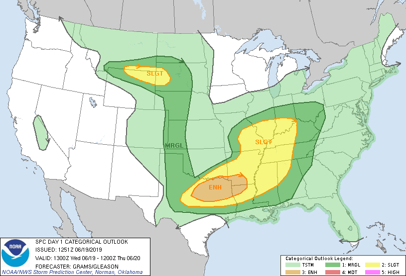
Quack quack quack. Now, the breast meat of this duck-look is featuring an enhanced risk of severe weather. Looking at the bulk of the severe weather in the forecast, it is apparent that here is a cold front running roughly from the Great Lakes to the Red River Valley, with a second embedded low over north Texas to inflame any severe storms in the region.
There is something mildly unusual about this particular forecast, and it has been part of an ongoing trend to the spring and early meteorological summer. It’s been so cold in the central US that the bullseye for severe weather hasn’t really shifted as far north as it usually does this time of year.
Here is the SPC climatology for severe weather for 6/19s through history.
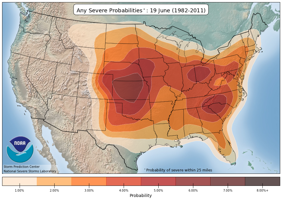
Certainly, there has been severe weather further north this season, such as the tornadoes in Dayton and Jefferson City, and Kansas and Nebraska have had some severe storms as well, but the particularly cool start to summer in the Upper Midwest has kept the Great Lakes fairly quiet so far this season, it has also lead to a prolonged storm season through Texas and Louisiana.
With the long term outlook for the next couple of weeks turning warmer in the center of the country, the severe threat looks to be moving further north. Additionally, a standing trough coming to the west looks to set up a clash of air masses in the Dakotas late in the month to the beginning of July. It’s certainly too far out to make any specific predictions, but it certainly looks like we are on our way to course correction through the middle of summer.